TopoQuest Logo
Do you find TopoQuest useful?
Help keep TopoQuest running and adding new maps/features by donating!
Bitcoin:  19c7KJd3qBynnjoSw5npx9KScwjBe4ifkT
Litecoin:  LXs6TkuXGGXo1vDsWCkWVdjQX94eUKd6ui
Home View Maps Find Maps Find Places Resources & Links


Huddleston, Virginia Topographic Map

USGS Map Title: Huddleston, VA
USGS Map MRC: 37079B4
DRG (GeoTIFF) Download: o37079b4.tif


Neighboring USGS Topographic Map Quads:


  Bedford, VA  
37079C5
 

  Goode, VA  
37079C4
 

  Forest, VA  
37079C3
 

  Moneta, VA  
37079B5
 

  Huddleston, VA  
37079B4
 

  Lynch Station, VA  
37079B3
 

  Smith Mountain Dam, VA  
37079A5
 

  Leesville, VA  
37079A4
 

  Altavista, VA  
37079A3


Map MRC Location:

N38°
W80°
N38°
W79°
H8 H7 H6 H5 H4 H3 H2 H1
G8 G7 G6 G5 G4 G3 G2 G1
F8 F7 F6 F5 F4 F3 F2 F1
E8 E7 E6 E5 E4 E3 E2 E1
D8 D7 D6 D5 D4 D3 D2 D1
C8 C7 C6 C5 C4 C3 C2 C1
B8 B7 B6 B5 B4 B3 B2 B1
A8 A7 A6 A5 A4 A3 A2 A1
N37°
W80°
N37°
W79°

Huddleston, VA USGS 1:24K Topographic Map Preview:
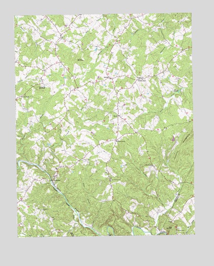
Huddleston, VA USGS Topographic Map
Click on map above to begin viewing in our Map Viewer.

This topographic map contains these locations and features:
Feature Name Type Latitude Longitude GNIS ID View Map
Altavista Life Saving CrewSchoolN37.2206°W79.4592°2086365View Map
Altavista Police DepartmentSchoolN37.1942°W79.4844°2086371View Map
Altavista Volunteer Fire DepartmentSchoolN37.1922°W79.4856°2086340View Map
Amos BranchStreamN37.1374°W79.4564°1462452View Map
Back CreekStreamN37.1263°W79.3995°1462643View Map
Bethany ChurchChurchN37.1329°W79.3911°1463126View Map
Bethesda ChurchChurchN37.2138°W79.4103°1463219View Map
Bold BranchStreamN37.2488°W79.4286°1463639View Map
Buffalo BranchStreamN37.1385°W79.3936°1464028View Map
Buttermilk CreekStreamN37.2454°W79.3936°1464183View Map
Carter Mill CreekStreamN37.1374°W79.4575°1464485View Map
Chestnut ForkPopulated PlaceN37.2043°W79.4961°1495385View Map
Church CampgroundLocaleN37.1565°W79.4334°1464908View Map
Church of GodChurchN37.1571°W79.4336°1674830View Map
Crab Orchard CreekStreamN37.1621°W79.4803°1465373View Map
Creasy School (historical)SchoolN37.2332°W79.4703°1674835View Map
District 3CivilN37.2279°W79.4220°2750019View Map
Dumpling MountainSummitN37.2093°W79.4836°1495481View Map
GillespiePopulated PlaceN37.2140°W79.4323°1477349View Map
Glader BranchStreamN37.1663°W79.4900°1467123View Map
HuddlestonPopulated PlaceN37.1568°W79.4745°1477429View Map
Huddleston Elementary SchoolSchoolN37.1638°W79.4715°1674854View Map
Huddleston Fire Department Station 2BuildingN37.1689°W79.4540°2075585View Map
Huddleston Fire Department Station 4BuildingN37.2136°W79.4117°2075584View Map
Huddleston Life Saving and First Aid CrewBuildingN37.1583°W79.4797°2075587View Map
Huddleston Volunteer Fire Department Company 7BuildingN37.1584°W79.4801°2075586View Map
Independence ChurchChurchN37.1646°W79.4036°1468453View Map
Island BranchStreamN37.1293°W79.4611°1468529View Map
Leesville TempleChurchN37.1274°W79.3878°1469283View Map
Leftwich CemeteryCemeteryN37.1682°W79.4528°1469302View Map
Leftwich Church (historical)ChurchN37.1682°W79.4542°1674859View Map
MentowPopulated PlaceN37.1926°W79.4270°1477533View Map
Moon MountainSummitN37.1279°W79.3914°1470701View Map
Mount Horeb ChurchChurchN37.1404°W79.4817°1470909View Map
Old Bethany CemeteryCemeteryN37.1329°W79.3911°1674969View Map
Pecks ChurchChurchN37.2371°W79.4667°1472166View Map
Preston MillpondReservoirN37.2059°W79.3843°1472780View Map
Stony ForkStreamN37.1638°W79.4998°1475209View Map
Turner MountainSummitN37.2243°W79.4564°1496335View Map
Waltons StoreLocaleN37.2132°W79.4097°1476299View Map
Woodford CornerPopulated PlaceN37.1790°W79.4295°1477895View Map

Note: Coordinates in the location and feature list above are referenced to NAD83 datum.


Copyright (C) 2008-2024 Ryan Niemi / Sunset Dynamics ... All Rights Reserved