TopoQuest Logo
Do you find TopoQuest useful?
Help keep TopoQuest running and adding new maps/features by donating!
Bitcoin:  19c7KJd3qBynnjoSw5npx9KScwjBe4ifkT
Litecoin:  LXs6TkuXGGXo1vDsWCkWVdjQX94eUKd6ui
Home View Maps Find Maps Find Places Resources & Links


Lynch Station, Virginia Topographic Map

USGS Map Title: Lynch Station, VA
USGS Map MRC: 37079B3
DRG (GeoTIFF) Download: o37079b3.tif


Neighboring USGS Topographic Map Quads:


  Goode, VA  
37079C4
 

  Forest, VA  
37079C3
 

  City Farm, VA  
37079C2
 

  Huddleston, VA  
37079B4
 

  Lynch Station, VA  
37079B3
 

  Castle Craig, VA  
37079B2
 

  Leesville, VA  
37079A4
 

  Altavista, VA  
37079A3
 

  Straightstone, VA  
37079A2


Map MRC Location:

N38°
W80°
N38°
W79°
H8 H7 H6 H5 H4 H3 H2 H1
G8 G7 G6 G5 G4 G3 G2 G1
F8 F7 F6 F5 F4 F3 F2 F1
E8 E7 E6 E5 E4 E3 E2 E1
D8 D7 D6 D5 D4 D3 D2 D1
C8 C7 C6 C5 C4 C3 C2 C1
B8 B7 B6 B5 B4 B3 B2 B1
A8 A7 A6 A5 A4 A3 A2 A1
N37°
W80°
N37°
W79°

Lynch Station, VA USGS 1:24K Topographic Map Preview:
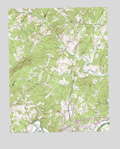
Lynch Station, VA USGS Topographic Map
Click on map above to begin viewing in our Map Viewer.

This topographic map contains these locations and features:
Feature Name Type Latitude Longitude GNIS ID View Map
Altavista DistrictCivilN37.1794°W79.3131°1927076View Map
Altavista Elementary SchoolSchoolN37.1324°W79.2831°1674918View Map
Altavista Emergency Medical ServicesBuildingN37.1296°W79.2700°2721158View Map
Bethlehem Baptist ChurchChurchN37.2332°W79.3631°1463233View Map
Big Otter RiverStreamN37.1329°W79.2520°1481758View Map
Bishop CreekStreamN37.1376°W79.3381°1463461View Map
Buffalo CreekStreamN37.2360°W79.3261°1464037View Map
Campbell County Industrial ParkLocaleN37.1426°W79.2672°1674963View Map
EvingtonPopulated PlaceN37.2338°W79.2895°1495519View Map
Evington Post OfficePost OfficeN37.2328°W79.2817°2766198View Map
Evington Volunteer Fire Department Station 1 HeadquartersBuildingN37.2328°W79.2920°2721078View Map
Flat CreekStreamN37.1940°W79.2709°1466648View Map
Good Shepherd ChurchChurchN37.2299°W79.2761°1467215View Map
Haden MountainSummitN37.1993°W79.2575°1495636View Map
Johnson CreekStreamN37.2043°W79.2978°1468793View Map
Johnson MountainSummitN37.1924°W79.3620°1468800View Map
LakewoodPopulated PlaceN37.1299°W79.2825°1674962View Map
Lick RunStreamN37.2460°W79.3495°1469409View Map
Lynch StationPopulated PlaceN37.1463°W79.3009°1469954View Map
Lynch Station Baptist ChurchChurchN37.1507°W79.3031°1674958View Map
Lynch Station Post OfficePost OfficeN37.1485°W79.3017°1965013View Map
Mill CreekStreamN37.2107°W79.3056°1470482View Map
Mount Evergreen ChurchChurchN37.2351°W79.2967°1470868View Map
Mount Hermon CemeteryCemeteryN37.1451°W79.3114°1674965View Map
Mount Hermon ChurchChurchN37.1449°W79.3117°1470885View Map
Mount Pisgah ChurchChurchN37.2343°W79.2809°1471020View Map
Mount Plain ChurchChurchN37.2007°W79.3570°1471024View Map
Orrix CreekStreamN37.2357°W79.3300°1471954View Map
Otter RiverLocaleN37.1813°W79.2931°1471966View Map
Otterwood ChurchChurchN37.2154°W79.2961°1471973View Map
Piney Grove ChurchChurchN37.2368°W79.3589°1472404View Map
Pocket CreekStreamN37.1468°W79.3300°1472541View Map
Pretty CreekStreamN37.1335°W79.3456°1472783View Map
Saint Andrews ChurchChurchN37.1638°W79.2678°1473699View Map
Saint Pauls ChurchChurchN37.1490°W79.2947°1473876View Map
Scott MountainSummitN37.1715°W79.2750°1496189View Map
Seminole RidgePopulated PlaceN37.1265°W79.2911°1674999View Map
Shiloh ChurchChurchN37.1821°W79.3200°1474506View Map
Tardy BranchStreamN37.1829°W79.2697°1475478View Map
Town of Altavista Industrial ParkLocaleN37.1307°W79.2947°1675000View Map
Troublesome CreekStreamN37.1810°W79.2578°1475891View Map
Union ChapelChurchN37.1735°W79.3378°1476032View Map
Valley View HeightsPopulated PlaceN37.1274°W79.2742°1675001View Map
Vaughn CemeteryCemeteryN37.1779°W79.3275°1674987View Map
White Oak Springs Dairy FarmLocaleN37.1858°W79.2675°2676020View Map
WRVL-FM (Lynchburg)TowerN37.1974°W79.3517°1502661View Map

Note: Coordinates in the location and feature list above are referenced to NAD83 datum.


Copyright (C) 2008-2024 Ryan Niemi / Sunset Dynamics ... All Rights Reserved