TopoQuest Logo
Do you find TopoQuest useful?
Help keep TopoQuest running and adding new maps/features by donating!
Bitcoin:  19c7KJd3qBynnjoSw5npx9KScwjBe4ifkT
Litecoin:  LXs6TkuXGGXo1vDsWCkWVdjQX94eUKd6ui
Home View Maps Find Maps Find Places Resources & Links


Humansville, Missouri Topographic Map

USGS Map Title: Humansville, MO
USGS Map MRC: 37093G5
DRG (GeoTIFF) Download: o37093g5.tif


Neighboring USGS Topographic Map Quads:


  Vista, MO  
37093H6
 

  Weaubleau, MO  
37093H5
 

  Wheatland, MO  
37093H4
 

  Arnica, MO  
37093G6
 

  Humansville, MO  
37093G5
 

  Elkton, MO  
37093G4
 

  Bearcreek, MO  
37093F6
 

  Fair Play, MO  
37093F5
 

  Cliquot, MO  
37093F4


Map MRC Location:

N38°
W94°
N38°
W93°
H8 H7 H6 H5 H4 H3 H2 H1
G8 G7 G6 G5 G4 G3 G2 G1
F8 F7 F6 F5 F4 F3 F2 F1
E8 E7 E6 E5 E4 E3 E2 E1
D8 D7 D6 D5 D4 D3 D2 D1
C8 C7 C6 C5 C4 C3 C2 C1
B8 B7 B6 B5 B4 B3 B2 B1
A8 A7 A6 A5 A4 A3 A2 A1
N37°
W94°
N37°
W93°

Humansville, MO USGS 1:24K Topographic Map Preview:
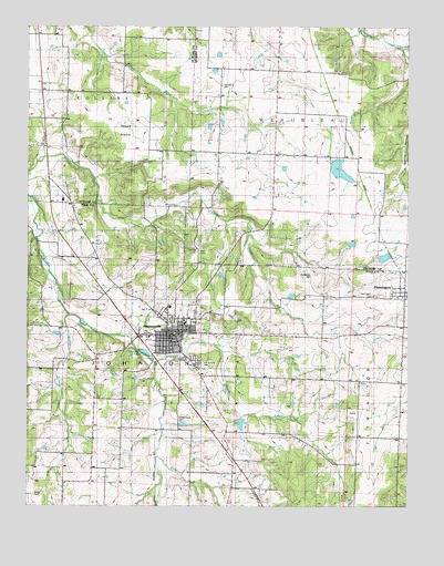
Humansville, MO USGS Topographic Map
Click on map above to begin viewing in our Map Viewer.

This topographic map contains these locations and features:
Feature Name Type Latitude Longitude GNIS ID View Map
Alley Lake DamDamN37.8400°W93.5252°762905View Map
Brush College School (historical)SchoolN37.8206°W93.5502°745323View Map
Cedar Grove SchoolSchoolN37.7617°W93.5583°715599View Map
City of HumansvilleCivilN37.7950°W93.5765°2394443View Map
Elm Grove SchoolSchoolN37.7886°W93.6141°717516View Map
FlemingtonPopulated PlaceN37.8048°W93.5013°718013View Map
Flemington CemeteryCemeteryN37.8048°W93.5110°718014View Map
Flemington Post OfficePost OfficeN37.8062°W93.5031°2782626View Map
HumansvillePopulated PlaceN37.7945°W93.5780°719986View Map
Humansville CemeteryCemeteryN37.7884°W93.5705°719987View Map
Humansville Fire and Rescue Station 1BuildingN37.7953°W93.5784°2621582View Map
Humansville Police DepartmentBuildingN37.7954°W93.5782°2752330View Map
Humansville Post OfficePost OfficeN37.7942°W93.5787°2779442View Map
Kingdom Hall ChurchChurchN37.7811°W93.5763°748302View Map
Locust Grove School (historical)SchoolN37.8575°W93.5880°756322View Map
Montgomery SchoolSchoolN37.7939°W93.5430°722544View Map
Number 15 DamReservoirN37.8376°W93.5228°762906View Map
Owens Lake Section 4 DamDamN37.8200°W93.5819°765462View Map
Pleasant Hill SchoolSchoolN37.8114°W93.6010°735787View Map
Pocomo LakeReservoirN37.7716°W93.5549°763310View Map
Richardson CemeteryCemeteryN37.8103°W93.5324°725258View Map
Rose Bud SchoolSchoolN37.7595°W93.6033°735824View Map
Round PrairieAreaN37.8500°W93.5941°756617View Map
Rule CreekStreamN37.7939°W93.5002°725660View Map
Sadler BranchStreamN37.8000°W93.6116°725709View Map
Shady Grove CemeteryCemeteryN37.7736°W93.5749°726236View Map
Souders CemeteryCemeteryN37.8600°W93.5624°748303View Map
South Fork Brush CreekStreamN37.7875°W93.5835°726731View Map
Sprowls DamDamN37.7734°W93.5552°763309View Map
Tinker CemeteryCemeteryN37.7534°W93.6185°748301View Map
Township of FlemingtonCivilN37.7751°W93.5021°767214View Map
Township of JohnsonCivilN37.7815°W93.5820°767217View Map
Township of WeaubleauCivilN37.8673°W93.5219°766759View Map
Vanderford Number One DamDamN37.8150°W93.5102°763184View Map
Village of FlemingtonCivilN37.8039°W93.5014°2398884View Map
Vine Hill School (historical)SchoolN37.8506°W93.6124°756852View Map

Note: Coordinates in the location and feature list above are referenced to NAD83 datum.


Copyright (C) 2008-2024 Ryan Niemi / Sunset Dynamics ... All Rights Reserved