TopoQuest Logo
Do you find TopoQuest useful?
Help keep TopoQuest running and adding new maps/features by donating!
Bitcoin:  19c7KJd3qBynnjoSw5npx9KScwjBe4ifkT
Litecoin:  LXs6TkuXGGXo1vDsWCkWVdjQX94eUKd6ui
Home View Maps Find Maps Find Places Resources & Links


Vista, Missouri Topographic Map

USGS Map Title: Vista, MO
USGS Map MRC: 37093H6
DRG (GeoTIFF) Download: o37093h6.tif


Neighboring USGS Topographic Map Quads:


  Monegaw Springs, MO  
38093A7
 

  Osceola, MO  
38093A6
 

  Iconium, MO  
38093A5
 

  Roscoe, MO  
37093H7
 

  Vista, MO  
37093H6
 

  Weaubleau, MO  
37093H5
 

  Caplinger Mills, MO  
37093G7
 

  Arnica, MO  
37093G6
 

  Humansville, MO  
37093G5


Map MRC Location:

N38°
W94°
N38°
W93°
H8 H7 H6 H5 H4 H3 H2 H1
G8 G7 G6 G5 G4 G3 G2 G1
F8 F7 F6 F5 F4 F3 F2 F1
E8 E7 E6 E5 E4 E3 E2 E1
D8 D7 D6 D5 D4 D3 D2 D1
C8 C7 C6 C5 C4 C3 C2 C1
B8 B7 B6 B5 B4 B3 B2 B1
A8 A7 A6 A5 A4 A3 A2 A1
N37°
W94°
N37°
W93°

Vista, MO USGS 1:24K Topographic Map Preview:
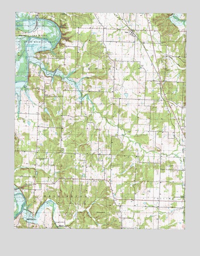
Vista, MO USGS Topographic Map
Click on map above to begin viewing in our Map Viewer.

This topographic map contains these locations and features:
Feature Name Type Latitude Longitude GNIS ID View Map
Allen CemeteryCemeteryN37.8970°W93.6524°755680View Map
Ashworth School (historical)SchoolN37.9361°W93.6969°755702View Map
Bishop BranchStreamN37.8861°W93.6977°755775View Map
Bradford School (historical)SchoolN37.9845°W93.7049°755809View Map
Brush CreekStreamN37.8863°W93.7434°755826View Map
Buckhart BranchStreamN37.9625°W93.7119°755831View Map
Cannon BranchStreamN37.8759°W93.7174°755854View Map
Coleman LakeReservoirN37.9431°W93.7270°760561View Map
Colemans Valley Lake DamDamN37.9434°W93.7285°760560View Map
Coon CreekStreamN37.9714°W93.7405°755924View Map
Culbertson CemeteryCemeteryN37.9114°W93.6374°755961View Map
Doyal CemeteryCemeteryN37.9692°W93.6583°755995View Map
East Branch Coon CreekStreamN37.8878°W93.6260°756009View Map
Elliot Lake DamDamN37.9700°W93.6685°763450View Map
Freeman-Holsapple CemeteryCemeteryN37.8817°W93.6713°758435View Map
Jackson School (historical)SchoolN37.8959°W93.6791°756220View Map
Long Ridge School (historical)SchoolN37.9820°W93.6258°756327View Map
Nance CemeteryCemeteryN37.9311°W93.6677°756439View Map
Oak Grove ChurchChurchN37.9150°W93.7338°756463View Map
Peterman Airport (historical)AirportN37.8917°W93.6252°758645View Map
Pleasant Hill School (historical)SchoolN37.9286°W93.7494°756539View Map
Prairie School (historical)SchoolN37.8950°W93.6444°756554View Map
RaneyPopulated PlaceN37.9520°W93.7288°756565View Map
Roberts CemeteryCemeteryN37.9667°W93.6399°756589View Map
Sandy HollowValleyN37.9859°W93.7391°756690View Map
Shady Nook School (historical)SchoolN37.9320°W93.6460°756708View Map
Shryers BluffCliffN37.8839°W93.6888°756719View Map
Southwick BranchStreamN37.9217°W93.6572°756744View Map
TopperPopulated PlaceN37.9523°W93.6460°758115View Map
Tower Grove School (historical)SchoolN37.9006°W93.7208°756798View Map
Township of DoyalCivilN37.9596°W93.6879°767314View Map
TracyPopulated PlaceN37.9800°W93.6552°756800View Map
Union CemeteryCemeteryN37.9547°W93.6874°756821View Map
Union School (historical)SchoolN37.9559°W93.6774°756825View Map
Valley ChurchChurchN37.9414°W93.7333°756839View Map
Village of VistaCivilN37.9891°W93.6637°2400076View Map
VistaPopulated PlaceN37.9884°W93.6641°756858View Map
Vista School (historical)SchoolN37.9831°W93.6591°757206View Map
West Branch Coon CreekStreamN37.8878°W93.6260°756892View Map

Note: Coordinates in the location and feature list above are referenced to NAD83 datum.


Copyright (C) 2008-2025 Ryan Niemi / Sunset Dynamics ... All Rights Reserved