TopoQuest Logo
Do you find TopoQuest useful?
Help keep TopoQuest running and adding new maps/features by donating!
Bitcoin:  19c7KJd3qBynnjoSw5npx9KScwjBe4ifkT
Litecoin:  LXs6TkuXGGXo1vDsWCkWVdjQX94eUKd6ui
Home View Maps Find Maps Find Places Resources & Links


Humeston, Iowa Topographic Map

USGS Map Title: Humeston, IA
USGS Map MRC: 40093G4
DRG (GeoTIFF) Download: o40093g4.tif


Neighboring USGS Topographic Map Quads:


  Le Roy, IA  
40093H5
 

  Derby, IA  
40093H4
 

  Corydon NE, IA  
40093H3
 

  Garden Grove, IA  
40093G5
 

  Humeston, IA  
40093G4
 

  Corydon, IA  
40093G3
 

  Woodland, IA  
40093F5
 

  Clio, IA  
40093F4
 

  Allerton, IA  
40093F3


Map MRC Location:

N41°
W94°
N41°
W93°
H8 H7 H6 H5 H4 H3 H2 H1
G8 G7 G6 G5 G4 G3 G2 G1
F8 F7 F6 F5 F4 F3 F2 F1
E8 E7 E6 E5 E4 E3 E2 E1
D8 D7 D6 D5 D4 D3 D2 D1
C8 C7 C6 C5 C4 C3 C2 C1
B8 B7 B6 B5 B4 B3 B2 B1
A8 A7 A6 A5 A4 A3 A2 A1
N40°
W94°
N40°
W93°

Humeston, IA USGS 1:24K Topographic Map Preview:
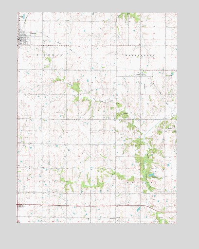
Humeston, IA USGS Topographic Map
Click on map above to begin viewing in our Map Viewer.

This topographic map contains these locations and features:
Feature Name Type Latitude Longitude GNIS ID View Map
Benton Center SchoolSchoolN40.7689°W93.3755°454520View Map
Brown Jug SchoolSchoolN40.8264°W93.4985°454863View Map
CambriaPopulated PlaceN40.8378°W93.4024°455097View Map
Cambria (historical)LocaleN40.8408°W93.4038°1970473View Map
Cambria CemeteryCemeteryN40.8384°W93.3828°1823267View Map
Cambria Post Office (historical)Post OfficeN40.8378°W93.4024°1970474View Map
Christian United Methodist ChurchChurchN40.8589°W93.4974°1970515View Map
City of HumestonCivilN40.8609°W93.4972°2394446View Map
Clay Center SchoolSchoolN40.7683°W93.4974°455444View Map
Dick CreekStreamN40.7778°W93.4016°455911View Map
Fairyview SchoolSchoolN40.7681°W93.4627°456527View Map
First Baptist ChurchChurchN40.8592°W93.4969°1970514View Map
First Presbyterian ChurchChurchN40.8589°W93.4974°1970516View Map
Greenlee CemeteryCemeteryN40.7778°W93.3897°1823266View Map
HumestonPopulated PlaceN40.8589°W93.4974°457720View Map
Humeston (historical)LocaleN40.8583°W93.4999°1970513View Map
Humeston Fire DepartmentBuildingN40.8587°W93.4969°2577227View Map
Humeston First RespondersBuildingN40.8587°W93.4969°2599655View Map
Humeston LibraryBuildingN40.8592°W93.4988°1970512View Map
Humeston Medical ClinicHospitalN40.8592°W93.4988°1970511View Map
Humeston Post OfficePost OfficeN40.8592°W93.4988°1970510View Map
Kirby CemeteryCemeteryN40.8153°W93.4172°1823269View Map
Locust Grove SchoolSchoolN40.7681°W93.4233°458557View Map
Lucerne (historical)LocaleN40.8556°W93.4613°466378View Map
Lucerne Post Office (historical)Post OfficeN40.8278°W93.4447°1970463View Map
Lucerne SchoolSchoolN40.8256°W93.4608°458676View Map
Maple Grove SchoolSchoolN40.7969°W93.4719°458780View Map
New Zion ChurchChurchN40.7528°W93.4235°459499View Map
Ninemile CreekStreamN40.8028°W93.4005°459523View Map
Orlando Post Office (historical)Post OfficeN40.7539°W93.4233°1970459View Map
Railroad right-of-way Public Hunting AreaAreaN40.8686°W93.4952°464352View Map
Rush CemeteryCemeteryN40.8067°W93.3824°1823268View Map
SaxonPopulated PlaceN40.7531°W93.4572°464328View Map
Saxon Post Office (historical)Post OfficeN40.7531°W93.4572°1970457View Map
Township of BentonCivilN40.7680°W93.3847°467448View Map
Township of ClayCivilN40.7683°W93.4994°467611View Map
Township of RichmanCivilN40.8549°W93.4995°468617View Map
Township of WashingtonCivilN40.8547°W93.3846°468945View Map
Wells FieldAirportN40.7537°W93.4015°2770676View Map
Willow Grove SchoolSchoolN40.7967°W93.4227°463090View Map
Wolf Hollow Wildlife AreaParkN40.8689°W93.4044°1970453View Map

Note: Coordinates in the location and feature list above are referenced to NAD83 datum.


Copyright (C) 2008-2024 Ryan Niemi / Sunset Dynamics ... All Rights Reserved