TopoQuest Logo
Do you find TopoQuest useful?
Help keep TopoQuest running and adding new maps/features by donating!
Bitcoin:  19c7KJd3qBynnjoSw5npx9KScwjBe4ifkT
Litecoin:  LXs6TkuXGGXo1vDsWCkWVdjQX94eUKd6ui
Home View Maps Find Maps Find Places Resources & Links


Le Roy, Iowa Topographic Map

USGS Map Title: Le Roy, IA
USGS Map MRC: 40093H5
DRG (GeoTIFF) Download: o40093h5.tif


Neighboring USGS Topographic Map Quads:


  Jamison, IA  
41093A6
 

  Woodburn, IA  
41093A5
 

  Lucas, IA  
41093A4
 

  Weldon, IA  
40093H6
 

  Le Roy, IA  
40093H5
 

  Derby, IA  
40093H4
 

  Garden Grove SW, IA  
40093G6
 

  Garden Grove, IA  
40093G5
 

  Humeston, IA  
40093G4


Map MRC Location:

N41°
W94°
N41°
W93°
H8 H7 H6 H5 H4 H3 H2 H1
G8 G7 G6 G5 G4 G3 G2 G1
F8 F7 F6 F5 F4 F3 F2 F1
E8 E7 E6 E5 E4 E3 E2 E1
D8 D7 D6 D5 D4 D3 D2 D1
C8 C7 C6 C5 C4 C3 C2 C1
B8 B7 B6 B5 B4 B3 B2 B1
A8 A7 A6 A5 A4 A3 A2 A1
N40°
W94°
N40°
W93°

Le Roy, IA USGS 1:24K Topographic Map Preview:
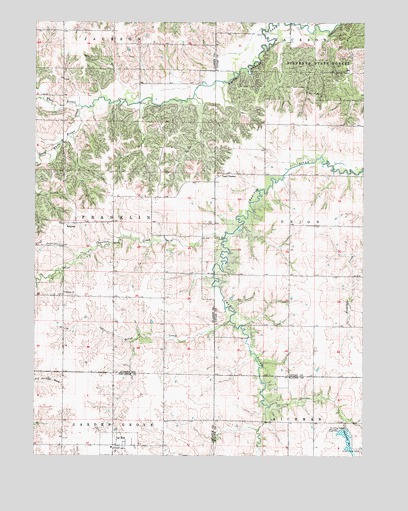
Le Roy, IA USGS Topographic Map
Click on map above to begin viewing in our Map Viewer.

This topographic map contains these locations and features:
Feature Name Type Latitude Longitude GNIS ID View Map
Blair CemeteryCemeteryN40.9082°W93.6222°1969824View Map
Brush CreekStreamN40.9139°W93.5508°454883View Map
Chariton CreekStreamN40.9381°W93.5535°455351View Map
City of Le RoyCivilN40.8784°W93.5925°2395658View Map
Clarke CemeteryCemeteryN40.9781°W93.6221°1969825View Map
Gwinn CemeteryCemeteryN40.8917°W93.5238°457189View Map
Humeston ParkParkN40.8789°W93.5077°457722View Map
Humeston ReservoirReservoirN40.8801°W93.5063°457723View Map
Last ChancePopulated PlaceN40.9564°W93.5535°464611View Map
Last Chance CemeteryCemeteryN40.9579°W93.5537°1975664View Map
Last Chance Post Office (historical)Post OfficeN40.9564°W93.5535°1970576View Map
Le RoyPopulated PlaceN40.8778°W93.5927°458257View Map
Le Roy (historical)LocaleN40.8778°W93.5927°1969726View Map
Le Roy Post Office (historical)Post OfficeN40.8778°W93.5927°1969727View Map
Selma (historical)LocaleN40.8950°W93.5024°466377View Map
Selma Post Office (historical)Post OfficeN40.8950°W93.5024°1975663View Map
SmyrnaPopulated PlaceN40.9422°W93.6097°461716View Map
Smyrna CemeteryCemeteryN40.9360°W93.6158°461717View Map
Smyrna ChurchChurchN40.9225°W93.6138°461718View Map
Smyrna Post Office (historical)Post OfficeN40.9422°W93.6097°1969826View Map
South White Breast CreekStreamN40.9758°W93.6077°461822View Map
Stephens State Forest - White Breast UnitForestN40.9858°W93.5130°461987View Map
Township of FranklinCivilN40.9428°W93.6143°467852View Map

Note: Coordinates in the location and feature list above are referenced to NAD83 datum.


Copyright (C) 2008-2024 Ryan Niemi / Sunset Dynamics ... All Rights Reserved