TopoQuest Logo
Do you find TopoQuest useful?
Help keep TopoQuest running and adding new maps/features by donating!
Bitcoin:  19c7KJd3qBynnjoSw5npx9KScwjBe4ifkT
Litecoin:  LXs6TkuXGGXo1vDsWCkWVdjQX94eUKd6ui
Home View Maps Find Maps Find Places Resources & Links


Corydon NE, Iowa Topographic Map

USGS Map Title: Corydon NE, IA
USGS Map MRC: 40093H3
DRG (GeoTIFF) Download: o40093h3.tif


Neighboring USGS Topographic Map Quads:


  Lucas, IA  
41093A4
 

  Chariton, IA  
41093A3
 

  Olmitz, IA  
41093A2
 

  Derby, IA  
40093H4
 

  Corydon NE, IA  
40093H3
 

  Russell, IA  
40093H2
 

  Humeston, IA  
40093G4
 

  Corydon, IA  
40093G3
 

  Confidence, IA  
40093G2


Map MRC Location:

N41°
W94°
N41°
W93°
H8 H7 H6 H5 H4 H3 H2 H1
G8 G7 G6 G5 G4 G3 G2 G1
F8 F7 F6 F5 F4 F3 F2 F1
E8 E7 E6 E5 E4 E3 E2 E1
D8 D7 D6 D5 D4 D3 D2 D1
C8 C7 C6 C5 C4 C3 C2 C1
B8 B7 B6 B5 B4 B3 B2 B1
A8 A7 A6 A5 A4 A3 A2 A1
N40°
W94°
N40°
W93°

Corydon NE, IA USGS 1:24K Topographic Map Preview:
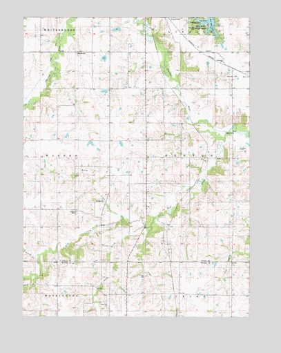
Corydon NE, IA USGS Topographic Map
Click on map above to begin viewing in our Map Viewer.

This topographic map contains these locations and features:
Feature Name Type Latitude Longitude GNIS ID View Map
Braden SchoolSchoolN40.9542°W93.2883°454796View Map
Brush CreekStreamN40.9131°W93.3083°454889View Map
Cinder Marsh ParkParkN40.9917°W93.3502°1970570View Map
Douglass CemeteryCemeteryN40.9920°W93.2944°1970657View Map
Fivemile CreekStreamN40.9003°W93.3672°456625View Map
Freedom CampLocaleN40.9186°W93.3474°1823280View Map
Freedom CemeteryCemeteryN40.9231°W93.3357°456756View Map
Freedom Post Office (historical)Post OfficeN40.9194°W93.3335°1970586View Map
Freedom SchoolSchoolN40.9175°W93.3410°456758View Map
Harmony SchoolSchoolN40.9708°W93.3366°457269View Map
Harts Mill CreekStreamN40.9708°W93.3366°457303View Map
Honey CreekStreamN40.9150°W93.3199°457611View Map
Jack Coffey Memorial LibraryBuildingN40.9947°W93.3074°1970626View Map
Lincoln SchoolSchoolN40.8839°W93.2691°458371View Map
Mayflower SchoolSchoolN40.8850°W93.3080°458868View Map
Milan Post Office (historical)Post OfficeN40.9056°W93.2738°1970585View Map
Moore Private AirportAirportN40.8754°W93.2668°466877View Map
Myers SchoolSchoolN40.9231°W93.2597°459424View Map
Otterbein ChurchChurchN40.9453°W93.3077°459947View Map
Palmer SchoolSchoolN40.9061°W93.2977°460001View Map
Pin Oak MarshParkN40.9944°W93.3072°1970628View Map
Pin Oak Marsh Lodge Educational CenterBuildingN40.9947°W93.3074°1970627View Map
Red Haw LakeReservoirN40.9937°W93.2742°1823359View Map
Red Haw State ParkParkN40.9958°W93.2794°463767View Map
Ryan CemeteryCemeteryN40.8917°W93.3083°1823278View Map
Salem CemeteryCemeteryN40.9754°W93.2594°1970661View Map
Salem ChurchChurchN40.9817°W93.2652°461365View Map
Salem SchoolSchoolN40.9817°W93.2655°461373View Map
Sharon CemeteryCemeteryN40.8797°W93.3297°1970561View Map
Sharon ChurchChurchN40.8800°W93.3294°461535View Map
Sugar CreekStreamN40.9122°W93.3044°462050View Map
Township of BentonCivilN40.9418°W93.2700°467445View Map
Union SchoolSchoolN40.9492°W93.3277°462464View Map
Washington SchoolSchoolN40.9303°W93.3074°462708View Map
Waynick CemeteryCemeteryN40.9853°W93.3462°1823279View Map
Wolf CreekStreamN40.9489°W93.2672°463167View Map

Note: Coordinates in the location and feature list above are referenced to NAD83 datum.


Copyright (C) 2008-2024 Ryan Niemi / Sunset Dynamics ... All Rights Reserved