TopoQuest Logo
Do you find TopoQuest useful?
Help keep TopoQuest running and adding new maps/features by donating!
Bitcoin:  19c7KJd3qBynnjoSw5npx9KScwjBe4ifkT
Litecoin:  LXs6TkuXGGXo1vDsWCkWVdjQX94eUKd6ui
Home View Maps Find Maps Find Places Resources & Links


Baileyville, Texas Topographic Map

USGS Map Title: Baileyville, TX
USGS Map MRC: 31096A7
DRG (GeoTIFF) Download: o31096a7.tif


Neighboring USGS Topographic Map Quads:


  Cedar Springs, TX  
31096B8
 

  Reagan, TX  
31096B7
 

  Bremond, TX  
31096B6
 

  Rosebud, TX  
31096A8
 

  Baileyville, TX  
31096A7
 

  Hammond, TX  
31096A6
 

  Ben Arnold, TX  
30096H8
 

  Maysfield, TX  
30096H7
 

  Calvert, TX  
30096H6


Map MRC Location:

N32°
W97°
N32°
W96°
H8 H7 H6 H5 H4 H3 H2 H1
G8 G7 G6 G5 G4 G3 G2 G1
F8 F7 F6 F5 F4 F3 F2 F1
E8 E7 E6 E5 E4 E3 E2 E1
D8 D7 D6 D5 D4 D3 D2 D1
C8 C7 C6 C5 C4 C3 C2 C1
B8 B7 B6 B5 B4 B3 B2 B1
A8 A7 A6 A5 A4 A3 A2 A1
N31°
W97°
N31°
W96°

Baileyville, TX USGS 1:24K Topographic Map Preview:
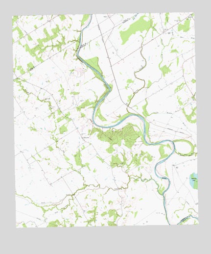
Baileyville, TX USGS Topographic Map
Click on map above to begin viewing in our Map Viewer.

This topographic map contains these locations and features:
Feature Name Type Latitude Longitude GNIS ID View Map
Allday - Jones CemeteryCemeteryN31.0474°W96.7936°1350990View Map
Alligator CreekStreamN31.1049°W96.7714°1351013View Map
BaileyvillePopulated PlaceN31.0527°W96.8286°1379379View Map
Bozeman CemeteryCemeteryN31.0741°W96.8300°1352796View Map
Burns LakeReservoirN31.0590°W96.8280°1858929View Map
Burns Lake DamDamN31.0585°W96.8286°1858928View Map
Caddo CemeteryCemeteryN31.0863°W96.8511°1353507View Map
Chair BranchStreamN31.1093°W96.7669°1354255View Map
Cottonmouth CreekStreamN31.1153°W96.8283°2100387View Map
Darting Minnow CreekStreamN31.1089°W96.8292°2100388View Map
Duck LakeLakeN31.1228°W96.7907°1356397View Map
Ellison LakeReservoirN31.0922°W96.8293°1858931View Map
Ellison Lake DamDamN31.0919°W96.8286°1858930View Map
EloisePopulated PlaceN31.1230°W96.8086°1379721View Map
Hardin SloughStreamN31.0660°W96.7941°1358771View Map
Herndon CemeteryCemeteryN31.0413°W96.8636°2043282View Map
Hog CreekStreamN31.0244°W96.8264°1359357View Map
Hopper RanchLocaleN31.1130°W96.7691°1359559View Map
Little Brazos River Diversion ChannelChannelN31.0419°W96.7525°1361289View Map
Little Pond CreekStreamN31.0188°W96.8364°1372176View Map
Macedonia CemeteryCemeteryN31.1210°W96.7614°1362021View Map
Macedonia ChurchChurchN31.1227°W96.7530°1362027View Map
Morning Star CemeteryCemeteryN31.0752°W96.8540°2043284View Map
Morning Star ChurchChurchN31.0752°W96.8539°1363154View Map
Mount Zion CemeteryCemeteryN31.0366°W96.8028°2043281View Map
Mount Zion ChurchChurchN31.0369°W96.8028°1363354View Map
Pearson CemeteryCemeteryN31.0702°W96.8608°1364943View Map
Pond CreekStreamN31.0177°W96.7747°1375523View Map
Salter FarmLocaleN31.0349°W96.7661°1367449View Map
Stoneham CemeteryCemeteryN31.0419°W96.7903°1369242View Map
True-Vine ChurchChurchN31.1146°W96.7714°1370158View Map

Note: Coordinates in the location and feature list above are referenced to NAD83 datum.


Copyright (C) 2008-2025 Ryan Niemi / Sunset Dynamics ... All Rights Reserved