TopoQuest Logo
Do you find TopoQuest useful?
Help keep TopoQuest running and adding new maps/features by donating!
Bitcoin:  19c7KJd3qBynnjoSw5npx9KScwjBe4ifkT
Litecoin:  LXs6TkuXGGXo1vDsWCkWVdjQX94eUKd6ui
Home View Maps Find Maps Find Places Resources & Links


Hungry Ridge, Idaho Topographic Map

USGS Map Title: Hungry Ridge, ID
USGS Map MRC: 45115G8
DRG (GeoTIFF) Download: o45115g8.tif


Neighboring USGS Topographic Map Quads:


  Grangeville East, ID  
45116H1
 

  Harpster, ID  
45115H8
 

  Corral Hill, ID  
45115H7
 

  Goodwin Meadows, ID  
45116G1
 

  Hungry Ridge, ID  
45115G8
 

  Huddleson Bluff, ID  
45115G7
 

  Dairy Mountain, ID  
45116F1
 

  Sawyer Ridge, ID  
45115F8
 

  Sourdough Peak, ID  
45115F7


Map MRC Location:

N46°
W116°
N46°
W115°
H8 H7 H6 H5 H4 H3 H2 H1
G8 G7 G6 G5 G4 G3 G2 G1
F8 F7 F6 F5 F4 F3 F2 F1
E8 E7 E6 E5 E4 E3 E2 E1
D8 D7 D6 D5 D4 D3 D2 D1
C8 C7 C6 C5 C4 C3 C2 C1
B8 B7 B6 B5 B4 B3 B2 B1
A8 A7 A6 A5 A4 A3 A2 A1
N45°
W116°
N45°
W115°

Hungry Ridge, ID USGS 1:24K Topographic Map Preview:
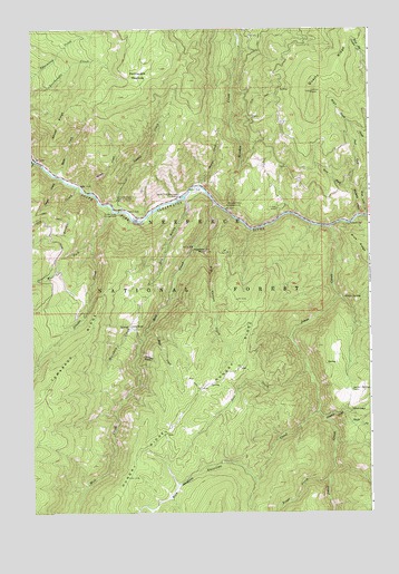
Hungry Ridge, ID USGS Topographic Map
Click on map above to begin viewing in our Map Viewer.

This topographic map contains these locations and features:
Feature Name Type Latitude Longitude GNIS ID View Map
American CreekStreamN45.7760°W115.8949°376591View Map
Asbestos PointLocaleN45.8179°W115.9410°376736View Map
Asbestos PointPopulated PlaceN45.8179°W115.9407°376737View Map
Barton CabinLocaleN45.7816°W115.8824°397409View Map
Big Canyon CreekStreamN45.8191°W115.9401°397434View Map
Bivouac CreekStreamN45.8341°W115.9835°377716View Map
Browns CreekStreamN45.8343°W115.9374°397484View Map
Buck MeadowsFlatN45.7560°W115.9476°378380View Map
Bully CreekStreamN45.8413°W115.9996°378494View Map
Castle CreekStreamN45.8282°W115.9679°378999View Map
Castle Creek CampgroundLocaleN45.8279°W115.9685°379005View Map
Castle Creek Work CenterLocaleN45.8310°W115.9679°397532View Map
Deer CreekStreamN45.7871°W115.8990°397618View Map
Dry GulchValleyN45.8310°W115.9435°397658View Map
Earthquake MeadowsFlatN45.8627°W115.9601°381012View Map
East Fork Wickiup CreekStreamN45.8335°W115.8824°381199View Map
Fisher MineMineN45.8285°W115.9093°397704View Map
Freds SpringSpringN45.8056°W115.8848°382028View Map
Gilmore CreekStreamN45.7743°W115.8929°382275View Map
Gilmore RanchLocaleN45.7757°W115.8824°397738View Map
Grouse CreekStreamN45.8296°W115.9729°382738View Map
Hays CreekStreamN45.7966°W115.9582°397781View Map
Hungry RidgeRidgeN45.7591°W115.9651°383553View Map
Hungry Ridge Ranch AirportAirportN45.7830°W115.9376°2443813View Map
Jackass GulchValleyN45.7913°W115.9615°383822View Map
Johns CreekStreamN45.8238°W115.8899°383966View Map
Jungle CreekStreamN45.8357°W115.9888°384067View Map
Lamb RanchLocaleN45.7982°W115.9640°397845View Map
Markham CreekStreamN45.7949°W115.9601°386470View Map
Meadow CreekStreamN45.8288°W115.9293°399989View Map
Meadow Creek CampgroundLocaleN45.8293°W115.9276°386708View Map
Mill CreekStreamN45.8299°W115.9329°386948View Map
Nelson CreekStreamN45.8327°W115.9790°387509View Map
Quartz RidgeRidgeN45.8732°W115.8840°388975View Map
Ralph Smith CreekStreamN45.8268°W115.8760°389065View Map
Sheep CreekStreamN45.8379°W115.9929°390192View Map
Sheep RidgeRidgeN45.8507°W115.9890°390252View Map
South Fork CampgroundLocaleN45.8249°W115.9632°394012View Map
South Fork Clearwater StationLocaleN45.8318°W115.9457°390909View Map
South Fork Gilmore CreekStreamN45.7757°W115.8849°390939View Map
Tamarack RidgeRidgeN45.7971°W115.9782°391834View Map
Trout CreekStreamN45.7585°W115.8910°392416View Map
West Fork Grouse CreekStreamN45.8202°W115.9782°393113View Map
West Fork Wickiup CreekStreamN45.8335°W115.8824°393224View Map
Wickiup CreekStreamN45.8266°W115.8787°393405View Map

Note: Coordinates in the location and feature list above are referenced to NAD83 datum.


Copyright (C) 2008-2024 Ryan Niemi / Sunset Dynamics ... All Rights Reserved