TopoQuest Logo
Do you find TopoQuest useful?
Help keep TopoQuest running and adding new maps/features by donating!
Bitcoin:  19c7KJd3qBynnjoSw5npx9KScwjBe4ifkT
Litecoin:  LXs6TkuXGGXo1vDsWCkWVdjQX94eUKd6ui
Home View Maps Find Maps Find Places Resources & Links


Harpster, Idaho Topographic Map

USGS Map Title: Harpster, ID
USGS Map MRC: 45115H8
DRG (GeoTIFF) Download: o45115h8.tif


Neighboring USGS Topographic Map Quads:


  Nezperce SE, ID  
46116A1
 

  Stites, ID  
46115A8
 

  Big Cedar, ID  
46115A7
 

  Grangeville East, ID  
45116H1
 

  Harpster, ID  
45115H8
 

  Corral Hill, ID  
45115H7
 

  Goodwin Meadows, ID  
45116G1
 

  Hungry Ridge, ID  
45115G8
 

  Huddleson Bluff, ID  
45115G7


Map MRC Location:

N46°
W116°
N46°
W115°
H8 H7 H6 H5 H4 H3 H2 H1
G8 G7 G6 G5 G4 G3 G2 G1
F8 F7 F6 F5 F4 F3 F2 F1
E8 E7 E6 E5 E4 E3 E2 E1
D8 D7 D6 D5 D4 D3 D2 D1
C8 C7 C6 C5 C4 C3 C2 C1
B8 B7 B6 B5 B4 B3 B2 B1
A8 A7 A6 A5 A4 A3 A2 A1
N45°
W116°
N45°
W115°

Harpster, ID USGS 1:24K Topographic Map Preview:
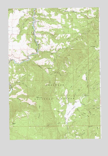
Harpster, ID USGS Topographic Map
Click on map above to begin viewing in our Map Viewer.

This topographic map contains these locations and features:
Feature Name Type Latitude Longitude GNIS ID View Map
Blacktail ButteSummitN45.8899°W115.9971°396146View Map
Blacktail RidgeRidgeN45.9066°W115.9579°377832View Map
China CreekStreamN45.9910°W115.9665°379291View Map
Covert CreekStreamN45.8910°W115.9221°379932View Map
Doe CreekStreamN45.9141°W115.8760°380677View Map
Downey CreekStreamN45.9241°W115.9974°380741View Map
False CreekStreamN45.9229°W115.8901°381585View Map
Farris CreekStreamN45.8977°W115.9226°381608View Map
Green CreekStreamN45.9596°W115.9601°382631View Map
Green Creek PointSummitN45.9616°W115.8813°396587View Map
HarpsterPopulated PlaceN45.9866°W115.9635°397775View Map
Harpster Volunteer Fire DepartmentBuildingN45.9847°W115.9611°2619030View Map
Kiddler PlaceLocaleN45.9735°W115.9229°394013View Map
Lightning CreekStreamN45.9524°W115.9715°384629View Map
Little Lightning CreekStreamN45.9360°W115.9460°384878View Map
McComas MeadowsFlatN45.9032°W115.9168°386579View Map
McComas Ranch (historical)LocaleN45.9068°W115.9190°399350View Map
Monument HillSummitN45.8868°W115.8926°396917View Map
North Blacktail ButteSummitN45.9146°W115.9629°396964View Map
North Meadow CampLocaleN45.9166°W115.8963°387829View Map
North Meadow CreekStreamN45.9082°W115.9024°387830View Map
Orchard CreekStreamN45.9077°W115.9107°387982View Map
Potlatch Camp 58LocaleN45.8896°W115.9226°394014View Map
Rock CreekStreamN45.8818°W115.9207°389476View Map
Sears CreekStreamN45.9782°W115.9640°390071View Map
Space CreekStreamN45.9035°W115.8918°391088View Map
SugarloafSummitN45.9421°W115.9471°391586View Map
Swan CreekStreamN45.9049°W115.8890°391716View Map
Swede CreekStreamN45.9071°W115.9101°391757View Map
Swede RidgeRidgeN45.8952°W115.8901°391762View Map
Whitman CreekStreamN45.9049°W115.9168°393394View Map

Note: Coordinates in the location and feature list above are referenced to NAD83 datum.


Copyright (C) 2008-2025 Ryan Niemi / Sunset Dynamics ... All Rights Reserved