TopoQuest Logo
Do you find TopoQuest useful?
Help keep TopoQuest running and adding new maps/features by donating!
Bitcoin:  19c7KJd3qBynnjoSw5npx9KScwjBe4ifkT
Litecoin:  LXs6TkuXGGXo1vDsWCkWVdjQX94eUKd6ui
Home View Maps Find Maps Find Places Resources & Links


Grangeville East, Idaho Topographic Map

USGS Map Title: Grangeville East, ID
USGS Map MRC: 45116H1
DRG (GeoTIFF) Download: o45116h1.tif


Neighboring USGS Topographic Map Quads:


  Nezperce SW, ID  
46116A2
 

  Nezperce SE, ID  
46116A1
 

  Stites, ID  
46115A8
 

  Grangeville West, ID  
45116H2
 

  Grangeville East, ID  
45116H1
 

  Harpster, ID  
45115H8
 

  White Bird Hill, ID  
45116G2
 

  Goodwin Meadows, ID  
45116G1
 

  Hungry Ridge, ID  
45115G8


Map MRC Location:

N46°
W117°
N46°
W116°
H8 H7 H6 H5 H4 H3 H2 H1
G8 G7 G6 G5 G4 G3 G2 G1
F8 F7 F6 F5 F4 F3 F2 F1
E8 E7 E6 E5 E4 E3 E2 E1
D8 D7 D6 D5 D4 D3 D2 D1
C8 C7 C6 C5 C4 C3 C2 C1
B8 B7 B6 B5 B4 B3 B2 B1
A8 A7 A6 A5 A4 A3 A2 A1
N45°
W117°
N45°
W116°

Grangeville East, ID USGS 1:24K Topographic Map Preview:
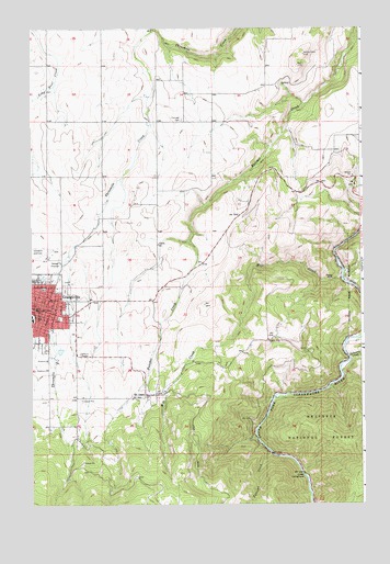
Grangeville East, ID USGS Topographic Map
Click on map above to begin viewing in our Map Viewer.

This topographic map contains these locations and features:
Feature Name Type Latitude Longitude GNIS ID View Map
A ManesLocaleN45.9152°W116.0549°394498View Map
BlakelyLocaleN45.9560°W116.1149°394500View Map
Boundary CampgroundLocaleN45.8891°W116.0349°394495View Map
City of GrangevilleCivilN45.9259°W116.1224°2410641View Map
Cotter Bar Picnic AreaLocaleN45.8824°W116.0229°379814View Map
CoxLocaleN45.9732°W116.0290°400564View Map
Dewey MineMineN45.9341°W116.0110°380559View Map
ElmenLocaleN45.9691°W116.0218°394483View Map
Fairview CemeteryCemeteryN45.9760°W116.0676°398516View Map
Farrens CreekStreamN45.8888°W116.0357°381607View Map
GrangevillePopulated PlaceN45.9266°W116.1224°396579View Map
Grangeville Elementary - Junior High SchoolSchoolN45.9234°W116.1247°401345View Map
Grangeville Fire DepartmentBuildingN45.9271°W116.1214°2619163View Map
Grangeville Police DepartmentBuildingN45.9271°W116.1216°2722467View Map
Grangeville Post OfficePost OfficeN45.9261°W116.1226°2766883View Map
GroomLocaleN45.9777°W116.0038°400565View Map
Idaho County AirportAirportN45.9426°W116.1234°400826View Map
Idaho County Poor FarmLocaleN45.9052°W116.0760°400566View Map
Idaho County Sheriff's OfficeBuildingN45.9263°W116.1232°2722369View Map
KORT-FM (Grangeville)TowerN45.8846°W116.1093°401776View Map
LikkepLocaleN45.9416°W116.1065°394499View Map
Mill CreekStreamN45.9341°W116.0088°386933View Map
MorreLocaleN45.9124°W116.0479°394497View Map
Mount IdahoPopulated PlaceN45.9038°W116.0821°396932View Map
MundtLocaleN45.9493°W116.0879°394481View Map
Schwartz CreekStreamN45.9135°W116.0054°390034View Map
SnodgrassLocaleN45.9096°W116.0524°394496View Map
YastesLocaleN45.9388°W116.0557°394482View Map

Note: Coordinates in the location and feature list above are referenced to NAD83 datum.


Copyright (C) 2008-2024 Ryan Niemi / Sunset Dynamics ... All Rights Reserved