TopoQuest Logo
Do you find TopoQuest useful?
Help keep TopoQuest running and adding new maps/features by donating!
Bitcoin:  19c7KJd3qBynnjoSw5npx9KScwjBe4ifkT
Litecoin:  LXs6TkuXGGXo1vDsWCkWVdjQX94eUKd6ui
Home View Maps Find Maps Find Places Resources & Links


Baily Points, New Mexico Topographic Map

USGS Map Title: Baily Points, NM
USGS Map MRC: 33107C8
DRG (GeoTIFF) Download: o33107c8.tif


Neighboring USGS Topographic Map Quads:


  Spring Canyon, NM  
33108D1
 

  Taylor Peak, NM  
33107D8
 

  Sawmill Peak, NM  
33107D7
 

  Wall Lake, NM  
33108C1
 

  Baily Points, NM  
33107C8
 

  Lookout Mountain, NM  
33107C7
 

  Middle Mesa, NM  
33108B1
 

  Bonner Canyon, NM  
33107B8
 

  Reeds Peak, NM  
33107B7


Map MRC Location:

N34°
W108°
N34°
W107°
H8 H7 H6 H5 H4 H3 H2 H1
G8 G7 G6 G5 G4 G3 G2 G1
F8 F7 F6 F5 F4 F3 F2 F1
E8 E7 E6 E5 E4 E3 E2 E1
D8 D7 D6 D5 D4 D3 D2 D1
C8 C7 C6 C5 C4 C3 C2 C1
B8 B7 B6 B5 B4 B3 B2 B1
A8 A7 A6 A5 A4 A3 A2 A1
N33°
W108°
N33°
W107°

Baily Points, NM USGS 1:24K Topographic Map Preview:
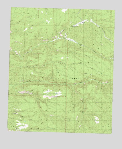
Baily Points, NM USGS Topographic Map
Click on map above to begin viewing in our Map Viewer.

This topographic map contains these locations and features:
Feature Name Type Latitude Longitude GNIS ID View Map
Baily CreekStreamN33.2967°W107.9984°903501View Map
Baily PointsSummitN33.2615°W107.9600°2038774View Map
Big Bear TankReservoirN33.2586°W107.9984°899179View Map
Black Range Ranger DistrictForestN33.3456°W107.9217°2038372View Map
Caves WellWellN33.2990°W107.9812°2038398View Map
Cox TankReservoirN33.3612°W107.9592°899185View Map
Inman Cienega TankReservoirN33.3700°W107.9576°899184View Map
Maverick TankReservoirN33.3105°W107.8897°899182View Map
McCauley RanchLocaleN33.3453°W107.9420°908496View Map
Miller SpringSpringN33.3453°W107.9375°936775View Map
Road TankReservoirN33.3744°W107.9169°899188View Map
Round MountainSummitN33.3101°W107.9106°910444View Map
Running Water CanyonValleyN33.2987°W107.9287°910474View Map
Running Water SpringSpringN33.2748°W107.9087°899197View Map
Saucer TankReservoirN33.3354°W107.8840°899183View Map
Seventy-Four DrawMineN33.3723°W107.8939°915570View Map
Seventyfour DrawValleyN33.3445°W107.9437°910963View Map
Sevety-four Draw WellReservoirN33.3578°W107.9206°936776View Map
Shallow TankReservoirN33.3742°W107.9925°899187View Map
Slick Rock TankReservoirN33.2604°W107.9797°899180View Map
South MesaSummitN33.2776°W107.9289°911262View Map
South Mesa TankReservoirN33.2894°W107.9429°899178View Map
Turkey DrawValleyN33.3395°W107.9564°911874View Map
Turkey RunStreamN33.3395°W107.9564°911888View Map
Upper Dry TankReservoirN33.3184°W107.9470°2038738View Map

Note: Coordinates in the location and feature list above are referenced to NAD83 datum.


Copyright (C) 2008-2025 Ryan Niemi / Sunset Dynamics ... All Rights Reserved