TopoQuest Logo
Do you find TopoQuest useful?
Help keep TopoQuest running and adding new maps/features by donating!
Bitcoin:  19c7KJd3qBynnjoSw5npx9KScwjBe4ifkT
Litecoin:  LXs6TkuXGGXo1vDsWCkWVdjQX94eUKd6ui
Home View Maps Find Maps Find Places Resources & Links


Wall Lake, New Mexico Topographic Map

USGS Map Title: Wall Lake, NM
USGS Map MRC: 33108C1
DRG (GeoTIFF) Download: o33108c1.tif


Neighboring USGS Topographic Map Quads:


  Black Mountain, NM  
33108D2
 

  Spring Canyon, NM  
33108D1
 

  Taylor Peak, NM  
33107D8
 

  Burnt Corral Canyon, NM  
33108C2
 

  Wall Lake, NM  
33108C1
 

  Baily Points, NM  
33107C8
 

  Gila Hot Springs, NM  
33108B2
 

  Middle Mesa, NM  
33108B1
 

  Bonner Canyon, NM  
33107B8


Map MRC Location:

N34°
W109°
N34°
W108°
H8 H7 H6 H5 H4 H3 H2 H1
G8 G7 G6 G5 G4 G3 G2 G1
F8 F7 F6 F5 F4 F3 F2 F1
E8 E7 E6 E5 E4 E3 E2 E1
D8 D7 D6 D5 D4 D3 D2 D1
C8 C7 C6 C5 C4 C3 C2 C1
B8 B7 B6 B5 B4 B3 B2 B1
A8 A7 A6 A5 A4 A3 A2 A1
N33°
W109°
N33°
W108°

Wall Lake, NM USGS 1:24K Topographic Map Preview:
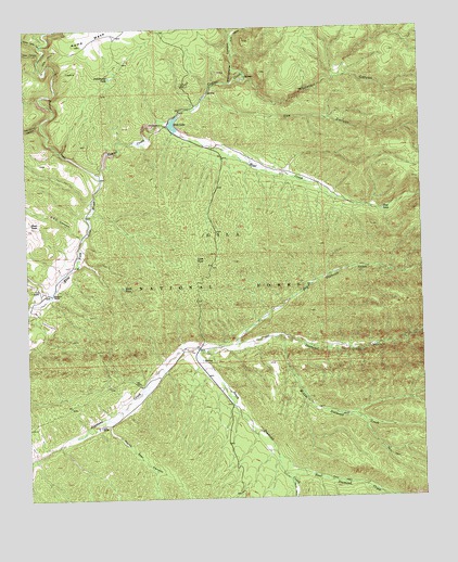
Wall Lake, NM USGS Topographic Map
Click on map above to begin viewing in our Map Viewer.

This topographic map contains these locations and features:
Feature Name Type Latitude Longitude GNIS ID View Map
Beaver CreekStreamN33.3353°W108.1020°903711View Map
Beaver CreekMineN33.3648°W108.1117°917228View Map
CCC CanyonValleyN33.3203°W108.1087°904270View Map
Cobb WellWellN33.2906°W108.0159°899055View Map
Cox CanyonValleyN33.3565°W108.0664°905461View Map
D D RanchLocaleN33.3056°W108.1214°905573View Map
Deer CanyonValleyN33.3662°W108.1209°905685View Map
Dry Diamond CreekStreamN33.2895°W108.0592°905878View Map
East Diamond CreekStreamN33.2565°W108.0456°905960View Map
East Diamond TankReservoirN33.2520°W108.0153°899063View Map
Horse Trap SpringSpringN33.3095°W108.1245°936747View Map
Hoyt CreekStreamN33.3478°W108.0773°907131View Map
Hoyt TankReservoirN33.3266°W108.0126°907132View Map
Knife TankReservoirN33.3063°W108.0948°907576View Map
Lake TankReservoirN33.3137°W108.0717°907831View Map
Link RanchLocaleN33.2692°W108.1031°907973View Map
Lost TankReservoirN33.2520°W108.0453°899061View Map
Middle Diamond CreekStreamN33.2934°W108.0456°908687View Map
Middle Diamond TankReservoirN33.2743°W108.0379°899060View Map
Middle Diamond Tank Number TwoReservoirN33.2779°W108.0006°899181View Map
Middle Diamond WellWellN33.2720°W108.0248°899058View Map
New TankReservoirN33.2594°W108.1230°899052View Map
No Name TankReservoirN33.3107°W108.0054°899056View Map
North Star CanyonValleyN33.2695°W108.1003°909193View Map
Pot Hole TankReservoirN33.2929°W108.0470°899053View Map
River TankReservoirN33.3236°W108.1242°910324View Map
Road Canyon TankReservoirN33.2684°W108.0635°899054View Map
South Diamond CreekStreamN33.2890°W108.0728°911226View Map
South Diamond WellWellN33.2565°W108.0453°899062View Map
Steeple U RanchLocaleN33.3048°W108.1178°911401View Map
Taylor CreekStreamN33.3353°W108.1017°911559View Map
Taylor Creek Placer and LodeMineN33.3631°W108.0637°916792View Map
Trap Corral CanyonValleyN33.3506°W108.1209°911795View Map
Undertaker TankReservoirN33.3621°W108.0985°911954View Map
Upper Gate CanyonValleyN33.3709°W108.1200°911989View Map
Wall LakeReservoirN33.3496°W108.0785°896206View Map
Wall Lake CampgroundLocaleN33.3501°W108.0817°936748View Map
Whitetail CanyonValleyN33.3615°W108.0550°912338View Map
Whitetail TankReservoirN33.3601°W108.0162°899057View Map
Whitewater CanyonValleyN33.3598°W108.0659°912350View Map

Note: Coordinates in the location and feature list above are referenced to NAD83 datum.


Copyright (C) 2008-2024 Ryan Niemi / Sunset Dynamics ... All Rights Reserved