TopoQuest Logo
Do you find TopoQuest useful?
Help keep TopoQuest running and adding new maps/features by donating!
Bitcoin:  19c7KJd3qBynnjoSw5npx9KScwjBe4ifkT
Litecoin:  LXs6TkuXGGXo1vDsWCkWVdjQX94eUKd6ui
Home View Maps Find Maps Find Places Resources & Links


Hunter, Ohio Topographic Map

USGS Map Title: Hunter, OH
USGS Map MRC: 39081H1
DRG (GeoTIFF) Download: o39081h1.tif


Neighboring USGS Topographic Map Quads:


  Fairview, OH  
40081A2
 

  Bethesda, OH  
40081A1
 

  Saint Clairsville, OH  
40080A8
 

  Barnesville, OH  
39081H2
 

  Hunter, OH  
39081H1
 

  Armstrongs Mills, OH  
39080H8
 

  Lewisville, OH  
39081G2
 

  Woodsfield, OH  
39081G1
 

  Cameron, OH  
39080G8


Map MRC Location:

N40°
W82°
N40°
W81°
H8 H7 H6 H5 H4 H3 H2 H1
G8 G7 G6 G5 G4 G3 G2 G1
F8 F7 F6 F5 F4 F3 F2 F1
E8 E7 E6 E5 E4 E3 E2 E1
D8 D7 D6 D5 D4 D3 D2 D1
C8 C7 C6 C5 C4 C3 C2 C1
B8 B7 B6 B5 B4 B3 B2 B1
A8 A7 A6 A5 A4 A3 A2 A1
N39°
W82°
N39°
W81°

Hunter, OH USGS 1:24K Topographic Map Preview:
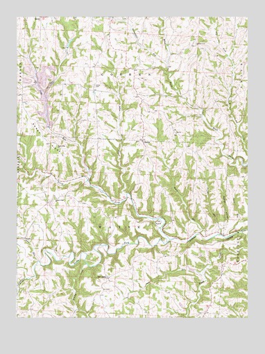
Hunter, OH USGS Topographic Map
Click on map above to begin viewing in our Map Viewer.

This topographic map contains these locations and features:
Feature Name Type Latitude Longitude GNIS ID View Map
Bailey Dairy FarmLocaleN39.9650°W81.1194°2634750View Map
Berrys RunStreamN39.9092°W81.0151°1065921View Map
Bethesda Sportsmans Club PondReservoirN39.9892°W81.0967°1078141View Map
Bethesda Sportsmans Club Pond DamDamN39.9867°W81.0982°1078140View Map
Brushy CreekStreamN39.8973°W81.0870°1085505View Map
Casey RunStreamN39.9087°W81.0098°1065951View Map
Center CemeteryCemeteryN39.9715°W81.0832°1038929View Map
Century MineMineN39.9008°W81.0225°2724985View Map
Chestnut Level CemeteryCemeteryN39.9881°W81.0287°1699355View Map
Chestnut Level ChurchChurchN39.9878°W81.0287°1039047View Map
Cranenest CreekStreamN39.8909°W81.1198°1075645View Map
Flag RunStreamN39.8981°W81.1132°1040495View Map
Horeb ChurchChurchN39.9140°W81.0501°1041792View Map
HunterPopulated PlaceN39.9478°W81.0573°1064878View Map
Hunter CemeteryCemeteryN39.9486°W81.0582°1699380View Map
Hunter Christian ChurchChurchN39.9484°W81.0573°1699381View Map
Hunter Post Office (historical)Post OfficeN39.9473°W81.0582°1959435View Map
Jakes RunStreamN39.9256°W81.0659°1066049View Map
Long RunStreamN39.9323°W81.0868°1042758View Map
Long RunStreamN39.8931°W81.0243°1042753View Map
Mikes RunStreamN39.9098°W81.0262°1043302View Map
Mount Horeb CemeteryCemeteryN39.9149°W81.0493°1699390View Map
Mount Zion CemeteryCemeteryN39.9516°W81.0390°1699391View Map
New CastlePopulated PlaceN39.8909°W81.0757°1065114View Map
North Fork Captina CreekStreamN39.9076°W81.0423°1065743View Map
Packsaddle RunStreamN39.9812°W81.0440°1065744View Map
Pleasant Ridge CemeteryCemeteryN39.9242°W81.1034°1699405View Map
Pleasant Ridge ChurchChurchN39.9245°W81.1037°1044575View Map
Reeves HollowValleyN39.9123°W81.0140°1044921View Map
Sandy RidgeRidgeN39.9495°W81.1107°1066187View Map
Sandy Ridge ChurchChurchN39.9456°W81.1029°1045957View Map
South Fork Captina CreekStreamN39.9070°W81.0423°1046446View Map
Tacoma Post Office (historical)Post OfficeN39.9917°W81.0804°1964821View Map
Township of GoshenCivilN39.9931°W81.0641°1085778View Map
Township of WayneCivilN39.9057°W81.0694°1085789View Map
Zion ChurchChurchN39.9517°W81.0393°1048270View Map

Note: Coordinates in the location and feature list above are referenced to NAD83 datum.


Copyright (C) 2008-2024 Ryan Niemi / Sunset Dynamics ... All Rights Reserved