TopoQuest Logo
Do you find TopoQuest useful?
Help keep TopoQuest running and adding new maps/features by donating!
Bitcoin:  19c7KJd3qBynnjoSw5npx9KScwjBe4ifkT
Litecoin:  LXs6TkuXGGXo1vDsWCkWVdjQX94eUKd6ui
Home View Maps Find Maps Find Places Resources & Links


Bethesda, Ohio Topographic Map

USGS Map Title: Bethesda, OH
USGS Map MRC: 40081A1
DRG (GeoTIFF) Download: o40081a1.tif


Neighboring USGS Topographic Map Quads:


  Piedmont, OH  
40081B2
 

  Flushing, OH  
40081B1
 

  Harrisville, OH  
40080B8
 

  Fairview, OH  
40081A2
 

  Bethesda, OH  
40081A1
 

  Saint Clairsville, OH  
40080A8
 

  Barnesville, OH  
39081H2
 

  Hunter, OH  
39081H1
 

  Armstrongs Mills, OH  
39080H8


Map MRC Location:

N41°
W82°
N41°
W81°
H8 H7 H6 H5 H4 H3 H2 H1
G8 G7 G6 G5 G4 G3 G2 G1
F8 F7 F6 F5 F4 F3 F2 F1
E8 E7 E6 E5 E4 E3 E2 E1
D8 D7 D6 D5 D4 D3 D2 D1
C8 C7 C6 C5 C4 C3 C2 C1
B8 B7 B6 B5 B4 B3 B2 B1
A8 A7 A6 A5 A4 A3 A2 A1
N40°
W82°
N40°
W81°

Bethesda, OH USGS 1:24K Topographic Map Preview:
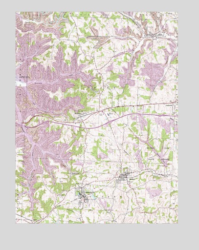
Bethesda, OH USGS Topographic Map
Click on map above to begin viewing in our Map Viewer.

This topographic map contains these locations and features:
Feature Name Type Latitude Longitude GNIS ID View Map
BadgertownPopulated PlaceN40.0298°W81.0820°1064370View Map
Barkcamp CreekStreamN40.0284°W81.0079°1065908View Map
BelmontPopulated PlaceN40.0292°W81.0390°1064410View Map
Belmont Elementary SchoolSchoolN40.0259°W81.0415°1050261View Map
Belmont Historic DistrictParkN40.0292°W81.0401°1071526View Map
Belmont LakeReservoirN40.0414°W81.0158°1078131View Map
Belmont Lake DamDamN40.0334°W81.0098°1078130View Map
Belmont Lake State ReserveParkN40.0428°W81.0143°1060861View Map
Belmont Post OfficePost OfficeN40.0292°W81.0387°1959456View Map
Belmont Town CemeteryCemeteryN40.0283°W81.0367°1699343View Map
Belmont Volunteer Fire Department Station 17BuildingN40.0301°W81.0405°2549464View Map
BethesdaPopulated PlaceN40.0162°W81.0726°1064431View Map
Bethesda CemeteryCemeteryN40.0147°W81.0668°1699347View Map
Bethesda Elementary SchoolSchoolN40.0217°W81.0751°1050260View Map
Bethesda Fire and Rescue Station 18BuildingN40.0154°W81.0712°2549519View Map
Bethesda Post OfficePost OfficeN40.0153°W81.0720°1959453View Map
Bethesda ReservoirReservoirN40.0159°W81.0648°1078133View Map
Bethesda Reservoir DamDamN40.0151°W81.0632°1078132View Map
Coal RunStreamN40.0831°W81.1195°1039208View Map
Ebenezer CemeteryCemeteryN40.0157°W81.0901°1040052View Map
Epworth ParkParkN40.0187°W81.0765°1040092View Map
Interchange 204CrossingN40.0573°W81.1176°1050251View Map
Interchange 208CrossingN40.0598°W81.0526°1050250View Map
LaffertyPopulated PlaceN40.1117°W81.0193°1064960View Map
Lafferty Census Designated PlaceCensusN40.1142°W81.0189°2628914View Map
Lafferty Fire and Emergency Medical Services Station 27BuildingN40.1119°W81.0194°2550566View Map
Lafferty Post OfficePost OfficeN40.1112°W81.0193°1959445View Map
LoomisPopulated PlaceN40.0287°W81.0084°1048934View Map
Mil-mar Trailer CourtPopulated PlaceN40.0119°W81.0700°2633569View Map
MorristownPopulated PlaceN40.0631°W81.0743°1065060View Map
Morristown Elementary SchoolSchoolN40.0612°W81.0734°1050259View Map
Morristown Fire Department Station 31BuildingN40.0648°W81.0754°2550215View Map
Morristown First CemeteryCemeteryN40.0632°W81.0726°1699389View Map
Morristown Historic DistrictParkN40.0640°W81.0726°1069085View Map
Morristown Post OfficePost OfficeN40.0631°W81.0748°1959463View Map
Plainfield CemeteryCemeteryN40.0646°W81.0040°1044515View Map
Saint Marys CemeteryCemeteryN40.1160°W81.0237°1045641View Map
SpeidelPopulated PlaceN40.0020°W81.1134°1065364View Map
Speidel CemeteryCemeteryN40.0021°W81.1121°1699425View Map
Speidel Post Office (historical)Post OfficeN40.0015°W81.1137°1959428View Map
Township of UnionCivilN40.0792°W81.0590°1085786View Map
Union CemeteryCemeteryN40.0654°W81.0732°1047278View Map
Union High SchoolSchoolN40.0648°W81.0532°1047324View Map
Village of BelmontCivilN40.0280°W81.0409°2398086View Map
Village of BethesdaCivilN40.0164°W81.0728°2398112View Map
Village of MorristownCivilN40.0638°W81.0696°2399399View Map

Note: Coordinates in the location and feature list above are referenced to NAD83 datum.


Copyright (C) 2008-2024 Ryan Niemi / Sunset Dynamics ... All Rights Reserved