TopoQuest Logo
Do you find TopoQuest useful?
Help keep TopoQuest running and adding new maps/features by donating!
Bitcoin:  19c7KJd3qBynnjoSw5npx9KScwjBe4ifkT
Litecoin:  LXs6TkuXGGXo1vDsWCkWVdjQX94eUKd6ui
Home View Maps Find Maps Find Places Resources & Links


Fairview, Ohio Topographic Map

USGS Map Title: Fairview, OH
USGS Map MRC: 40081A2
DRG (GeoTIFF) Download: o40081a2.tif


Neighboring USGS Topographic Map Quads:


  Freeport, OH  
40081B3
 

  Piedmont, OH  
40081B2
 

  Flushing, OH  
40081B1
 

  Antrim, OH  
40081A3
 

  Fairview, OH  
40081A2
 

  Bethesda, OH  
40081A1
 

  Quaker City, OH  
39081H3
 

  Barnesville, OH  
39081H2
 

  Hunter, OH  
39081H1


Map MRC Location:

N41°
W82°
N41°
W81°
H8 H7 H6 H5 H4 H3 H2 H1
G8 G7 G6 G5 G4 G3 G2 G1
F8 F7 F6 F5 F4 F3 F2 F1
E8 E7 E6 E5 E4 E3 E2 E1
D8 D7 D6 D5 D4 D3 D2 D1
C8 C7 C6 C5 C4 C3 C2 C1
B8 B7 B6 B5 B4 B3 B2 B1
A8 A7 A6 A5 A4 A3 A2 A1
N40°
W82°
N40°
W81°

Fairview, OH USGS 1:24K Topographic Map Preview:
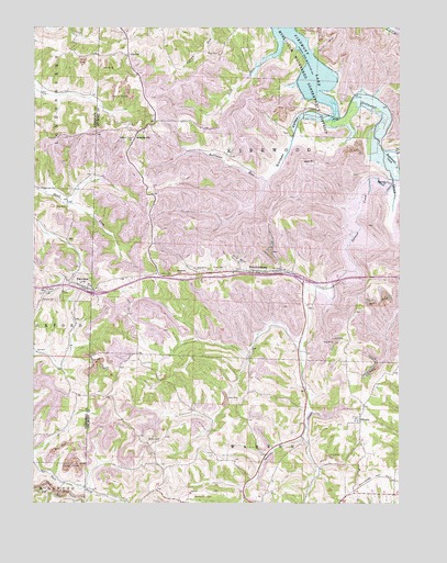
Fairview, OH USGS Topographic Map
Click on map above to begin viewing in our Map Viewer.

This topographic map contains these locations and features:
Feature Name Type Latitude Longitude GNIS ID View Map
Barnesville-Bradfield AirportAirportN40.0028°W81.1962°1082483View Map
Buttermilk CreekStreamN40.0923°W81.1298°1038573View Map
CabinetPopulated PlaceN40.1181°W81.2171°1056750View Map
Cabinet Post Office (historical)Post OfficeN40.1181°W81.2165°1959468View Map
Consolidation Coal Company Pond 0010-ReservoirN40.0434°W81.1448°1079471View Map
Consolidation Coal Company Pond 0010-016 DamDamN40.0434°W81.1448°1079470View Map
EgyptPopulated PlaceN40.0851°W81.1279°1064606View Map
Egypt Post Office (historical)Post OfficeN40.0848°W81.1276°1959441View Map
FairviewPopulated PlaceN40.0570°W81.2329°1040322View Map
Fairview CemeteryCemeteryN40.0534°W81.2418°1040328View Map
Fairview Volunteer Fire DepartmentBuildingN40.0581°W81.2380°2550194View Map
Gibson CemeteryCemeteryN40.0167°W81.2109°1040855View Map
HendrysburgPopulated PlaceN40.0609°W81.1732°1064823View Map
Hendrysburg Elementary School (historical)SchoolN40.0606°W81.1729°1070100View Map
Hendrysburg Post OfficePost OfficeN40.0612°W81.1734°1959446View Map
Hope CemeteryCemeteryN40.0622°W81.1844°1041760View Map
Interchange 198CrossingN40.0551°W81.2287°1050257View Map
Interchange 202CrossingN40.0590°W81.1579°1050258View Map
Lick RunStreamN40.1176°W81.1684°1042541View Map
Old Egypt CemeteryCemeteryN40.0865°W81.1409°1699398View Map
OlivettPopulated PlaceN40.0220°W81.1379°1065204View Map
Olivett Post OfficePost OfficeN40.0223°W81.1373°1959431View Map
Robinson RunStreamN40.0848°W81.1698°1066169View Map
Salem CemeteryCemeteryN40.0892°W81.1534°1699415View Map
Salem ChurchChurchN40.0898°W81.1537°1045889View Map
SewellsvillePopulated PlaceN40.0981°W81.2132°1065303View Map
Sewellsville CemeteryCemeteryN40.0973°W81.2118°1699418View Map
Sewellsville Methodist Episcopal ChurchChurchN40.0973°W81.2123°1699419View Map
Sewellsville Post Office (historical)Post OfficeN40.0987°W81.2137°1964823View Map
Sixteen ValleyValleyN40.1003°W81.1476°1046316View Map
Spencer CreekStreamN40.0840°W81.1270°1066218View Map
State Route 800 DamDamN40.0434°W81.1598°1079256View Map
State Route 800 ReservoirReservoirN40.0434°W81.1614°1079257View Map
Township of KirkwoodCivilN40.0828°W81.1727°1085779View Map
Village of FairviewCivilN40.0573°W81.2349°2398858View Map

Note: Coordinates in the location and feature list above are referenced to NAD83 datum.


Copyright (C) 2008-2025 Ryan Niemi / Sunset Dynamics ... All Rights Reserved