TopoQuest Logo
Do you find TopoQuest useful?
Help keep TopoQuest running and adding new maps/features by donating!
Bitcoin:  19c7KJd3qBynnjoSw5npx9KScwjBe4ifkT
Litecoin:  LXs6TkuXGGXo1vDsWCkWVdjQX94eUKd6ui
Home View Maps Find Maps Find Places Resources & Links


Hunter, New York Topographic Map

USGS Map Title: Hunter, NY
USGS Map MRC: 42074B2
DRG (GeoTIFF) Download: o42074b2.tif


Neighboring USGS Topographic Map Quads:


  Ashland, NY  
42074C3
 

  Hensonville, NY  
42074C2
 

  Freehold, NY  
42074C1
 

  Lexington, NY  
42074B3
 

  Hunter, NY  
42074B2
 

  Kaaterskill Clove, NY  
42074B1
 

  Phoenicia, NY  
42074A3
 

  Bearsville, NY  
42074A2
 

  Woodstock, NY  
42074A1


Map MRC Location:

N43°
W75°
N43°
W74°
H8 H7 H6 H5 H4 H3 H2 H1
G8 G7 G6 G5 G4 G3 G2 G1
F8 F7 F6 F5 F4 F3 F2 F1
E8 E7 E6 E5 E4 E3 E2 E1
D8 D7 D6 D5 D4 D3 D2 D1
C8 C7 C6 C5 C4 C3 C2 C1
B8 B7 B6 B5 B4 B3 B2 B1
A8 A7 A6 A5 A4 A3 A2 A1
N42°
W75°
N42°
W74°

Hunter, NY USGS 1:24K Topographic Map Preview:
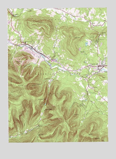
Hunter, NY USGS Topographic Map
Click on map above to begin viewing in our Map Viewer.

This topographic map contains these locations and features:
Feature Name Type Latitude Longitude GNIS ID View Map
Allen BrookStreamN42.1884°W74.1482°942346View Map
Becker HollowValleyN42.1791°W74.2068°943474View Map
Camp BeecherLocaleN42.2431°W74.2415°945550View Map
Camp MayfairLocaleN42.2009°W74.1893°945621View Map
Camp SchoharieLocaleN42.2181°W74.2276°945660View Map
Central SchoolSchoolN42.1968°W74.1374°946279View Map
Central SchoolSchoolN42.2095°W74.2118°946281View Map
Clum HillSummitN42.1840°W74.1315°946937View Map
Colonels ChairSummitN42.2006°W74.2307°947168View Map
Cook BrookStreamN42.1715°W74.1499°947338View Map
Devils TombstoneCliffN42.1554°W74.2043°948373View Map
Dolans LakeReservoirN42.2054°W74.2061°948549View Map
East JewettPopulated PlaceN42.2351°W74.1454°949141View Map
East Jewett CemeteryCemeteryN42.2499°W74.1862°2547542View Map
East Jewett Fire Department and Rescue SquadBuildingN42.2359°W74.1461°2718709View Map
East Jewett RangeSummitN42.2354°W74.2043°949142View Map
East Kill Valley ChurchChurchN42.2373°W74.1268°949147View Map
EdgewoodPopulated PlaceN42.1404°W74.2124°949378View Map
Elka ParkPopulated PlaceN42.1593°W74.1574°949499View Map
Evergreen CemeteryCemeteryN42.1833°W74.1522°949747View Map
Gooseberry CreekStreamN42.1870°W74.1649°951377View Map
Grill LakeReservoirN42.1638°W74.1519°951826View Map
Halsey BrookStreamN42.2329°W74.1390°970189View Map
HunterPopulated PlaceN42.2137°W74.2188°953467View Map
Hunter MountainSummitN42.1779°W74.2304°973354View Map
Hunter Mountain AirportAirportN42.2340°W74.2383°978079View Map
Hunter Mountain Fire TowerTowerN42.1772°W74.2297°2356869View Map
Hunter Post OfficePost OfficeN42.2132°W74.2190°2617972View Map
Hunter Public LibraryBuildingN42.2129°W74.2186°2617310View Map
Hunter Village CemeteryCemeteryN42.2081°W74.2063°2547546View Map
Hunter Volunteer Fire Company 1BuildingN42.2131°W74.2194°2735066View Map
Kaaterskill United Methodist ChurchChurchN42.1959°W74.1301°2616551View Map
Lake Rip Van WinkleReservoirN42.1920°W74.1291°962540View Map
Leach LakeReservoirN42.1996°W74.1523°955136View Map
Living Water Full Gospel ChurchChurchN42.2116°W74.2085°2616663View Map
Lower East Jewett ChurchChurchN42.2495°W74.1868°956081View Map
Mountain Drive-InLocaleN42.2375°W74.2442°2557416View Map
Myrtle BrookStreamN42.1331°W74.2318°958235View Map
Notch LakeLakeN42.1606°W74.2032°959036View Map
Onteora MountainSummitN42.2223°W74.1679°959412View Map
Onteora ParkPopulated PlaceN42.2201°W74.1354°959413View Map
Onteora PondReservoirN42.2166°W74.1508°959414View Map
Parker MountainSummitN42.2229°W74.1396°959909View Map
Pecoy NotchGapN42.1290°W74.1357°960095View Map
Plateau MountainSummitN42.1379°W74.1743°973359View Map
Red KillStreamN42.1993°W74.1993°962305View Map
Saint Francis De Sales Catholic ChurchChurchN42.1754°W74.1451°963493View Map
Saint Francis De Sales CemeteryCemeteryN42.1758°W74.1452°2547544View Map
Saint Johns ChurchChurchN42.1826°W74.1474°963649View Map
Saint Mary's of the Mountain Church CemeteryCemeteryN42.2043°W74.2003°2547545View Map
Saint Marys ChurchChurchN42.2040°W74.1999°963938View Map
Sawmill CreekStreamN42.1906°W74.1351°964530View Map
Shanty HollowValleyN42.1979°W74.2157°964941View Map
Silver Hollow NotchGapN42.1315°W74.2135°965251View Map
Spruce TopSummitN42.1506°W74.1679°966148View Map
Spruceton TrailTrailN42.2020°W74.2485°966150View Map
Star RockPillarN42.2256°W74.1304°966244View Map
Stony Clove NotchGapN42.1651°W74.2013°966548View Map
Stony Grove CampLocaleN42.1829°W74.1985°966569View Map
Sugarloaf MountainSummitN42.1312°W74.1501°966729View Map
TannersvillePopulated PlaceN42.1956°W74.1338°967045View Map
Tannersville Fire DepartmentBuildingN42.1959°W74.1315°2718335View Map
Tannersville Post OfficePost OfficeN42.1958°W74.1363°2618151View Map
Tannersville ReservoirsReservoirN42.2093°W74.1535°967046View Map
Tannersville Village Wastewater Treatment PlantLocaleN42.1868°W74.1513°2617764View Map
Taylor HollowValleyN42.2156°W74.2388°967091View Map
Town of HunterCivilN42.1647°W74.1516°979086View Map
Town of JewettCivilN42.2474°W74.2213°979108View Map
Twin MountainSummitN42.1256°W74.1290°968056View Map
Village of HunterCivilN42.2117°W74.2167°2390907View Map
Village of TannersvilleCivilN42.1936°W74.1354°2391163View Map

Note: Coordinates in the location and feature list above are referenced to NAD83 datum.


Copyright (C) 2008-2024 Ryan Niemi / Sunset Dynamics ... All Rights Reserved