TopoQuest Logo
Do you find TopoQuest useful?
Help keep TopoQuest running and adding new maps/features by donating!
Bitcoin:  19c7KJd3qBynnjoSw5npx9KScwjBe4ifkT
Litecoin:  LXs6TkuXGGXo1vDsWCkWVdjQX94eUKd6ui
Home View Maps Find Maps Find Places Resources & Links


Phoenicia, New York Topographic Map

USGS Map Title: Phoenicia, NY
USGS Map MRC: 42074A3
DRG (GeoTIFF) Download: o42074a3.tif


Neighboring USGS Topographic Map Quads:


  West Kill, NY  
42074B4
 

  Lexington, NY  
42074B3
 

  Hunter, NY  
42074B2
 

  Shandaken, NY  
42074A4
 

  Phoenicia, NY  
42074A3
 

  Bearsville, NY  
42074A2
 

  Peekamoose Mountain, NY  
41074H4
 

  West Shokan, NY  
41074H3
 

  Ashokan, NY  
41074H2


Map MRC Location:

N43°
W75°
N43°
W74°
H8 H7 H6 H5 H4 H3 H2 H1
G8 G7 G6 G5 G4 G3 G2 G1
F8 F7 F6 F5 F4 F3 F2 F1
E8 E7 E6 E5 E4 E3 E2 E1
D8 D7 D6 D5 D4 D3 D2 D1
C8 C7 C6 C5 C4 C3 C2 C1
B8 B7 B6 B5 B4 B3 B2 B1
A8 A7 A6 A5 A4 A3 A2 A1
N42°
W75°
N42°
W74°

Phoenicia, NY USGS 1:24K Topographic Map Preview:
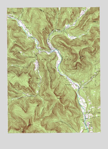
Phoenicia, NY USGS Topographic Map
Click on map above to begin viewing in our Map Viewer.

This topographic map contains these locations and features:
Feature Name Type Latitude Longitude GNIS ID View Map
AllabenPopulated PlaceN42.1168°W74.3704°942337View Map
Beaver KillStreamN42.0465°W74.2793°943389View Map
BeechfordPopulated PlaceN42.0212°W74.2704°943531View Map
BoicevillePopulated PlaceN42.0051°W74.2660°944398View Map
Boiceville School (historical)SchoolN42.0053°W74.2658°2371392View Map
Broadstreet HollowValleyN42.1123°W74.3593°944789View Map
Burroughs RangeSummitN42.0084°W74.3476°971957View Map
Catskill Corners Shopping CenterLocaleN42.0498°W74.2872°2599309View Map
ChichesterPopulated PlaceN42.1018°W74.3093°946567View Map
Chichester Post OfficePost OfficeN42.1018°W74.3087°2599242View Map
Cold BrookPopulated PlaceN42.0131°W74.2699°947024View Map
Coldbrook Station (historical)LocaleN42.0114°W74.2717°2371389View Map
Cornell MountainSummitN42.0015°W74.3568°973346View Map
Cross MountainSummitN42.0195°W74.3165°947805View Map
Cross Mountain HollowValleyN42.0381°W74.3335°947808View Map
Dougherty BranchStreamN42.0373°W74.3485°970076View Map
Fork RidgeRidgeN42.0406°W74.3679°950444View Map
Garfield MountainSummitN42.0912°W74.3665°950906View Map
H D Lane Volunteer Fire CompanyBuildingN42.1207°W74.2707°2735019View Map
Hudler CemeteryCemeteryN42.0337°W74.2766°953385View Map
Lanesville CemeteryCemeteryN42.1233°W74.2698°2547550View Map
Little Beaver KillStreamN42.0187°W74.2721°955459View Map
Longyear (historical)Populated PlaceN42.0522°W74.2922°2371391View Map
Longyear CemeteryCemeteryN42.0521°W74.2932°955950View Map
Mount PleasantPopulated PlaceN42.0484°W74.2890°957875View Map
Mount PleasantSummitN42.0343°W74.3082°960741View Map
Mount Pleasant CemeteryCemeteryN42.0294°W74.2717°968420View Map
Mount TremperPopulated PlaceN42.0448°W74.2754°957914View Map
Muddy BrookStreamN42.0759°W74.3357°958119View Map
Olive Volunteer Fire Department 1 Boiceville Company 5BuildingN42.0056°W74.2668°2735507View Map
Onteora High SchoolSchoolN42.0089°W74.2662°959410View Map
Onteora Hose CompanyBuildingN42.0438°W74.2773°2718290View Map
Onteora Middle SchoolSchoolN42.0092°W74.2673°2667575View Map
Our Lady of Good Counsel ChurchChurchN42.1123°W74.3579°959602View Map
Ox CloveValleyN42.1029°W74.3107°959702View Map
Panther KillStreamN42.0734°W74.3357°959816View Map
PhoeniciaPopulated PlaceN42.0848°W74.3154°960320View Map
Phoenicia Census Designated PlaceCensusN42.0825°W74.3098°2389666View Map
Phoenicia Elementary SchoolSchoolN42.0894°W74.3190°2598095View Map
Phoenicia LibraryBuildingN42.0830°W74.3147°2599429View Map
Phoenicia Post OfficePost OfficeN42.0841°W74.3126°2599244View Map
Phoenicia TrailTrailN42.0712°W74.2813°960321View Map
Phoenicia United Methodist ChurchChurchN42.0847°W74.3151°2598125View Map
Phoenicia Volunteer Fire Company Onteora Hose Company 3BuildingN42.0437°W74.2773°2735449View Map
Phoenicia Volunteer Fire Company Whitney Hose Company 1BuildingN42.0844°W74.3166°2735511View Map
Phoenicia Wesleyan ChurchChurchN42.0824°W74.3160°2598323View Map
Reginald Bennett Elementary SchoolSchoolN42.0107°W74.2658°943680View Map
Romer MountainSummitN42.0581°W74.3188°962845View Map
Saint Francis de Sales ChurchChurchN42.0835°W74.3112°2598324View Map
School Number 8 (historical)SchoolN42.1122°W74.3583°2371393View Map
Shandaken Rural CemeteryCemeteryN42.1056°W74.3500°964929View Map
Shandaken Station (historical)LocaleN42.1142°W74.3694°2371390View Map
Sheridan MountainSummitN42.1040°W74.3279°965067View Map
Silver HollowValleyN42.1023°W74.2976°970604View Map
Stony CloveValleyN42.0834°W74.3138°966546View Map
Stony Clove CreekStreamN42.0815°W74.3143°966547View Map
Terrace MountainSummitN42.0276°W74.3363°967168View Map
Tremper MountainSummitN42.0745°W74.2782°967788View Map
Warner CreekStreamN42.1020°W74.2976°968804View Map
Willow TrailTrailN42.0890°W74.2557°971374View Map
Wittenberg MountainSummitN42.0081°W74.3474°971528View Map
WoodlandPopulated PlaceN42.0531°W74.3318°971646View Map
Woodland CreekStreamN42.0818°W74.3313°971653View Map
Woodland ValleyValleyN42.0815°W74.3321°971657View Map

Note: Coordinates in the location and feature list above are referenced to NAD83 datum.


Copyright (C) 2008-2024 Ryan Niemi / Sunset Dynamics ... All Rights Reserved