TopoQuest Logo
Do you find TopoQuest useful?
Help keep TopoQuest running and adding new maps/features by donating!
Bitcoin:  19c7KJd3qBynnjoSw5npx9KScwjBe4ifkT
Litecoin:  LXs6TkuXGGXo1vDsWCkWVdjQX94eUKd6ui
Home View Maps Find Maps Find Places Resources & Links


Hunter Mountain, Oregon Topographic Map

USGS Map Title: Hunter Mountain, OR
USGS Map MRC: 44118A1
DRG (GeoTIFF) Download: o44118a1.tif


Neighboring USGS Topographic Map Quads:


  Clevenger Butte, OR  
44118B2
 

  De Bord Peaks, OR  
44118B1
 

  Clover Creek Ranch, OR  
44117B8
 

  Castle Rock, OR  
44118A2
 

  Hunter Mountain, OR  
44118A1
 

  Little Juniper Spring, OR  
44117A8
 

  Beulah, OR  
43118H2
 

  De Armond Mountain, OR  
43118H1
 

  Westfall Butte, OR  
43117H8


Map MRC Location:

N45°
W119°
N45°
W118°
H8 H7 H6 H5 H4 H3 H2 H1
G8 G7 G6 G5 G4 G3 G2 G1
F8 F7 F6 F5 F4 F3 F2 F1
E8 E7 E6 E5 E4 E3 E2 E1
D8 D7 D6 D5 D4 D3 D2 D1
C8 C7 C6 C5 C4 C3 C2 C1
B8 B7 B6 B5 B4 B3 B2 B1
A8 A7 A6 A5 A4 A3 A2 A1
N44°
W119°
N44°
W118°

Hunter Mountain, OR USGS 1:24K Topographic Map Preview:
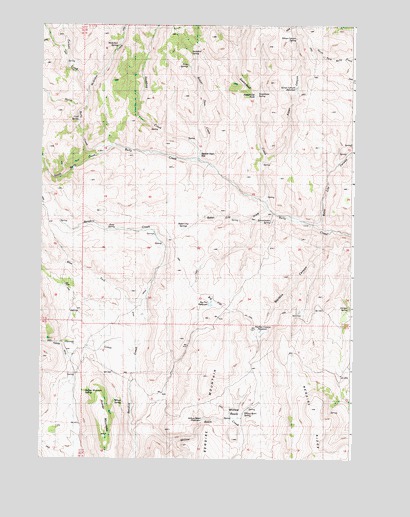
Hunter Mountain, OR USGS Topographic Map
Click on map above to begin viewing in our Map Viewer.

This topographic map contains these locations and features:
Feature Name Type Latitude Longitude GNIS ID View Map
Baker City CanyonValleyN44.0668°W118.0127°1637888View Map
Baker City DrawValleyN44.0721°W118.0346°1637889View Map
Baker City SpringsSpringN44.0668°W118.0663°1637890View Map
Beaver Dam CreekStreamN44.0860°W118.0627°1637891View Map
Beaver Dam FlatFlatN44.0874°W118.0624°1637892View Map
Big FlatFlatN44.0477°W118.0571°1637896View Map
Big Flat ReservoirReservoirN44.0446°W118.0571°1131795View Map
Buckskin SpringSpringN44.1170°W118.0658°1637899View Map
Cold SpringSpringN44.0975°W118.1104°1637901View Map
Earp SpringSpringN44.0661°W118.0969°1637905View Map
Godding CreekStreamN44.0893°W118.0630°1637908View Map
Hunter CreekStreamN44.0252°W118.0880°1637911View Map
Hunter DitchCanalN44.0252°W118.1158°1637912View Map
Hunter MountainSummitN44.0068°W118.0983°1637913View Map
Hunter Mountain SpringSpringN44.0193°W118.1069°1637914View Map
Hunter RanchLocaleN44.0227°W118.1149°1637915View Map
Juniper SpringSpringN44.0433°W118.0018°1637916View Map
Kitten CanyonValleyN44.0871°W118.0355°1637917View Map
Kitten Canyon ReservoirReservoirN44.1070°W118.0234°1637918View Map
Kitten Canyon SpringSpringN44.1213°W118.0234°1637919View Map
Mailbox CanyonValleyN44.0643°W118.0107°1637920View Map
Mailbox Canyon ReservoirReservoirN44.0370°W118.0370°1637921View Map
McArthur CreekStreamN44.1010°W118.1091°1637922View Map
McArthur SpringSpringN44.1190°W118.0949°1637923View Map
North Bully CreekStreamN44.0904°W118.0971°1637925View Map
Pinto SpringsSpringN44.1133°W118.0669°1637927View Map
Puckett CreekStreamN44.1063°W118.1077°1637928View Map
Schoolmarm SpringSpringN44.0684°W118.0331°1637929View Map
South Bully CreekStreamN44.0904°W118.0977°1637933View Map
Steamboat CreekStreamN44.0746°W118.0352°1637934View Map
Steamboat RockCliffN44.1049°W118.0408°1637935View Map
Steamboat SpringSpringN44.1056°W118.0388°1637936View Map
West Fork Bendire CreekStreamN44.0399°W118.0838°1637938View Map
Willow BasinBasinN44.0129°W118.0474°1637940View Map
Willow Basin CreekStreamN44.0110°W118.0835°1637941View Map
Willow Basin ReservoirReservoirN44.0113°W118.0601°1637942View Map
Willow Basin SpringSpringN44.0131°W118.0432°1637943View Map
Wilson SpringSpringN44.0164°W118.0956°1637944View Map

Note: Coordinates in the location and feature list above are referenced to NAD83 datum.


Copyright (C) 2008-2025 Ryan Niemi / Sunset Dynamics ... All Rights Reserved