TopoQuest Logo
Do you find TopoQuest useful?
Help keep TopoQuest running and adding new maps/features by donating!
Bitcoin:  19c7KJd3qBynnjoSw5npx9KScwjBe4ifkT
Litecoin:  LXs6TkuXGGXo1vDsWCkWVdjQX94eUKd6ui
Home View Maps Find Maps Find Places Resources & Links


Castle Rock, Oregon Topographic Map

USGS Map Title: Castle Rock, OR
USGS Map MRC: 44118A2
DRG (GeoTIFF) Download: o44118a2.tif


Neighboring USGS Topographic Map Quads:


  Flag Prairie, OR  
44118B3
 

  Clevenger Butte, OR  
44118B2
 

  De Bord Peaks, OR  
44118B1
 

  Buck Trough Spring, OR  
44118A3
 

  Castle Rock, OR  
44118A2
 

  Hunter Mountain, OR  
44118A1
 

  Cottonwood Reservoir, OR  
43118H3
 

  Beulah, OR  
43118H2
 

  De Armond Mountain, OR  
43118H1


Map MRC Location:

N45°
W119°
N45°
W118°
H8 H7 H6 H5 H4 H3 H2 H1
G8 G7 G6 G5 G4 G3 G2 G1
F8 F7 F6 F5 F4 F3 F2 F1
E8 E7 E6 E5 E4 E3 E2 E1
D8 D7 D6 D5 D4 D3 D2 D1
C8 C7 C6 C5 C4 C3 C2 C1
B8 B7 B6 B5 B4 B3 B2 B1
A8 A7 A6 A5 A4 A3 A2 A1
N44°
W119°
N44°
W118°

Castle Rock, OR USGS 1:24K Topographic Map Preview:
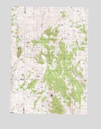
Castle Rock, OR USGS Topographic Map
Click on map above to begin viewing in our Map Viewer.

This topographic map contains these locations and features:
Feature Name Type Latitude Longitude GNIS ID View Map
Black ButteSummitN44.0749°W118.2363°1117746View Map
Campspot SpringSpringN44.1032°W118.1653°1118551View Map
Castle RockSummitN44.0210°W118.1827°1118665View Map
Castle Rock Fire StationLocaleN44.0563°W118.1869°1118668View Map
Castle Rock SpringSpringN44.0579°W118.1855°1118669View Map
Castle SpringSpringN44.0253°W118.1903°1118671View Map
Castle View SpringSpringN44.1187°W118.1713°1118672View Map
Goodwin TombLocaleN44.0785°W118.2244°1121237View Map
Horse FlatFlatN44.0113°W118.1916°1121998View Map
Horse Flat ReservoirReservoirN44.0096°W118.1944°1121999View Map
Hunter CampgroundLocaleN44.0035°W118.1621°1122146View Map
Hunter SpringSpringN44.0049°W118.1644°1122157View Map
Irish SpringSpringN44.0821°W118.1787°1122268View Map
Log SpringSpringN44.0311°W118.2003°1123351View Map
Lost CreekStreamN44.0688°W118.2258°1145524View Map
Lost Creek SpringSpringN44.0435°W118.2067°1123500View Map
Mouse LakeLakeN44.0935°W118.1577°1124435View Map
Mouse SpringSpringN44.0891°W118.1629°1124436View Map
Sheep Rock SpringsSpringN44.1192°W118.1443°1126840View Map
Whisky GulchValleyN44.1077°W118.1369°1128957View Map
Whisky Gulch SpringsSpringN44.1020°W118.1546°1128960View Map

Note: Coordinates in the location and feature list above are referenced to NAD83 datum.


Copyright (C) 2008-2025 Ryan Niemi / Sunset Dynamics ... All Rights Reserved