TopoQuest Logo
Do you find TopoQuest useful?
Help keep TopoQuest running and adding new maps/features by donating!
Bitcoin:  19c7KJd3qBynnjoSw5npx9KScwjBe4ifkT
Litecoin:  LXs6TkuXGGXo1vDsWCkWVdjQX94eUKd6ui
Home View Maps Find Maps Find Places Resources & Links


Huron City, Michigan Topographic Map

USGS Map Title: Huron City, MI
USGS Map MRC: 44082A7
DRG (GeoTIFF) Download: o44082a7.tif


Neighboring USGS Topographic Map Quads:


  Port Austin East, MI  
44082A8
 

  Huron City, MI  
44082A7


  Kinde East, MI  
43082H8
 

  Redman, MI  
43082H7
 

  Port Hope, MI  
43082H6


Map MRC Location:

N45°
W83°
N45°
W82°
H8 H7 H6 H5 H4 H3 H2 H1
G8 G7 G6 G5 G4 G3 G2 G1
F8 F7 F6 F5 F4 F3 F2 F1
E8 E7 E6 E5 E4 E3 E2 E1
D8 D7 D6 D5 D4 D3 D2 D1
C8 C7 C6 C5 C4 C3 C2 C1
B8 B7 B6 B5 B4 B3 B2 B1
A8 A7 A6 A5 A4 A3 A2 A1
N44°
W83°
N44°
W82°

Huron City, MI USGS 1:24K Topographic Map Preview:
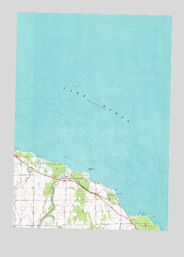
Huron City, MI USGS Topographic Map
Click on map above to begin viewing in our Map Viewer.

This topographic map contains these locations and features:
Feature Name Type Latitude Longitude GNIS ID View Map
Bald Eagle PointCapeN44.0347°W82.8149°620497View Map
Hubbard Memorial CemeteryCemeteryN44.0294°W82.8389°2548560View Map
Huron CityPopulated PlaceN44.0292°W82.8327°628861View Map
Huron City Historical MarkerParkN44.0283°W82.8317°2548584View Map
Huron City MuseumLocaleN44.0283°W82.8317°2548371View Map
Huron Post Office (historical)Post OfficeN44.0292°W82.8328°2548570View Map
Lighthouse County ParkParkN44.0200°W82.7955°630380View Map
New RiverStreamN44.0411°W82.8549°633338View Map
New River CemeteryCemeteryN44.0333°W82.8608°633339View Map
Orion RockIslandN44.0345°W82.8255°1618063View Map
Oscabe PointCapeN44.0125°W82.7722°1623118View Map
Oscube PointCapeN44.0081°W82.7663°1618065View Map
Pie aux Barques LightLocaleN44.0228°W82.7930°1618064View Map
Pointe Aux Barques LighthouseLocaleN44.0228°W82.7931°2548449View Map
Pointe aux Barques Lighthouse Historical MarkerParkN44.0219°W82.7942°2548596View Map
Pointe Aux Barques Lighthouse MuseumBuildingN44.0228°W82.7933°2548363View Map
South Branch Willow CreekStreamN44.0081°W82.8466°638325View Map
Willow CreekStreamN44.0353°W82.8297°1616533View Map

Note: Coordinates in the location and feature list above are referenced to NAD83 datum.


Copyright (C) 2008-2025 Ryan Niemi / Sunset Dynamics ... All Rights Reserved