TopoQuest Logo
Do you find TopoQuest useful?
Help keep TopoQuest running and adding new maps/features by donating!
Bitcoin:  19c7KJd3qBynnjoSw5npx9KScwjBe4ifkT
Litecoin:  LXs6TkuXGGXo1vDsWCkWVdjQX94eUKd6ui
Home View Maps Find Maps Find Places Resources & Links


Port Hope, Michigan Topographic Map

USGS Map Title: Port Hope, MI
USGS Map MRC: 43082H6
DRG (GeoTIFF) Download: o43082h6.tif


Neighboring USGS Topographic Map Quads:


  Huron City, MI  
44082A7


  Redman, MI  
43082H7
 

  Port Hope, MI  
43082H6


  Bad Axe SE, MI  
43082G7
 

  Harbor Beach, MI  
43082G6


Map MRC Location:

N44°
W83°
N44°
W82°
H8 H7 H6 H5 H4 H3 H2 H1
G8 G7 G6 G5 G4 G3 G2 G1
F8 F7 F6 F5 F4 F3 F2 F1
E8 E7 E6 E5 E4 E3 E2 E1
D8 D7 D6 D5 D4 D3 D2 D1
C8 C7 C6 C5 C4 C3 C2 C1
B8 B7 B6 B5 B4 B3 B2 B1
A8 A7 A6 A5 A4 A3 A2 A1
N43°
W83°
N43°
W82°

Port Hope, MI USGS 1:24K Topographic Map Preview:
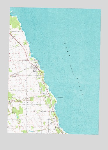
Port Hope, MI USGS Topographic Map
Click on map above to begin viewing in our Map Viewer.

This topographic map contains these locations and features:
Feature Name Type Latitude Longitude GNIS ID View Map
Diamond CreekStreamN43.9433°W82.7072°624631View Map
Forest BayBayN43.9014°W82.6833°1623102View Map
Forest Bay CemeteryCemeteryN43.8894°W82.6902°626251View Map
Gore CemeteryCemeteryN43.9706°W82.7458°626999View Map
Hardwood PointCapeN43.9111°W82.6827°627786View Map
Karg DrainCanalN43.8795°W82.7385°629461View Map
Kline CreekStreamN43.9050°W82.7472°629792View Map
Lake View CemeteryCemeteryN43.9311°W82.7458°630005View Map
Ludington Airport (historical)AirportN43.9178°W82.7478°1624114View Map
Ludington CemeteryCemeteryN43.8889°W82.6827°631202View Map
Ludingtons CoveBayN43.8845°W82.6769°1623110View Map
Ocha CreekStreamN43.9175°W82.6924°633932View Map
Port HopePopulated PlaceN43.9408°W82.7127°635265View Map
Port Hope CemeteryCemeteryN43.9403°W82.7200°2548555View Map
Port Hope Chimney Historical MarkerParkN43.9442°W82.7089°2548579View Map
Port Hope ClinicHospitalN43.9511°W82.7250°2548369View Map
Port Hope Post OfficePost OfficeN43.9367°W82.7117°2548365View Map
Port Hope SchoolSchoolN43.9375°W82.7161°2548368View Map
Port Hope Station (historical)LocaleN43.9408°W82.7106°2548364View Map
Rubicon BeachBeachN43.9295°W82.6997°1623120View Map
Saint John Lutheran ChurchChurchN43.9406°W82.7186°2548366View Map
Saint John's Lutheran SchoolSchoolN43.9411°W82.7194°2548367View Map
Saint Margaret MissionChurchN43.8817°W82.6810°636848View Map
Schmucker CreekStreamN43.8903°W82.6797°637350View Map
Smokers PointCapeN43.8933°W82.6802°1623122View Map
Snug HarborBayN43.9758°W82.7291°1623123View Map
Stafford County ParkParkN43.9458°W82.7105°638695View Map
Township of GoreCivilN43.9904°W82.6816°1626365View Map
Township of RubiconCivilN43.9049°W82.6793°1627014View Map
Village of Port HopeCivilN43.9394°W82.7150°2399003View Map
Village of Port Hope Fire DepartmentBuildingN43.9393°W82.7091°2548370View Map
Whiskey HarborBayN43.9939°W82.7472°1616285View Map

Note: Coordinates in the location and feature list above are referenced to NAD83 datum.


Copyright (C) 2008-2024 Ryan Niemi / Sunset Dynamics ... All Rights Reserved