TopoQuest Logo
Do you find TopoQuest useful?
Help keep TopoQuest running and adding new maps/features by donating!
Bitcoin:  19c7KJd3qBynnjoSw5npx9KScwjBe4ifkT
Litecoin:  LXs6TkuXGGXo1vDsWCkWVdjQX94eUKd6ui
Home View Maps Find Maps Find Places Resources & Links


Husum, Washington Topographic Map

USGS Map Title: Husum, WA
USGS Map MRC: 45121G4
DRG (GeoTIFF) Download: o45121g4.tif


Neighboring USGS Topographic Map Quads:


  Guler Mountain, WA  
45121H5
 

  Quigley Butte, WA  
45121H4
 

  Camas Prairie, WA  
45121H3
 

  Northwestern Lake, WA  
45121G5
 

  Husum, WA  
45121G4
 

  Appleton, WA  
45121G3
 

  Hood River, OR  
45121F5
 

  White Salmon, WA  
45121F4
 

  Lyle, WA  
45121F3


Map MRC Location:

N46°
W122°
N46°
W121°
H8 H7 H6 H5 H4 H3 H2 H1
G8 G7 G6 G5 G4 G3 G2 G1
F8 F7 F6 F5 F4 F3 F2 F1
E8 E7 E6 E5 E4 E3 E2 E1
D8 D7 D6 D5 D4 D3 D2 D1
C8 C7 C6 C5 C4 C3 C2 C1
B8 B7 B6 B5 B4 B3 B2 B1
A8 A7 A6 A5 A4 A3 A2 A1
N45°
W122°
N45°
W121°

Husum, WA USGS 1:24K Topographic Map Preview:
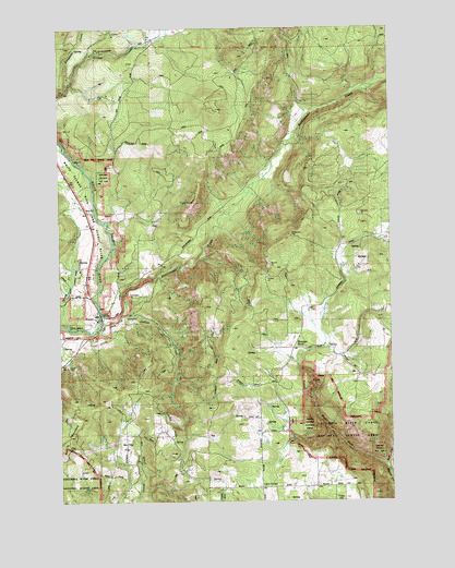
Husum, WA USGS Topographic Map
Click on map above to begin viewing in our Map Viewer.

This topographic map contains these locations and features:
Feature Name Type Latitude Longitude GNIS ID View Map
East Fork Major CreekStreamN45.7593°W121.3790°1519111View Map
GilmerPopulated PlaceN45.8712°W121.4654°1519965View Map
Hangman CreekStreamN45.8601°W121.4976°1520505View Map
HusumPopulated PlaceN45.7993°W121.4870°1521099View Map
Husum Post OfficePost OfficeN45.7993°W121.4867°2769263View Map
Indian CreekStreamN45.8001°W121.4773°1521165View Map
Klickitat County Fire District 3BuildingN45.7595°W121.4560°2643374View Map
Klickitat County Fire District 3 Mountain BrookBuildingN45.8010°W121.4099°2619699View Map
Klickitat County Fire Protection District 3 HusumBuildingN45.7979°W121.4869°2619515View Map
Kline CreekStreamN45.8735°W121.4592°1529469View Map
Laws CornerPopulated PlaceN45.7537°W121.4256°1521952View Map
McCoy FlatFlatN45.7671°W121.4729°1522876View Map
Mountain BrookPopulated PlaceN45.7907°W121.4115°1529975View Map
Mountain Brook SchoolSchoolN45.7907°W121.4112°1523437View Map
Port Elsner AirportAirportN45.8033°W121.4798°1534033View Map
Rattlesnake CreekStreamN45.7971°W121.4848°1524885View Map
Spencer ReservoirReservoirN45.8032°W121.4979°1532876View Map
Spencer Reservoir DamDamN45.8032°W121.4979°1532875View Map
Spring Creek Ranch AirportAirportN45.8080°W121.4949°2443441View Map
West Fork Major CreekStreamN45.7593°W121.3790°1527958View Map
White Salmon DivisionCivilN45.8732°W121.4744°1939673View Map

Note: Coordinates in the location and feature list above are referenced to NAD83 datum.


Copyright (C) 2008-2024 Ryan Niemi / Sunset Dynamics ... All Rights Reserved