TopoQuest Logo
Do you find TopoQuest useful?
Help keep TopoQuest running and adding new maps/features by donating!
Bitcoin:  19c7KJd3qBynnjoSw5npx9KScwjBe4ifkT
Litecoin:  LXs6TkuXGGXo1vDsWCkWVdjQX94eUKd6ui
Home View Maps Find Maps Find Places Resources & Links


Lyle, Washington Topographic Map

USGS Map Title: Lyle, WA
USGS Map MRC: 45121F3
DRG (GeoTIFF) Download: o45121f3.tif


Neighboring USGS Topographic Map Quads:


  Husum, WA  
45121G4
 

  Appleton, WA  
45121G3
 

  Klickitat, WA  
45121G2
 

  White Salmon, WA  
45121F4
 

  Lyle, WA  
45121F3
 

  The Dalles North, OR  
45121F2
 

  Ketchum Reservoir, OR  
45121E4
 

  Brown Creek, OR  
45121E3
 

  The Dalles South, OR  
45121E2


Map MRC Location:

N46°
W122°
N46°
W121°
H8 H7 H6 H5 H4 H3 H2 H1
G8 G7 G6 G5 G4 G3 G2 G1
F8 F7 F6 F5 F4 F3 F2 F1
E8 E7 E6 E5 E4 E3 E2 E1
D8 D7 D6 D5 D4 D3 D2 D1
C8 C7 C6 C5 C4 C3 C2 C1
B8 B7 B6 B5 B4 B3 B2 B1
A8 A7 A6 A5 A4 A3 A2 A1
N45°
W122°
N45°
W121°

Lyle, WA USGS 1:24K Topographic Map Preview:
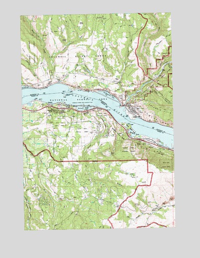
Lyle, WA USGS Topographic Map
Click on map above to begin viewing in our Map Viewer.

This topographic map contains these locations and features:
Feature Name Type Latitude Longitude GNIS ID View Map
Balch LakeLakeN45.7171°W121.3209°1503137View Map
Catherine CreekStreamN45.7071°W121.3581°1503861View Map
Chamberlain LakeLakeN45.7024°W121.3040°1503903View Map
Chatfield (historical)LocaleN45.6985°W121.3548°1139586View Map
Chatfield HillSummitN45.6838°W121.3512°2014046View Map
Dixon SpringSpringN45.7447°W121.3271°1504489View Map
Hanson CreekStreamN45.7246°W121.3526°1505377View Map
Hewett LakeLakeN45.7113°W121.3439°1505481View Map
Indian PointCapeN45.7029°W121.2681°1505726View Map
Klickitat County Fire District 4BuildingN45.6926°W121.2849°2643375View Map
Klickitat RiverStreamN45.6965°W121.2915°1521728View Map
LylePopulated PlaceN45.6960°W121.2862°1512412View Map
Lyle CemeteryCemeteryN45.7204°W121.3276°1506389View Map
Lyle Census Designated PlaceCensusN45.6956°W121.2805°2408154View Map
Lyle High SchoolSchoolN45.6941°W121.2803°1515132View Map
Lyle Post OfficePost OfficeN45.6934°W121.2873°2781608View Map
Lyle Treaty Fishing Access SiteReserveN45.6918°W121.2879°2434183View Map
Major CreekStreamN45.7090°W121.3512°1522650View Map
Marsh HillSummitN45.6857°W121.3406°2014048View Map
Martin SpringSpringN45.6740°W121.2786°1123814View Map
Mayer State ParkParkN45.6757°W121.2698°1123869View Map
Mayer State Park Boat RampLocaleN45.6816°W121.2884°2699582View Map
McCall PointSummitN45.6687°W121.3040°1133420View Map
McClure CemeteryCemeteryN45.6893°W121.3267°1156895View Map
McClure HillSummitN45.6869°W121.3531°1964944View Map
McClure LakeLakeN45.6953°W121.3260°1123915View Map
Memaloose Island (historical)IslandN45.7026°W121.3420°1639415View Map
Memaloose OverlookParkN45.6939°W121.3507°1124054View Map
Memaloose Safety Rest AreaLocaleN45.6958°W121.3389°1987584View Map
Memaloose State ParkParkN45.6957°W121.3329°1124055View Map
Middleswart SpringSpringN45.6934°W121.3456°1124132View Map
Molitor SpringSpringN45.7349°W121.3420°1506752View Map
Mosier Rural Fire District Station 2BuildingN45.6662°W121.3350°2576752View Map
Mud Spring CanyonValleyN45.7098°W121.2673°1523492View Map
OrtleyPopulated PlaceN45.6560°W121.2881°1136603View Map
Ortley Post Office (historical)Post OfficeN45.6560°W121.2881°1165749View Map
Rocky FlatFlatN45.7218°W121.3387°1507876View Map
RowenaPopulated PlaceN45.6723°W121.2684°1136714View Map
Rowena Census Designated PlaceCensusN45.6701°W121.2749°2409219View Map
Rowena CreekStreamN45.6951°W121.3170°1126344View Map
Rowena CrestCliffN45.6826°W121.2995°1129638View Map
Rowena DellValleyN45.6943°W121.3137°1126345View Map
Rowena Dell Airstrip (historical)AirportN45.6679°W121.3165°1131705View Map
Rowena Post Office (historical)Post OfficeN45.6723°W121.2684°1165888View Map
Salisbury SloughBayN45.6796°W121.2831°1126509View Map
Sevenmile HillRidgeN45.6598°W121.2665°1126764View Map
Silvas CreekStreamN45.7112°W121.2670°1525748View Map
Tunnel on WA 14TunnelN45.6875°W121.2753°2573597View Map
Wetland SpringSpringN45.6846°W121.3459°1129639View Map
Wide Sky CanyonValleyN45.7204°W121.2559°1528120View Map

Note: Coordinates in the location and feature list above are referenced to NAD83 datum.


Copyright (C) 2008-2024 Ryan Niemi / Sunset Dynamics ... All Rights Reserved