TopoQuest Logo
Do you find TopoQuest useful?
Help keep TopoQuest running and adding new maps/features by donating!
Bitcoin:  19c7KJd3qBynnjoSw5npx9KScwjBe4ifkT
Litecoin:  LXs6TkuXGGXo1vDsWCkWVdjQX94eUKd6ui
Home View Maps Find Maps Find Places Resources & Links


Hyndman Peak, Idaho Topographic Map

USGS Map Title: Hyndman Peak, ID
USGS Map MRC: 43114F2
DRG (GeoTIFF) Download: o43114f2.tif


Neighboring USGS Topographic Map Quads:


  Rock Roll Canyon, ID  
43114G3
 

  Phi Kappa Mountain, ID  
43114G2
 

  Standhope Peak, ID  
43114G1
 

  Sun Valley, ID  
43114F3
 

  Hyndman Peak, ID  
43114F2
 

  Grays Peak, ID  
43114F1
 

  Hailey, ID  
43114E3
 

  Baugh Creek SW, ID  
43114E2
 

  Baugh Creek, ID  
43114E1


Map MRC Location:

N44°
W115°
N44°
W114°
H8 H7 H6 H5 H4 H3 H2 H1
G8 G7 G6 G5 G4 G3 G2 G1
F8 F7 F6 F5 F4 F3 F2 F1
E8 E7 E6 E5 E4 E3 E2 E1
D8 D7 D6 D5 D4 D3 D2 D1
C8 C7 C6 C5 C4 C3 C2 C1
B8 B7 B6 B5 B4 B3 B2 B1
A8 A7 A6 A5 A4 A3 A2 A1
N43°
W115°
N43°
W114°

Hyndman Peak, ID USGS 1:24K Topographic Map Preview:
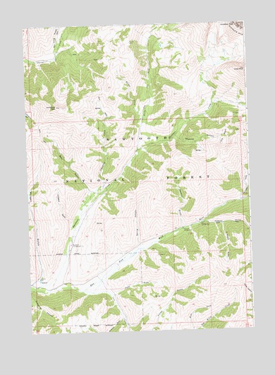
Hyndman Peak, ID USGS Topographic Map
Click on map above to begin viewing in our Map Viewer.

This topographic map contains these locations and features:
Feature Name Type Latitude Longitude GNIS ID View Map
Bear GulchValleyN43.6827°W114.2162°377143View Map
Button CreekStreamN43.7113°W114.1848°378618View Map
Cobb PeakSummitN43.7310°W114.1264°372073View Map
Cove CreekStreamN43.6419°W114.2212°379925View Map
Deadend CanyonValleyN43.7046°W114.1662°380310View Map
Driveway GulchValleyN43.6305°W114.1989°380761View Map
Federal GulchValleyN43.6694°W114.1498°381639View Map
Federal Gulch CampgroundLocaleN43.6688°W114.1531°381640View Map
Hook DrawValleyN43.6405°W114.2028°383313View Map
Hyndman CampgroundLocaleN43.6610°W114.2267°383586View Map
Hyndman PeakSummitN43.7491°W114.1309°383587View Map
Johnstone CreekStreamN43.6730°W114.2206°384002View Map
Johnstone PeakSummitN43.7171°W114.2328°384004View Map
Larkspur GulchValleyN43.6694°W114.2264°384447View Map
Little BasinBasinN43.7044°W114.1395°384718View Map
Long GulchValleyN43.7413°W114.2314°386055View Map
Lucky Gulch MineMineN43.6474°W114.2459°386270View Map
Milligan GulchValleyN43.6452°W114.2495°399996View Map
North Fork Hyndman CreekStreamN43.6988°W114.1889°387714View Map
Paymaster GulchValleyN43.6782°W114.1303°388285View Map
Pioneer CabinLocaleN43.7430°W114.1914°388550View Map
Pioneer MountainsRangeN43.7491°W114.1309°376219View Map
Sawmill CampgroundLocaleN43.6666°W114.1634°389943View Map
Sawmill GulchValleyN43.6674°W114.1639°389973View Map
Spring CanyonValleyN43.6605°W114.1889°391158View Map
Timber DrawValleyN43.6680°W114.1414°392148View Map

Note: Coordinates in the location and feature list above are referenced to NAD83 datum.


Copyright (C) 2008-2024 Ryan Niemi / Sunset Dynamics ... All Rights Reserved