TopoQuest Logo
Do you find TopoQuest useful?
Help keep TopoQuest running and adding new maps/features by donating!
Bitcoin:  19c7KJd3qBynnjoSw5npx9KScwjBe4ifkT
Litecoin:  LXs6TkuXGGXo1vDsWCkWVdjQX94eUKd6ui
Home View Maps Find Maps Find Places Resources & Links


Sun Valley, Idaho Topographic Map

USGS Map Title: Sun Valley, ID
USGS Map MRC: 43114F3
DRG (GeoTIFF) Download: o43114f3.tif


Neighboring USGS Topographic Map Quads:


  Amber Lakes, ID  
43114G4
 

  Rock Roll Canyon, ID  
43114G3
 

  Phi Kappa Mountain, ID  
43114G2
 

  Griffin Butte, ID  
43114F4
 

  Sun Valley, ID  
43114F3
 

  Hyndman Peak, ID  
43114F2
 

  Mahoney Butte, ID  
43114E4
 

  Hailey, ID  
43114E3
 

  Baugh Creek SW, ID  
43114E2


Map MRC Location:

N44°
W115°
N44°
W114°
H8 H7 H6 H5 H4 H3 H2 H1
G8 G7 G6 G5 G4 G3 G2 G1
F8 F7 F6 F5 F4 F3 F2 F1
E8 E7 E6 E5 E4 E3 E2 E1
D8 D7 D6 D5 D4 D3 D2 D1
C8 C7 C6 C5 C4 C3 C2 C1
B8 B7 B6 B5 B4 B3 B2 B1
A8 A7 A6 A5 A4 A3 A2 A1
N43°
W115°
N43°
W114°

Sun Valley, ID USGS 1:24K Topographic Map Preview:
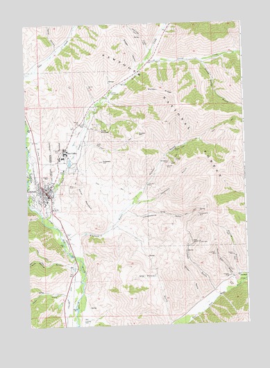
Sun Valley, ID USGS Topographic Map
Click on map above to begin viewing in our Map Viewer.

This topographic map contains these locations and features:
Feature Name Type Latitude Longitude GNIS ID View Map
Amicus MineMineN43.6977°W114.2887°376600View Map
Antelope CreekStreamN43.7391°W114.3014°376646View Map
Badger CanyonValleyN43.7319°W114.3100°376819View Map
Boundary CampgroundLocaleN43.7216°W114.3256°378114View Map
City of KetchumCivilN43.6867°W114.3730°2411539View Map
City of Sun ValleyCivilN43.6837°W114.3337°2412003View Map
Clear CreekStreamN43.6380°W114.3534°379394View Map
Cold Spring GulchValleyN43.6491°W114.3498°379550View Map
Colonnade MallLocaleN43.6824°W114.3614°395245View Map
Corral CreekStreamN43.7360°W114.3037°379791View Map
Courier GulchValleyN43.6466°W114.2537°399837View Map
Courier MineMineN43.6538°W114.2567°379919View Map
Decker GulchValleyN43.6352°W114.2762°399850View Map
Dollar MountainSummitN43.6791°W114.3431°380703View Map
Elkhorn GulchValleyN43.6624°W114.3442°399868View Map
Elkhorn VillagePopulated PlaceN43.6794°W114.3325°393978View Map
Ernest Hemingway ElementarySchoolN43.6825°W114.3711°401316View Map
Giacobbi SquareLocaleN43.6827°W114.3634°395417View Map
Hyndman CreekStreamN43.6427°W114.2512°399927View Map
Independence GulchValleyN43.6713°W114.3148°383635View Map
Independence MineMineN43.6707°W114.2762°383637View Map
June Day MineMineN43.6830°W114.3048°384064View Map
KetchumPopulated PlaceN43.6807°W114.3637°397833View Map
Ketchum CemeteryCemeteryN43.6865°W114.3672°2766752View Map
Ketchum Fire Department Station 1BuildingN43.6830°W114.3636°2618948View Map
Ketchum Police DepartmentBuildingN43.6829°W114.3636°2722442View Map
Ketchum Post OfficePost OfficeN43.6797°W114.3677°2766829View Map
Keystone GulchValleyN43.6757°W114.3131°384199View Map
Montgomery MineMineN43.6930°W114.2925°387102View Map
Morgan RidgeRidgeN43.7191°W114.2875°387219View Map
North Star GulchValleyN43.6449°W114.2573°400020View Map
North Star MineMineN43.6546°W114.2673°387848View Map
Old Triumph MineMineN43.6588°W114.2770°387943View Map
Parker GulchValleyN43.6757°W114.3134°400030View Map
Parker MineMineN43.6921°W114.2912°388222View Map
Penny MountainSummitN43.6871°W114.3620°388337View Map
Peters GulchValleyN43.6252°W114.2934°400035View Map
Pierce TunnelMineN43.6935°W114.2884°388439View Map
Proctor MountainSummitN43.7041°W114.3092°388889View Map
Prospect HillSummitN43.6931°W114.3297°388907View Map
Pumphrey CanyonValleyN43.6407°W114.2525°388922View Map
Ruud MountainSummitN43.7057°W114.3312°401834View Map
Saint Louis MineMineN43.6907°W114.2937°389837View Map
Saint Luke's Wood River Medical CenterHospitalN43.6483°W114.3499°399537View Map
Sun ValleyPopulated PlaceN43.6971°W114.3517°398200View Map
Sun Valley Fire DepartmentBuildingN43.6741°W114.3236°2618973View Map
Sun Valley Fire Department Elkhorn StationBuildingN43.6925°W114.3457°2619090View Map
Sun Valley jPost OfficePost OfficeN43.6968°W114.3541°2767316View Map
Sun Valley Police DepartmentBuildingN43.6925°W114.3456°2722461View Map
Sun Valley Post OfficePost OfficeN43.6968°W114.3541°2766881View Map
Sun Valley VillageLocaleN43.6957°W114.3537°396009View Map
Taylor CanyonValleyN43.7407°W114.3559°391861View Map
Trail CreekStreamN43.6669°W114.3626°392299View Map
Trail Creek DamDamN43.6916°W114.3509°398644View Map
TriumphPopulated PlaceN43.6449°W114.2542°398264View Map
Triumph GulchValleyN43.6391°W114.2681°400143View Map
Triumph MineMineN43.6446°W114.2598°392405View Map
Uncle Johns GulchValleyN43.7338°W114.2720°392607View Map

Note: Coordinates in the location and feature list above are referenced to NAD83 datum.


Copyright (C) 2008-2024 Ryan Niemi / Sunset Dynamics ... All Rights Reserved