TopoQuest Logo
Do you find TopoQuest useful?
Help keep TopoQuest running and adding new maps/features by donating!
Bitcoin:  19c7KJd3qBynnjoSw5npx9KScwjBe4ifkT
Litecoin:  LXs6TkuXGGXo1vDsWCkWVdjQX94eUKd6ui
Home View Maps Find Maps Find Places Resources & Links


Whiskeytown, California Topographic Map

USGS Map Title: Whiskeytown, CA
USGS Map MRC: 40122F5
DRG (GeoTIFF) Download: o40122f5.tif


Neighboring USGS Topographic Map Quads:


  Papoose Creek, CA  
40122G6
 

  Schell Mountain, CA  
40122G5
 

  Bohemotash Mountain, CA  
40122G4
 

  French Gulch, CA  
40122F6
 

  Whiskeytown, CA  
40122F5
 

  Shasta Dam, CA  
40122F4
 

  Shasta Bally, CA  
40122E6
 

  Igo, CA  
40122E5
 

  Redding, CA  
40122E4


Map MRC Location:

N41°
W123°
N41°
W122°
H8 H7 H6 H5 H4 H3 H2 H1
G8 G7 G6 G5 G4 G3 G2 G1
F8 F7 F6 F5 F4 F3 F2 F1
E8 E7 E6 E5 E4 E3 E2 E1
D8 D7 D6 D5 D4 D3 D2 D1
C8 C7 C6 C5 C4 C3 C2 C1
B8 B7 B6 B5 B4 B3 B2 B1
A8 A7 A6 A5 A4 A3 A2 A1
N40°
W123°
N40°
W122°

Whiskeytown, CA USGS 1:24K Topographic Map Preview:
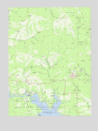
Whiskeytown, CA USGS Topographic Map
Click on map above to begin viewing in our Map Viewer.

This topographic map contains these locations and features:
Feature Name Type Latitude Longitude GNIS ID View Map
Balaklaia MineMineN40.7240°W122.5014°218560View Map
Boulder CreekStreamN40.6410°W122.5908°219688View Map
Bright Star MineMineN40.6813°W122.5920°219836View Map
Bull GulchValleyN40.6521°W122.6125°220110View Map
China GulchValleyN40.7135°W122.6153°221042View Map
Deadwood GulchValleyN40.6774°W122.5681°222140View Map
Desmond MineMineN40.6493°W122.5433°222273View Map
Drunken GulchValleyN40.7451°W122.6192°222601View Map
Dry CreekStreamN40.6260°W122.5825°222614View Map
Dry Creek CampgroundLocaleN40.6254°W122.5808°222636View Map
Dry Creek CampgroundLocaleN40.6257°W122.5808°276912View Map
Early Bird MineMineN40.7257°W122.5181°222844View Map
Eiler MineMineN40.6446°W122.5183°223011View Map
Ganim MineMineN40.6518°W122.5722°224070View Map
Ganim MineMineN40.6524°W122.5725°276923View Map
Gladstone MineMineN40.7210°W122.5806°224199View Map
Graddock GulchValleyN40.6263°W122.5331°224377View Map
Great Verde ProspectMineN40.7315°W122.5072°1675853View Map
Grizzly GulchValleyN40.6532°W122.6000°224635View Map
Hopper GulchValleyN40.7138°W122.5909°225580View Map
Iron MountainSummitN40.6746°W122.5311°225988View Map
Iron MountainPopulated PlaceN40.6707°W122.5242°1658834View Map
Iron Mountain MineMineN40.6754°W122.5281°1675854View Map
Jic GulchValleyN40.7160°W122.5959°226234View Map
KEWB-FM (Anderson)TowerN40.6538°W122.5211°1662791View Map
KSHA-FM (Redding)TowerN40.6538°W122.5211°1663019View Map
KVIP-FM (Redding)TowerN40.6549°W122.5236°1663020View Map
Liberty GulchValleyN40.6529°W122.5545°227062View Map
Lone Star ProspectMineN40.6876°W122.5372°1675856View Map
Mad Mule GulchValleyN40.6721°W122.5667°227895View Map
Mad Mule MineMineN40.6763°W122.5870°1675857View Map
Mad Mule MountainSummitN40.6749°W122.5881°227896View Map
Mad Ox GulchValleyN40.6796°W122.5628°227897View Map
Mad Ox MineMineN40.6838°W122.5553°227898View Map
Marlowe GulchValleyN40.6576°W122.5606°1661827View Map
Merry MountainSummitN40.6721°W122.6134°228532View Map
Mexican SpringSpringN40.6365°W122.5251°228244View Map
Minnesota MineMineN40.6574°W122.5020°1683016View Map
Modesty GulchValleyN40.6596°W122.5983°228894View Map
Murderers GulchValleyN40.6429°W122.5706°229341View Map
New York GulchValleyN40.6438°W122.5800°229505View Map
North Star MineMineN40.6615°W122.5797°229769View Map
Oak Bottom (historical)Populated PlaceN40.6490°W122.5831°1661838View Map
Oak Bottom CampgroundLocaleN40.6488°W122.5925°229837View Map
Oak Bottom CamproundLocaleN40.6488°W122.5922°276922View Map
Old American MineMineN40.7224°W122.6089°229959View Map
Portuguese FlatFlatN40.6646°W122.5589°230969View Map
Red GulchValleyN40.6457°W122.5522°231327View Map
Rippley GulchValleyN40.7110°W122.6017°231630View Map
Shirttail PeakSummitN40.7401°W122.5939°233035View Map
Slickrock CreekStreamN40.6554°W122.5014°233274View Map
Slug GulchValleyN40.6735°W122.5372°233301View Map
South Fork MountainSummitN40.6543°W122.5245°235030View Map
Spanish GulchValleyN40.6665°W122.5592°235156View Map
Spring GulchValleyN40.6899°W122.5470°235259View Map
Stone GulchValleyN40.7154°W122.5867°235520View Map
Stowell MineMineN40.7096°W122.5150°235571View Map
Studhorse GulchValleyN40.6693°W122.5989°235617View Map
Sugarloaf MountainSummitN40.6885°W122.5114°235671View Map
Sugarloaf ProspectMineN40.6885°W122.5036°1675859View Map
Whiskey CreekStreamN40.6310°W122.5553°237612View Map
Whiskey Creek Picnic AreaLocaleN40.6479°W122.5567°237613View Map
WhiskeytownPopulated PlaceN40.6388°W122.5597°1660162View Map
Whiskeytown LakeReservoirN40.6256°W122.5591°268967View Map
White Rock GulchValleyN40.6393°W122.5475°237669View Map

Note: Coordinates in the location and feature list above are referenced to NAD83 datum.


Copyright (C) 2008-2024 Ryan Niemi / Sunset Dynamics ... All Rights Reserved