TopoQuest Logo
Do you find TopoQuest useful?
Help keep TopoQuest running and adding new maps/features by donating!
Bitcoin:  19c7KJd3qBynnjoSw5npx9KScwjBe4ifkT
Litecoin:  LXs6TkuXGGXo1vDsWCkWVdjQX94eUKd6ui
Home View Maps Find Maps Find Places Resources & Links


Illgen City, Minnesota Topographic Map

USGS Map Title: Illgen City, MN
USGS Map MRC: 47091C2
DRG (GeoTIFF) Download: o47091c2.tif


Neighboring USGS Topographic Map Quads:


  Doyle Lake, MN  
47091D3
 

  Finland, MN  
47091D2
 

  Little Marais, MN  
47090D8
 

  Silver Bay, MN  
47091C3
 

  Illgen City, MN  
47091C2


  Split Rock Point NE, MN  
47091B3


Map MRC Location:

N48°
W92°
N48°
W91°
H8 H7 H6 H5 H4 H3 H2 H1
G8 G7 G6 G5 G4 G3 G2 G1
F8 F7 F6 F5 F4 F3 F2 F1
E8 E7 E6 E5 E4 E3 E2 E1
D8 D7 D6 D5 D4 D3 D2 D1
C8 C7 C6 C5 C4 C3 C2 C1
B8 B7 B6 B5 B4 B3 B2 B1
A8 A7 A6 A5 A4 A3 A2 A1
N47°
W92°
N47°
W91°

Illgen City, MN USGS 1:24K Topographic Map Preview:
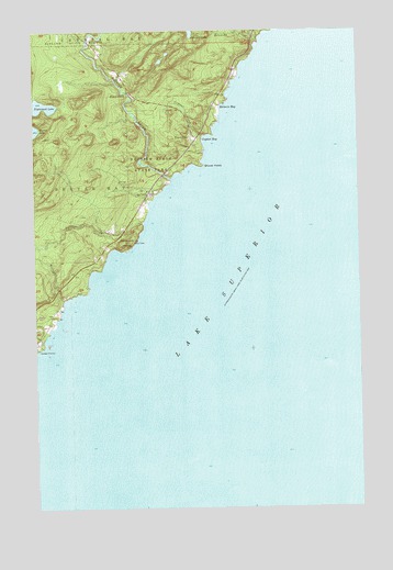
Illgen City, MN USGS Topographic Map
Click on map above to begin viewing in our Map Viewer.

This topographic map contains these locations and features:
Feature Name Type Latitude Longitude GNIS ID View Map
Baptism RiverStreamN47.3360°W91.1977°639621View Map
Baptism River Rest AreaLocaleN47.3389°W91.1972°2093495View Map
Baptism River State ParkParkN47.3402°W91.2038°639622View Map
Belmore BayBayN47.3541°W91.1774°639902View Map
Crystal BayBayN47.3469°W91.1835°642520View Map
Crystal CreekStreamN47.3471°W91.1854°642524View Map
Illgen CityPopulated PlaceN47.3469°W91.1896°654765View Map
Illgen FallsFallsN47.3582°W91.2141°645339View Map
Jehovah's Witnesses CongregationChurchN47.3472°W91.1875°2093510View Map
Kennedy CreekStreamN47.3727°W91.1632°646091View Map
Nipisiquit LakeLakeN47.3552°W91.2470°657605View Map
Northern Exposure CampgroundLocaleN47.3111°W91.2361°2094031View Map
Palisade Baptist ChurchChurchN47.3222°W91.2172°2093509View Map
Palisade CreekStreamN47.3246°W91.2085°657729View Map
Palisade HeadSummitN47.3194°W91.2163°649122View Map
Palisade Head Historical MarkerParkN47.3208°W91.2181°2093508View Map
Shovel PointCapeN47.3396°W91.1852°652000View Map
Williams CreekStreamN47.3046°W91.2388°654166View Map

Note: Coordinates in the location and feature list above are referenced to NAD83 datum.


Copyright (C) 2008-2025 Ryan Niemi / Sunset Dynamics ... All Rights Reserved