TopoQuest Logo
Do you find TopoQuest useful?
Help keep TopoQuest running and adding new maps/features by donating!
Bitcoin:  19c7KJd3qBynnjoSw5npx9KScwjBe4ifkT
Litecoin:  LXs6TkuXGGXo1vDsWCkWVdjQX94eUKd6ui
Home View Maps Find Maps Find Places Resources & Links


Silver Bay, Minnesota Topographic Map

USGS Map Title: Silver Bay, MN
USGS Map MRC: 47091C3
DRG (GeoTIFF) Download: o47091c3.tif


Neighboring USGS Topographic Map Quads:


  Cloquet Lake, MN  
47091D4
 

  Doyle Lake, MN  
47091D3
 

  Finland, MN  
47091D2
 

  Silver Bay SW, MN  
47091C4
 

  Silver Bay, MN  
47091C3
 

  Illgen City, MN  
47091C2
 

  Split Rock Point, MN  
47091B4
 

  Split Rock Point NE, MN  
47091B3


Map MRC Location:

N48°
W92°
N48°
W91°
H8 H7 H6 H5 H4 H3 H2 H1
G8 G7 G6 G5 G4 G3 G2 G1
F8 F7 F6 F5 F4 F3 F2 F1
E8 E7 E6 E5 E4 E3 E2 E1
D8 D7 D6 D5 D4 D3 D2 D1
C8 C7 C6 C5 C4 C3 C2 C1
B8 B7 B6 B5 B4 B3 B2 B1
A8 A7 A6 A5 A4 A3 A2 A1
N47°
W92°
N47°
W91°

Silver Bay, MN USGS 1:24K Topographic Map Preview:
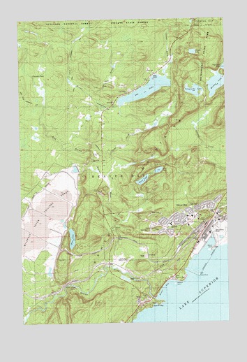
Silver Bay, MN USGS Topographic Map
Click on map above to begin viewing in our Map Viewer.

This topographic map contains these locations and features:
Feature Name Type Latitude Longitude GNIS ID View Map
Bay Area Health CenterHospitalN47.2956°W91.2594°2093519View Map
Bay Area VineyardChurchN47.2933°W91.2706°2093518View Map
Bean LakeLakeN47.3086°W91.3010°655278View Map
Bear LakeLakeN47.2852°W91.3444°655286View Map
Bear LakeLakeN47.3126°W91.2911°655287View Map
Beaver BayBayN47.2638°W91.2882°655293View Map
Beaver BayPopulated PlaceN47.2577°W91.3004°655294View Map
Beaver Bay Post OfficePost OfficeN47.2611°W91.3003°2093477View Map
Beaver Bay Volunteer Fire DepartmentBuildingN47.2583°W91.3023°2666423View Map
Beaver IslandIslandN47.2805°W91.2579°655298View Map
Beaver RiverStreamN47.2591°W91.2929°655311View Map
Beaver River FallsFallsN47.2652°W91.2977°659273View Map
Cedar CreekStreamN47.3102°W91.3218°655675View Map
City of Beaver BayCivilN47.2562°W91.3062°2394099View Map
City of Silver BayCivilN47.2933°W91.2775°2395886View Map
East Beaver BayPopulated PlaceN47.2677°W91.2829°656085View Map
East Branch Beaver RiverStreamN47.2727°W91.3179°659989View Map
East Branch Fortythree CreekStreamN47.3433°W91.3299°656089View Map
Faith Lutheran ChurchChurchN47.2903°W91.2775°2093515View Map
Fortythree CreekStreamN47.3299°W91.2957°656302View Map
Glenn Avon FallsFallsN47.2655°W91.3432°659184View Map
Kelly High SchoolSchoolN47.2913°W91.2763°659276View Map
Lax LakeLakeN47.3459°W91.2975°656968View Map
Lax LakePopulated PlaceN47.3441°W91.3088°656969View Map
Lax Lake Post Office (historical)Post OfficeN47.3461°W91.2972°2093268View Map
Little Thirtynine CreekStreamN47.2999°W91.3738°657136View Map
MacDonald Middle SchoolSchoolN47.2905°W91.2846°659275View Map
Mariner MountainSummitN47.2883°W91.2999°659175View Map
Micmac LakeLakeN47.3478°W91.2551°657383View Map
Milepost Seven Tailings PondsReservoirN47.2927°W91.3621°659252View Map
Minnesota Veterans HomeHospitalN47.2969°W91.2639°2073058View Map
Nicado CreekStreamN47.3510°W91.2852°657592View Map
Nicado LakeLakeN47.3612°W91.2693°657593View Map
Pancake FallsFallsN47.3519°W91.3663°657733View Map
Pellet IslandIslandN47.2694°W91.2682°657766View Map
Saint Mary's ChurchChurchN47.2906°W91.2839°2093513View Map
Silver BayPopulated PlaceN47.2944°W91.2574°658258View Map
Silver Bay Baptist ChurchChurchN47.2878°W91.2869°2093514View Map
Silver Bay City LibraryBridgeN47.2950°W91.2736°2093511View Map
Silver Bay Country ClubLocaleN47.2763°W91.3121°659272View Map
Silver Bay Police DepartmentBuildingN47.2948°W91.2696°2093512View Map
Silver Bay Post OfficePost OfficeN47.2944°W91.2572°2093259View Map
Silver Bay Volunteer Fire DepartmentBuildingN47.2947°W91.2708°2666420View Map
Sychar Lutheran ChurchChurchN47.2936°W91.2742°2093517View Map
Tetagouche LakeLakeN47.3451°W91.2688°658642View Map
Tetagouche Lake CampgroundLocaleN47.3485°W91.2707°659190View Map
Tettegouche State ParkParkN47.3588°W91.2641°1814956View Map
Township of Beaver BayCivilN47.3691°W91.3346°663540View Map
United Protestant ChurchChurchN47.2908°W91.2786°2093516View Map
West Branch Beaver RiverStreamN47.2513°W91.3746°658942View Map
West Branch Fortythree CreekStreamN47.3430°W91.3304°658943View Map
Wieland IslandIslandN47.2660°W91.2824°659271View Map

Note: Coordinates in the location and feature list above are referenced to NAD83 datum.


Copyright (C) 2008-2025 Ryan Niemi / Sunset Dynamics ... All Rights Reserved