TopoQuest Logo
Do you find TopoQuest useful?
Help keep TopoQuest running and adding new maps/features by donating!
Bitcoin:  19c7KJd3qBynnjoSw5npx9KScwjBe4ifkT
Litecoin:  LXs6TkuXGGXo1vDsWCkWVdjQX94eUKd6ui
Home View Maps Find Maps Find Places Resources & Links


Imogene, Iowa Topographic Map

USGS Map Title: Imogene, IA
USGS Map MRC: 40095H4
DRG (GeoTIFF) Download: o40095h4.tif


Neighboring USGS Topographic Map Quads:


  Malvern, IA  
41095A5
 

  Emerson, IA  
41095A4
 

  Wales, IA  
41095A3
 

  Tabor NE, IA  
40095H5
 

  Imogene, IA  
40095H4
 

  Coburg, IA  
40095H3
 

  Randolph, IA  
40095G5
 

  Shenandoah West, IA  
40095G4
 

  Shenandoah East, IA  
40095G3


Map MRC Location:

N41°
W96°
N41°
W95°
H8 H7 H6 H5 H4 H3 H2 H1
G8 G7 G6 G5 G4 G3 G2 G1
F8 F7 F6 F5 F4 F3 F2 F1
E8 E7 E6 E5 E4 E3 E2 E1
D8 D7 D6 D5 D4 D3 D2 D1
C8 C7 C6 C5 C4 C3 C2 C1
B8 B7 B6 B5 B4 B3 B2 B1
A8 A7 A6 A5 A4 A3 A2 A1
N40°
W96°
N40°
W95°

Imogene, IA USGS 1:24K Topographic Map Preview:
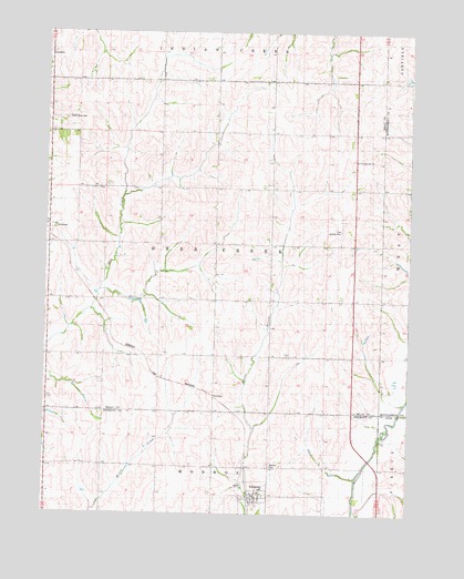
Imogene, IA USGS Topographic Map
Click on map above to begin viewing in our Map Viewer.

This topographic map contains these locations and features:
Feature Name Type Latitude Longitude GNIS ID View Map
Aero-Lane Airport (historical)AirportN40.8850°W95.4853°466924View Map
Champion Hill ChurchChurchN40.9669°W95.3936°455340View Map
City of ImogeneCivilN40.8790°W95.4275°2394465View Map
Cole Landing Strip (historical)AirportN40.9514°W95.3989°1968471View Map
Crestland Co-op ElevatorLocaleN40.8794°W95.4269°1949913View Map
David Farm CemeteryCemeteryN40.9250°W95.3767°1968767View Map
ImogenePopulated PlaceN40.8794°W95.4269°457781View Map
Imogene (historical)LocaleN40.8794°W95.4269°1949917View Map
Imogene Fire DepartmentBuildingN40.8794°W95.4269°1949914View Map
Imogene Post OfficePost OfficeN40.8794°W95.4269°1949912View Map
Imogene Town HallBuildingN40.8794°W95.4269°1949916View Map
Monroe CemeteryCemeteryN40.8881°W95.4225°459178View Map
Saint Patrick Catholic ChurchChurchN40.8794°W95.4269°1949915View Map
SolomonPopulated PlaceN40.9053°W95.4419°464750View Map
Solomon (historical)LocaleN40.9053°W95.4419°1968369View Map
Solomon Post Office (historical)Post OfficeN40.9053°W95.4419°1968368View Map
South Grove CemeteryCemeteryN40.9775°W95.4933°461787View Map
StrahanPopulated PlaceN40.9497°W95.4992°462024View Map
Strahan Post Office (historical)Post OfficeN40.9497°W95.4997°1968367View Map
Strahan United Methodist ChurchChurchN40.9503°W95.4997°1968431View Map
Township of Deer CreekCivilN40.9445°W95.4420°467693View Map
Wabash Trace Nature TrailTrailN40.8756°W95.4292°1949816View Map

Note: Coordinates in the location and feature list above are referenced to NAD83 datum.


Copyright (C) 2008-2024 Ryan Niemi / Sunset Dynamics ... All Rights Reserved