TopoQuest Logo
Do you find TopoQuest useful?
Help keep TopoQuest running and adding new maps/features by donating!
Bitcoin:  19c7KJd3qBynnjoSw5npx9KScwjBe4ifkT
Litecoin:  LXs6TkuXGGXo1vDsWCkWVdjQX94eUKd6ui
Home View Maps Find Maps Find Places Resources & Links


Baker NW, Montana Topographic Map

USGS Map Title: Baker NW, MT
USGS Map MRC: 46104D4
DRG (GeoTIFF) Download: o46104d4.tif


Neighboring USGS Topographic Map Quads:


  Lawrence Creek West, MT  
46104E5
 

  Lawrence Creek East, MT  
46104E4
 

  Rush Hall Reservoir, MT  
46104E3
 

  Plevna, MT  
46104D5
 

  Baker NW, MT  
46104D4
 

  Baker NE, MT  
46104D3
 

  Little Pine Creek, MT  
46104C5
 

  South Sandstone Reservoir, MT  
46104C4
 

  Baker, MT  
46104C3


Map MRC Location:

N47°
W105°
N47°
W104°
H8 H7 H6 H5 H4 H3 H2 H1
G8 G7 G6 G5 G4 G3 G2 G1
F8 F7 F6 F5 F4 F3 F2 F1
E8 E7 E6 E5 E4 E3 E2 E1
D8 D7 D6 D5 D4 D3 D2 D1
C8 C7 C6 C5 C4 C3 C2 C1
B8 B7 B6 B5 B4 B3 B2 B1
A8 A7 A6 A5 A4 A3 A2 A1
N46°
W105°
N46°
W104°

Baker NW, MT USGS 1:24K Topographic Map Preview:
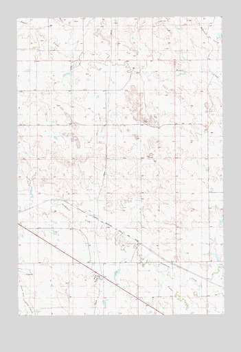
Baker NW, MT USGS Topographic Map
Click on map above to begin viewing in our Map Viewer.

This topographic map contains these locations and features:
Feature Name Type Latitude Longitude GNIS ID View Map
07N58E04AD__01 WellWellN46.3917°W104.4505°815982View Map
07N59E06CB__01 WellWellN46.3886°W104.3836°815964View Map
08N58E02AABB01 WellWellN46.4839°W104.4177°816481View Map
08N58E08DC__01 WellWellN46.4597°W104.4949°816368View Map
08N58E10DB__01 WellWellN46.4611°W104.4186°816374View Map
08N58E26AA__01 WellWellN46.4264°W104.4297°816200View Map
08N58E29ABAA01 WellWellN46.4272°W104.4936°816203View Map
08N58E34CA__01 WellWellN46.4028°W104.4574°816058View Map
08N58E35DB__01 WellWellN46.4056°W104.4324°816072View Map
08N58E36DD__01 WellWellN46.3989°W104.4072°816041View Map
08N59E07CD__01 WellWellN46.4581°W104.3963°816363View Map
08N59E08CC__01 WellWellN46.4581°W104.3808°816362View Map
08N59E18AA__01 WellWellN46.4542°W104.3880°816348View Map
08N59E18AB__01 WellWellN46.4545°W104.3911°816350View Map
09N58E27CD__01 WellWellN46.4983°W104.4105°816532View Map
09N58E30CC__01 WellWellN46.4983°W104.4788°816533View Map
09N58E33CDCD01 WellWellN46.4856°W104.4294°816488View Map
H A Wyrick Number 1 DamDamN46.4567°W104.4555°797854View Map
Oscar Number 1 DamDamN46.4283°W104.4922°797505View Map
Thielen Number 1 DamDamN46.4733°W104.4205°797524View Map
Timber CreekStreamN46.3922°W104.4186°777662View Map
Tonquin (historical)LocaleN46.3972°W104.4077°1688625View Map

Note: Coordinates in the location and feature list above are referenced to NAD83 datum.


Copyright (C) 2008-2025 Ryan Niemi / Sunset Dynamics ... All Rights Reserved