TopoQuest Logo
Do you find TopoQuest useful?
Help keep TopoQuest running and adding new maps/features by donating!
Bitcoin:  19c7KJd3qBynnjoSw5npx9KScwjBe4ifkT
Litecoin:  LXs6TkuXGGXo1vDsWCkWVdjQX94eUKd6ui
Home View Maps Find Maps Find Places Resources & Links


South Sandstone Reservoir, Montana Topographic Map

USGS Map Title: South Sandstone Reservoir, MT
USGS Map MRC: 46104C4
DRG (GeoTIFF) Download: o46104c4.tif


Neighboring USGS Topographic Map Quads:


  Plevna, MT  
46104D5
 

  Baker NW, MT  
46104D4
 

  Baker NE, MT  
46104D3
 

  Little Pine Creek, MT  
46104C5
 

  South Sandstone Reservoir, MT  
46104C4
 

  Baker, MT  
46104C3
 

  Seven-up Butte, MT  
46104B5
 

  Sportsman Pond, MT  
46104B4
 

  Willard, MT  
46104B3


Map MRC Location:

N47°
W105°
N47°
W104°
H8 H7 H6 H5 H4 H3 H2 H1
G8 G7 G6 G5 G4 G3 G2 G1
F8 F7 F6 F5 F4 F3 F2 F1
E8 E7 E6 E5 E4 E3 E2 E1
D8 D7 D6 D5 D4 D3 D2 D1
C8 C7 C6 C5 C4 C3 C2 C1
B8 B7 B6 B5 B4 B3 B2 B1
A8 A7 A6 A5 A4 A3 A2 A1
N46°
W105°
N46°
W104°

South Sandstone Reservoir, MT USGS 1:24K Topographic Map Preview:
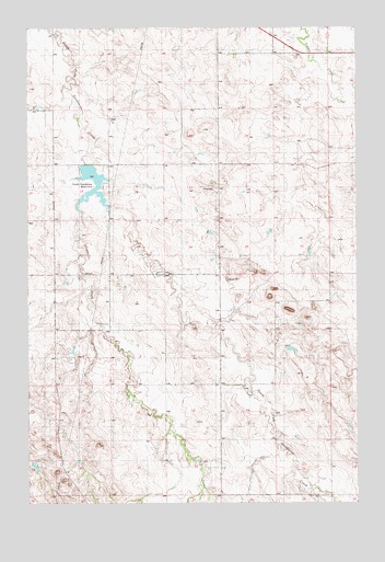
South Sandstone Reservoir, MT USGS Topographic Map
Click on map above to begin viewing in our Map Viewer.

This topographic map contains these locations and features:
Feature Name Type Latitude Longitude GNIS ID View Map
06N58E04BB__01 WellWellN46.3078°W104.4658°815307View Map
06N58E04BD__01 WellWellN46.3056°W104.4608°815284View Map
06N58E05BA__01 WellWellN46.3083°W104.4811°815312View Map
06N58E06AC__01 WellWellN46.3056°W104.4963°815285View Map
06N58E10DC__01 WellWellN46.2875°W104.4352°815097View Map
06N58E14ABCD01 WellWellN46.2783°W104.4152°815024View Map
06N58E15CC__01 WellWellN46.2681°W104.4452°814946View Map
06N58E24BDAC01 WellWellN46.2619°W104.3977°814893View Map
06N58E25AA__01 WellWellN46.2503°W104.3880°814792View Map
06N58E25AA__02 WellWellN46.2514°W104.3880°814793View Map
07N58E13AB__01 WellWellN46.3664°W104.3933°815775View Map
07N58E13AC__01 WellWellN46.3628°W104.3933°815739View Map
07N58E18DD__01 WellWellN46.3556°W104.4922°815682View Map
07N58E32AA__01 WellWellN46.3228°W104.4713°815436View Map
07N58E32AA__02 WellWellN46.3228°W104.4713°815437View Map
07N58E33DC__01 WellWellN46.3139°W104.4533°815357View Map
07N59E24DCBB01 WellWellN46.3428°W104.3952°815601View Map
07N59E31BC__01 WellWellN46.3222°W104.3824°815434View Map
Coon CreekStreamN46.3311°W104.4783°770074View Map
Ehret Number 1 DamDamN46.2900°W104.4805°797493View Map
Fallon CountyCivilN46.3340°W104.4174°1688745View Map
R Maier DamDamN46.3417°W104.4755°797972View Map
South Sandstone Creek DamDamN46.3333°W104.4838°797107View Map
South Sandstone Fishing Access SiteLocaleN46.3325°W104.4741°1744436View Map
South Sandstone ReservoirReservoirN46.3319°W104.4759°799258View Map

Note: Coordinates in the location and feature list above are referenced to NAD83 datum.


Copyright (C) 2008-2024 Ryan Niemi / Sunset Dynamics ... All Rights Reserved