TopoQuest Logo
Do you find TopoQuest useful?
Help keep TopoQuest running and adding new maps/features by donating!
Bitcoin:  19c7KJd3qBynnjoSw5npx9KScwjBe4ifkT
Litecoin:  LXs6TkuXGGXo1vDsWCkWVdjQX94eUKd6ui
Home View Maps Find Maps Find Places Resources & Links


Indian Peak, New Mexico Topographic Map

USGS Map Title: Indian Peak, NM
USGS Map MRC: 31108G8
DRG (GeoTIFF) Download: o31108g8.tif


Neighboring USGS Topographic Map Quads:


  Portal NE, AZ  
31109H1
 

  Antelope Pass, NM  
31108H8
 

  Animas, NM  
31108H7
 

  Rodeo, NM  
31109G1
 

  Indian Peak, NM  
31108G8
 

  Tank Mountain, NM  
31108G7
 

  Skull Canyon, NM  
31109F1
 

  Mount Baldy, NM  
31108F8
 

  Animas Peak NE, NM  
31108F7


Map MRC Location:

N32°
W109°
N32°
W108°
H8 H7 H6 H5 H4 H3 H2 H1
G8 G7 G6 G5 G4 G3 G2 G1
F8 F7 F6 F5 F4 F3 F2 F1
E8 E7 E6 E5 E4 E3 E2 E1
D8 D7 D6 D5 D4 D3 D2 D1
C8 C7 C6 C5 C4 C3 C2 C1
B8 B7 B6 B5 B4 B3 B2 B1
A8 A7 A6 A5 A4 A3 A2 A1
N31°
W109°
N31°
W108°

Indian Peak, NM USGS 1:24K Topographic Map Preview:
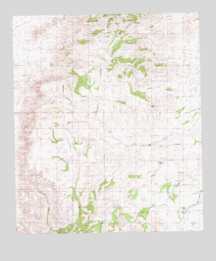
Indian Peak, NM USGS Topographic Map
Click on map above to begin viewing in our Map Viewer.

This topographic map contains these locations and features:
Feature Name Type Latitude Longitude GNIS ID View Map
Antelope PassGapN31.8448°W108.9576°885781View Map
Birtrong TankReservoirN31.7895°W108.9021°901062View Map
Burro PassGapN31.8254°W108.9712°886962View Map
Coe RanchLocaleN31.7576°W108.9376°887726View Map
Cottonwood SpringSpringN31.7595°W108.9948°887936View Map
Dupree CanyonValleyN31.8304°W108.8917°900881View Map
Gibson Place (historical)LocaleN31.7634°W108.9603°934046View Map
Indian PeakSummitN31.8218°W108.9067°900911View Map
Jim Robinson Ranch (historical)LocaleN31.7695°W108.9706°934047View Map
MaloneyLocaleN31.7965°W108.8873°933944View Map
Maloney RanchLocaleN31.7923°W108.9609°891556View Map
Maloney RanchLocaleN31.7976°W108.8892°891557View Map
Mouser PlaceLocaleN31.7998°W108.9212°933943View Map
Mud SpringsSpringN31.7609°W108.8881°892307View Map
Old Maddox School (historical)SchoolN31.7507°W108.9384°934045View Map
Pages StoreLocaleN31.8409°W108.9312°934049View Map
Rough CreekStreamN31.7972°W108.8886°2568201View Map
Tase Golman (historical)LocaleN31.7845°W108.9584°934048View Map
Trail CreekStreamN31.7998°W108.9076°895792View Map
XT CanyonValleyN31.7600°W108.9394°2568202View Map

Note: Coordinates in the location and feature list above are referenced to NAD83 datum.


Copyright (C) 2008-2025 Ryan Niemi / Sunset Dynamics ... All Rights Reserved