TopoQuest Logo
Do you find TopoQuest useful?
Help keep TopoQuest running and adding new maps/features by donating!
Bitcoin:  19c7KJd3qBynnjoSw5npx9KScwjBe4ifkT
Litecoin:  LXs6TkuXGGXo1vDsWCkWVdjQX94eUKd6ui
Home View Maps Find Maps Find Places Resources & Links


Rodeo, New Mexico Topographic Map

USGS Map Title: Rodeo, NM
USGS Map MRC: 31109G1
DRG (GeoTIFF) Download: o31109g1.tif


Neighboring USGS Topographic Map Quads:


  Portal, AZ  
31109H2
 

  Portal NE, AZ  
31109H1
 

  Antelope Pass, NM  
31108H8
 

  Portal Peak, AZ  
31109G2
 

  Rodeo, NM  
31109G1
 

  Indian Peak, NM  
31108G8
 

  Apache, AZ  
31109F2
 

  Skull Canyon, NM  
31109F1
 

  Mount Baldy, NM  
31108F8


Map MRC Location:

N32°
W110°
N32°
W109°
H8 H7 H6 H5 H4 H3 H2 H1
G8 G7 G6 G5 G4 G3 G2 G1
F8 F7 F6 F5 F4 F3 F2 F1
E8 E7 E6 E5 E4 E3 E2 E1
D8 D7 D6 D5 D4 D3 D2 D1
C8 C7 C6 C5 C4 C3 C2 C1
B8 B7 B6 B5 B4 B3 B2 B1
A8 A7 A6 A5 A4 A3 A2 A1
N31°
W110°
N31°
W109°

Rodeo, NM USGS 1:24K Topographic Map Preview:
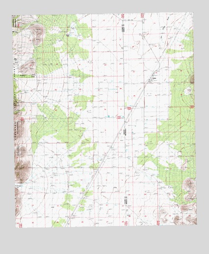
Rodeo, NM USGS Topographic Map
Click on map above to begin viewing in our Map Viewer.

This topographic map contains these locations and features:
Feature Name Type Latitude Longitude GNIS ID View Map
09002 Water WellWellN31.8256°W109.0673°922945View Map
09003 Water WellWellN31.8256°W109.0673°922944View Map
09004 Water WellWellN31.7990°W109.0714°922943View Map
Birts TankReservoirN31.8492°W109.1248°2568889View Map
Damell RanchLocaleN31.8150°W109.0797°2568890View Map
Horseshoe CanyonValleyN31.7745°W109.1203°6012View Map
Main Well South Water WellWellN31.8384°W109.0289°921372View Map
Miller RanchLocaleN31.8381°W109.1211°2568891View Map
Mystery Well Ranch AirportAirportN31.8099°W109.0591°2623651View Map
Owl CanyonValleyN31.7868°W109.0389°892979View Map
RodeoPopulated PlaceN31.8354°W109.0312°894117View Map
Rodeo CemeteryCemeteryN31.8334°W109.0092°1851874View Map
Rodeo Census Designated PlaceCensusN31.8397°W109.0266°2584194View Map
Rodeo Volunteer Fire DepartmentBuildingN31.8396°W109.0279°2657568View Map
Rodeo Weather StationLocaleN31.8354°W109.0312°931663View Map
Saint Simon Episcopal MissionChurchN31.8354°W109.0312°901979View Map
San Felipe Catholic ChurchChurchN31.8354°W109.0312°901949View Map
Stanford RanchLocaleN31.8637°W109.0856°22236View Map
Stanford TanksReservoirN31.8632°W109.0859°2568685View Map
Sulphur DrawValleyN31.8393°W109.1167°11937View Map

Note: Coordinates in the location and feature list above are referenced to NAD83 datum.


Copyright (C) 2008-2025 Ryan Niemi / Sunset Dynamics ... All Rights Reserved