TopoQuest Logo
Do you find TopoQuest useful?
Help keep TopoQuest running and adding new maps/features by donating!
Bitcoin:  19c7KJd3qBynnjoSw5npx9KScwjBe4ifkT
Litecoin:  LXs6TkuXGGXo1vDsWCkWVdjQX94eUKd6ui
Home View Maps Find Maps Find Places Resources & Links


Indian Rocks, Wyoming Topographic Map

USGS Map Title: Indian Rocks, WY
USGS Map MRC: 41106C8
DRG (GeoTIFF) Download: o41106c8.tif


Neighboring USGS Topographic Map Quads:


  Jack Creek Reservoir, WY  
41107D1
 

  Walck Ranch, WY  
41106D8
 

  Saratoga, WY  
41106D7
 

  Sharp Hill, WY  
41107C1
 

  Indian Rocks, WY  
41106C8
 

  Cow Creek Ranch, WY  
41106C7
 

  Bridger Peak, WY  
41107B1
 

  Red Mountain, WY  
41106B8
 

  Encampment, WY  
41106B7


Map MRC Location:

N42°
W107°
N42°
W106°
H8 H7 H6 H5 H4 H3 H2 H1
G8 G7 G6 G5 G4 G3 G2 G1
F8 F7 F6 F5 F4 F3 F2 F1
E8 E7 E6 E5 E4 E3 E2 E1
D8 D7 D6 D5 D4 D3 D2 D1
C8 C7 C6 C5 C4 C3 C2 C1
B8 B7 B6 B5 B4 B3 B2 B1
A8 A7 A6 A5 A4 A3 A2 A1
N41°
W107°
N41°
W106°

Indian Rocks, WY USGS 1:24K Topographic Map Preview:
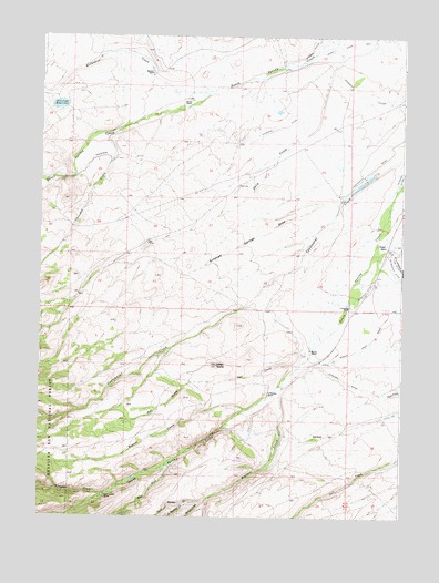
Indian Rocks, WY USGS Topographic Map
Click on map above to begin viewing in our Map Viewer.

This topographic map contains these locations and features:
Feature Name Type Latitude Longitude GNIS ID View Map
Antelope DamDamN41.3583°W106.9939°1606254View Map
Antelope ReservoirReservoirN41.3569°W106.9940°1597782View Map
Antelope Springs DrawValleyN41.3336°W106.8962°1597784View Map
Bartlett RanchLocaleN41.3652°W106.9625°1597942View Map
Bath RanchLocaleN41.2700°W106.9020°1597962View Map
Beaver CreekStreamN41.2780°W106.9284°1598057View Map
Berger RanchLocaleN41.3586°W106.9503°1598117View Map
C Swanson RanchLocaleN41.3047°W106.8928°1598547View Map
Cherokee CreekStreamN41.3494°W106.9764°1598710View Map
Cherokee DitchCanalN41.3508°W106.9200°1598711View Map
Chippewa CreekStreamN41.2558°W106.9762°1598747View Map
Cozy Canyon RanchLocaleN41.2552°W106.9770°1598996View Map
Dunkard DitchCanalN41.2855°W106.8942°1599422View Map
East Fork South Spring CreekStreamN41.2644°W106.9542°1599496View Map
Heather CreekStreamN41.2847°W106.9159°1600277View Map
Indian RocksSummitN41.2894°W106.9389°1600513View Map
Methodist CreekStreamN41.3611°W106.9409°1601363View Map
Mowry RanchLocaleN41.2927°W106.9067°1601598View Map
North Heather CreekStreamN41.2533°W106.9467°1601832View Map
Owl CreekStreamN41.2897°W106.9100°1601969View Map
Owl GulchValleyN41.2841°W106.9481°1601976View Map
Shingle CreekStreamN41.2539°W106.9431°1602895View Map
South Heather CreekStreamN41.2539°W106.9470°1603182View Map
V Swanson RanchLocaleN41.2814°W106.9209°1603897View Map
Waliser RanchLocaleN41.3202°W106.8806°1603958View Map

Note: Coordinates in the location and feature list above are referenced to NAD83 datum.


Copyright (C) 2008-2025 Ryan Niemi / Sunset Dynamics ... All Rights Reserved