TopoQuest Logo
Do you find TopoQuest useful?
Help keep TopoQuest running and adding new maps/features by donating!
Bitcoin:  19c7KJd3qBynnjoSw5npx9KScwjBe4ifkT
Litecoin:  LXs6TkuXGGXo1vDsWCkWVdjQX94eUKd6ui
Home View Maps Find Maps Find Places Resources & Links


Saratoga, Wyoming Topographic Map

USGS Map Title: Saratoga, WY
USGS Map MRC: 41106D7
DRG (GeoTIFF) Download: o41106d7.tif


Neighboring USGS Topographic Map Quads:


  Overland Crossing, WY  
41106E8
 

  Overland, WY  
41106E7
 

  Oberg Ranch, WY  
41106E6
 

  Walck Ranch, WY  
41106D8
 

  Saratoga, WY  
41106D7
 

  Finley Reservoir, WY  
41106D6
 

  Indian Rocks, WY  
41106C8
 

  Cow Creek Ranch, WY  
41106C7
 

  Cow Creek, WY  
41106C6


Map MRC Location:

N42°
W107°
N42°
W106°
H8 H7 H6 H5 H4 H3 H2 H1
G8 G7 G6 G5 G4 G3 G2 G1
F8 F7 F6 F5 F4 F3 F2 F1
E8 E7 E6 E5 E4 E3 E2 E1
D8 D7 D6 D5 D4 D3 D2 D1
C8 C7 C6 C5 C4 C3 C2 C1
B8 B7 B6 B5 B4 B3 B2 B1
A8 A7 A6 A5 A4 A3 A2 A1
N41°
W107°
N41°
W106°

Saratoga, WY USGS 1:24K Topographic Map Preview:
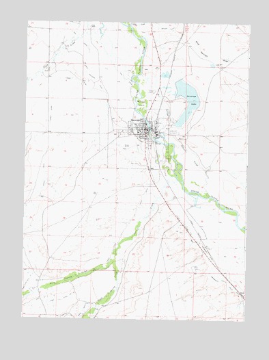
Saratoga, WY USGS Topographic Map
Click on map above to begin viewing in our Map Viewer.

This topographic map contains these locations and features:
Feature Name Type Latitude Longitude GNIS ID View Map
Brauer DitchCanalN41.4975°W106.7942°1585888View Map
Buck Springs DrawValleyN41.4955°W106.7900°1598444View Map
Cadwell CemeteryCemeteryN41.4532°W106.7672°2774475View Map
Cadwell SloughStreamN41.4536°W106.8031°1586269View Map
Cedar CreekStreamN41.4147°W106.7506°1598676View Map
DavisLocaleN41.3864°W106.7517°1597279View Map
Foote RanchLocaleN41.4977°W106.8387°1588613View Map
Forney DitchCanalN41.4758°W106.8464°1588626View Map
Hot SloughGutN41.4661°W106.7967°1589753View Map
Hugus Mullison DitchCanalN41.4744°W106.8334°1596728View Map
Lake CreekStreamN41.4989°W106.8145°1600784View Map
Lake GeorgeReservoirN41.4483°W106.7773°1605888View Map
Lake George DamDamN41.4483°W106.7773°1605887View Map
Lower DitchCanalN41.4208°W106.8098°1591081View Map
Mullison IslandIslandN41.4658°W106.8086°1591902View Map
North Spring CreekStreamN41.4047°W106.8212°1601862View Map
SaratogaPopulated PlaceN41.4550°W106.8064°1609150View Map
Saratoga CemeteryCemeteryN41.4593°W106.7938°2774476View Map
Saratoga DamDamN41.4733°W106.7906°1605949View Map
Saratoga High SchoolSchoolN41.4550°W106.8064°1795450View Map
Saratoga Hot SpringsSpringN41.4500°W106.8045°1794806View Map
Saratoga LakeLakeN41.4684°W106.7812°1593944View Map
Saratoga Middle SchoolSchoolN41.4550°W106.8064°1795451View Map
Saratoga Police DepartmentBuildingN41.4542°W106.8070°2752638View Map
Saratoga Post OfficePost OfficeN41.4555°W106.8083°2768529View Map
Saratoga ReservoirReservoirN41.4616°W106.7848°1605950View Map
Saratoga SchoolSchoolN41.4550°W106.8064°1795452View Map
Saratoga Volunteer Fire DepartmentBuildingN41.4541°W106.8065°2673423View Map
Seahorn Brothers Sand and Gravel PitMineN41.4575°W106.8061°1726102View Map
Shively FieldAirportN41.4469°W106.8178°1605623View Map
South Central Wyoming Emergency Medical Services Saratoga / Encampment / Medicine BowBuildingN41.4444°W106.8064°2673657View Map
South Spring CreekStreamN41.4047°W106.8212°1603201View Map
Spring CreekStreamN41.4347°W106.7889°1594826View Map
Town of SaratogaCivilN41.4517°W106.8108°2413260View Map

Note: Coordinates in the location and feature list above are referenced to NAD83 datum.


Copyright (C) 2008-2024 Ryan Niemi / Sunset Dynamics ... All Rights Reserved