TopoQuest Logo
Do you find TopoQuest useful?
Help keep TopoQuest running and adding new maps/features by donating!
Bitcoin:  19c7KJd3qBynnjoSw5npx9KScwjBe4ifkT
Litecoin:  LXs6TkuXGGXo1vDsWCkWVdjQX94eUKd6ui
Home View Maps Find Maps Find Places Resources & Links


Interior, Virginia Topographic Map

USGS Map Title: Interior, VA
USGS Map MRC: 37080D5
DRG (GeoTIFF) Download: o37080d5.tif


Neighboring USGS Topographic Map Quads:


  Greenville, WV  
37080E6
 

  Union, WV  
37080E5
 

  Gap Mills, WV  
37080E4
 

  Lindside, WV  
37080D6
 

  Interior, VA  
37080D5
 

  Waiteville, WV  
37080D4
 

  Pearisburg, VA  
37080C6
 

  Eggleston, VA  
37080C5
 

  Newport, VA  
37080C4


Map MRC Location:

N38°
W81°
N38°
W80°
H8 H7 H6 H5 H4 H3 H2 H1
G8 G7 G6 G5 G4 G3 G2 G1
F8 F7 F6 F5 F4 F3 F2 F1
E8 E7 E6 E5 E4 E3 E2 E1
D8 D7 D6 D5 D4 D3 D2 D1
C8 C7 C6 C5 C4 C3 C2 C1
B8 B7 B6 B5 B4 B3 B2 B1
A8 A7 A6 A5 A4 A3 A2 A1
N37°
W81°
N37°
W80°

Interior, VA USGS 1:24K Topographic Map Preview:
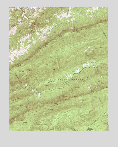
Interior, VA USGS Topographic Map
Click on map above to begin viewing in our Map Viewer.

This topographic map contains these locations and features:
Feature Name Type Latitude Longitude GNIS ID View Map
Allegheny TrailTrailN37.4426°W80.6098°1488735View Map
Alleheny TrailTrailN37.4426°W80.6098°1550005View Map
Bailey GapGapN37.3968°W80.5748°1481398View Map
Bailey Gap ShelterLocaleN37.4010°W80.5773°1488615View Map
Ballard-Harvey CemeteryCemeteryN37.4929°W80.6051°1550163View Map
Big MountainRidgeN37.3960°W80.5837°1481755View Map
Bradley BranchStreamN37.4921°W80.6062°1550437View Map
Brushy TopSummitN37.3912°W80.6003°1482084View Map
Dismal BranchStreamN37.4187°W80.5978°1483024View Map
Dixon BranchStreamN37.4487°W80.5648°1483039View Map
Dropping Lick CreekStreamN37.4985°W80.6084°1550955View Map
Epling DraftValleyN37.4390°W80.5154°1488502View Map
Falt Peter TrailTrailN37.4451°W80.5942°1488613View Map
Fortner CemeteryCemeteryN37.4748°W80.5920°1551167View Map
Fortner ChurchChurchN37.4771°W80.5895°1551168View Map
Hatfield MeadowsFlatN37.4265°W80.5665°1488501View Map
Hayes KnobSummitN37.4179°W80.5387°1483987View Map
Hemlock BranchStreamN37.3751°W80.5698°1481243View Map
Huckleberry RidgeRidgeN37.4401°W80.5815°1484259View Map
Hunters BranchStreamN37.3771°W80.5445°1484285View Map
InteriorLocaleN37.4137°W80.5878°1484348View Map
Interior Picnic AreaLocaleN37.4151°W80.5876°1494296View Map
Iron Spring BranchStreamN37.4140°W80.5853°1484362View Map
KirePopulated PlaceN37.4401°W80.5190°1495797View Map
Kire Community CemeteryCemeteryN37.4407°W80.5203°1674431View Map
Little MeadowsBasinN37.3921°W80.5581°1484928View Map
Little MountainRidgeN37.4890°W80.5878°1553551View Map
Locust KnobSummitN37.4373°W80.5695°1495859View Map
Lybrook GapGapN37.3835°W80.6070°1485134View Map
Maple Flats BranchStreamN37.3932°W80.5406°1485169View Map
Meredith BranchStreamN37.3832°W80.5690°1485356View Map
Minie Ball HillSummitN37.4076°W80.5151°1485493View Map
Mount Pleasant Fire and RescueBuildingN37.4064°W80.5181°2085992View Map
Mud BranchStreamN37.4182°W80.5662°1488614View Map
Nettle HollowValleyN37.4232°W80.5520°1485829View Map
Norfolk Southern Railway PoliceBuildingN37.4597°W80.5761°2085996View Map
North Fork Stony CreekStreamN37.4251°W80.5520°1487066View Map
Pine Swamp BranchStreamN37.4215°W80.6042°1486234View Map
Pine Swamp RidgeRidgeN37.4348°W80.6095°1486235View Map
Pine Swamp ShelterLocaleN37.4223°W80.6092°1488720View Map
Pond DrainStreamN37.3946°W80.5462°1486321View Map
Rock CampPopulated PlaceN37.4982°W80.6067°1555497View Map
Rock Camp American Baptist ChurchChurchN37.4979°W80.6065°1558753View Map
Rock Camp School (historical)SchoolN37.4771°W80.5901°1556702View Map
Rock Camp SpringSpringN37.4765°W80.5887°1557718View Map
Rocky MountainSummitN37.4251°W80.5298°1496164View Map
Sarton RidgeRidgeN37.4210°W80.5712°1486945View Map
Schoolhouse RidgeRidgeN37.4818°W80.5906°1552816View Map
Stony Creek Lookout TowerPillarN37.4157°W80.5128°1487619View Map
University of Virginia Mountain Lake Biological StationSchoolN37.3756°W80.5220°1488069View Map
Vinton Police DepartmentBuildingN37.4750°W80.5061°2085998View Map
Virginia Division Game and Inland Fisheries ShopLocaleN37.4107°W80.5884°1488616View Map
Wallace School (historical)SchoolN37.4932°W80.5467°1556721View Map
Walnut Knob School (historical)SchoolN37.4657°W80.5953°1556722View Map
White Pine LodgePopulated PlaceN37.3904°W80.5501°1496405View Map
White Rock BranchStreamN37.4418°W80.5192°1488305View Map
White Rock MountainSummitN37.4071°W80.6151°1488316View Map
Wildcat HollowValleyN37.4178°W80.5569°1488368View Map
Wind RockSummitN37.4143°W80.5167°1496425View Map
Wiseman BranchStreamN37.4885°W80.6009°1553492View Map
Wrights PeakSummitN37.4767°W80.5249°2572162View Map

Note: Coordinates in the location and feature list above are referenced to NAD83 datum.


Copyright (C) 2008-2025 Ryan Niemi / Sunset Dynamics ... All Rights Reserved