TopoQuest Logo
Do you find TopoQuest useful?
Help keep TopoQuest running and adding new maps/features by donating!
Bitcoin:  19c7KJd3qBynnjoSw5npx9KScwjBe4ifkT
Litecoin:  LXs6TkuXGGXo1vDsWCkWVdjQX94eUKd6ui
Home View Maps Find Maps Find Places Resources & Links


Greenville, West Virginia Topographic Map

USGS Map Title: Greenville, WV
USGS Map MRC: 37080E6
DRG (GeoTIFF) Download: o37080e6.tif


Neighboring USGS Topographic Map Quads:


  Talcott, WV  
37080F7
 

  Alderson, WV  
37080F6
 

  Fort Spring, WV  
37080F5
 

  Forest Hill, WV  
37080E7
 

  Greenville, WV  
37080E6
 

  Union, WV  
37080E5
 

  Peterstown, WV  
37080D7
 

  Lindside, WV  
37080D6
 

  Interior, VA  
37080D5


Map MRC Location:

N38°
W81°
N38°
W80°
H8 H7 H6 H5 H4 H3 H2 H1
G8 G7 G6 G5 G4 G3 G2 G1
F8 F7 F6 F5 F4 F3 F2 F1
E8 E7 E6 E5 E4 E3 E2 E1
D8 D7 D6 D5 D4 D3 D2 D1
C8 C7 C6 C5 C4 C3 C2 C1
B8 B7 B6 B5 B4 B3 B2 B1
A8 A7 A6 A5 A4 A3 A2 A1
N37°
W81°
N37°
W80°

Greenville, WV USGS 1:24K Topographic Map Preview:
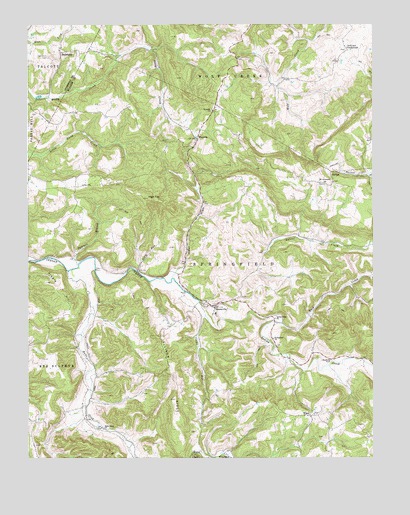
Greenville, WV USGS Topographic Map
Click on map above to begin viewing in our Map Viewer.

This topographic map contains these locations and features:
Feature Name Type Latitude Longitude GNIS ID View Map
Ash Hill School (historical)SchoolN37.6085°W80.6451°1556631View Map
Back CreekStreamN37.5390°W80.6581°1535097View Map
BallengeePopulated PlaceN37.6171°W80.7381°1553791View Map
Ballengee Post OfficePost OfficeN37.6182°W80.7379°1559416View Map
Buckeye School (historical)SchoolN37.5643°W80.6562°1556637View Map
Cooks RunStreamN37.5410°W80.6859°1537602View Map
Cooks Run School (historical)SchoolN37.5101°W80.6870°1556646View Map
Davis School (historical)SchoolN37.6112°W80.7404°1556910View Map
Ellison RidgeRidgeN37.5229°W80.6967°1538686View Map
Fairview School (historical)SchoolN37.5032°W80.6284°1556656View Map
GreenvillePopulated PlaceN37.5435°W80.6826°1558761View Map
Greenville Elementary School (historical)SchoolN37.5418°W80.6820°1556663View Map
Greenville Post OfficePost OfficeN37.5438°W80.6819°1559406View Map
Hans CreekStreamN37.5537°W80.7354°1551357View Map
Hans Creek ChurchChurchN37.5085°W80.7226°1539922View Map
Hans Creek School (historical)SchoolN37.5087°W80.7231°1556665View Map
High TopSummitN37.5751°W80.7070°1540253View Map
Hunter Springs School (historical)SchoolN37.5293°W80.6581°1556669View Map
Indian Creek ChurchChurchN37.5404°W80.6606°1540678View Map
Indian Creek School (historical)SchoolN37.5568°W80.7245°1556671View Map
Indian DraftValleyN37.5529°W80.6973°1540680View Map
Indian Draft School (historical)SchoolN37.5865°W80.6906°1556672View Map
Johnson CrossroadsPopulated PlaceN37.6176°W80.6340°1554819View Map
Kibble HillSummitN37.5454°W80.7367°1554873View Map
Laurel CreekStreamN37.5590°W80.6648°1541411View Map
Laurel Creek Covered BridgeBridgeN37.5612°W80.6265°1556676View Map
Lively School (historical)SchoolN37.6162°W80.7181°1556677View Map
Marvin Grove School (historical)SchoolN37.6196°W80.6745°1556680View Map
Milton Hall School (historical)SchoolN37.6007°W80.7156°1556681View Map
Mount Abraham School (historical)SchoolN37.5343°W80.7426°1556683View Map
Mount Alexander United Methodist ChurchChurchN37.5790°W80.6426°1543610View Map
Mount Hermon Missionary Baptist ChurchChurchN37.5798°W80.6392°1558744View Map
New Hope School (historical)SchoolN37.5798°W80.7429°1556688View Map
Oak Grove CemeteryCemeteryN37.6157°W80.7420°1544278View Map
Oak Grove Methodist ChurchChurchN37.6176°W80.7381°1558050View Map
Pleasant Grove School (historical)SchoolN37.5037°W80.7481°1556697View Map
Roanoke County Police DepartmentBuildingN37.5433°W80.6639°2085997View Map
SartonPopulated PlaceN37.5826°W80.6401°1555573View Map
Sarton Post OfficePost OfficeN37.5823°W80.6362°1559408View Map
Shady Grove School (historical)SchoolN37.5790°W80.6395°1556707View Map
Silas Gore SpringSpringN37.5160°W80.7317°1557725View Map
Slate RunStreamN37.5540°W80.7104°1546911View Map
Springfield ChurchChurchN37.5343°W80.6612°1547220View Map
Springfield District (historical)CivilN37.5235°W80.6523°1928370View Map
Symmes BranchStreamN37.5560°W80.7320°1547854View Map
Upton Church (historical)ChurchN37.5946°W80.6762°1558757View Map
Upton School (historical)SchoolN37.5946°W80.6762°1556719View Map
WaysidePopulated PlaceN37.5921°W80.6887°1548855View Map
Wayside CemeteryCemeteryN37.6004°W80.6831°1558758View Map
Wayside ChurchChurchN37.6004°W80.6834°1548856View Map
Wayside Post OfficePost OfficeN37.5924°W80.6886°1559412View Map
WikelPopulated PlaceN37.5121°W80.6476°1555982View Map
Wikel Baptist ChurchChurchN37.5121°W80.6498°1558759View Map
Woodrum SpringSpringN37.6179°W80.6326°1557737View Map

Note: Coordinates in the location and feature list above are referenced to NAD83 datum.


Copyright (C) 2008-2024 Ryan Niemi / Sunset Dynamics ... All Rights Reserved