TopoQuest Logo
Do you find TopoQuest useful?
Help keep TopoQuest running and adding new maps/features by donating!
Bitcoin:  19c7KJd3qBynnjoSw5npx9KScwjBe4ifkT
Litecoin:  LXs6TkuXGGXo1vDsWCkWVdjQX94eUKd6ui
Home View Maps Find Maps Find Places Resources & Links


Iron Mountain, New Mexico Topographic Map

USGS Map Title: Iron Mountain, NM
USGS Map MRC: 33107D6
DRG (GeoTIFF) Download: o33107d6.tif


Neighboring USGS Topographic Map Quads:


  Wahoo Peak, NM  
33107E7
 

  Wahoo Ranch, NM  
33107E6
 

  Montoya Butte, NM  
33107E5
 

  Sawmill Peak, NM  
33107D7
 

  Iron Mountain, NM  
33107D6
 

  Jaralosa Mountain, NM  
33107D5
 

  Lookout Mountain, NM  
33107C7
 

  Winston, NM  
33107C6
 

  Chise, NM  
33107C5


Map MRC Location:

N34°
W108°
N34°
W107°
H8 H7 H6 H5 H4 H3 H2 H1
G8 G7 G6 G5 G4 G3 G2 G1
F8 F7 F6 F5 F4 F3 F2 F1
E8 E7 E6 E5 E4 E3 E2 E1
D8 D7 D6 D5 D4 D3 D2 D1
C8 C7 C6 C5 C4 C3 C2 C1
B8 B7 B6 B5 B4 B3 B2 B1
A8 A7 A6 A5 A4 A3 A2 A1
N33°
W108°
N33°
W107°

Iron Mountain, NM USGS 1:24K Topographic Map Preview:
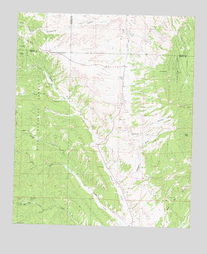
Iron Mountain, NM USGS Topographic Map
Click on map above to begin viewing in our Map Viewer.

This topographic map contains these locations and features:
Feature Name Type Latitude Longitude GNIS ID View Map
2 South Water WellWellN33.4084°W107.6864°925815View Map
Alaska DrawValleyN33.4320°W107.7495°903061View Map
Alaska GroupMineN33.4301°W107.7484°917460View Map
BackslopeMineN33.4673°W107.6364°917917View Map
Bear CreekStreamN33.4053°W107.7067°903654View Map
Bellboy MineMineN33.3909°W107.7467°903736View Map
Black MountainMineN33.4798°W107.7456°917928View Map
Blackhawk MineMineN33.3762°W107.7475°903902View Map
Blue Water WellWellN33.4231°W107.6936°925745View Map
Buster CreekStreamN33.4420°W107.7045°904251View Map
Buster Water WellWellN33.4376°W107.7014°921999View Map
C C TankReservoirN33.4624°W107.6763°904264View Map
Edwards DrawValleyN33.3931°W107.6723°906017View Map
Emporia MineMineN33.4320°W107.7445°940138View Map
Escondrijo WindmillLocaleN33.4103°W107.6250°2025690View Map
Gold CoinMineN33.4301°W107.7464°917455View Map
GraftonPopulated PlaceN33.4306°W107.7462°906676View Map
Grafton Post Office (historical)Post OfficeN33.4306°W107.7462°938058View Map
Great RepublicMineN33.4756°W107.7459°917923View Map
Horses HeadMineN33.4662°W107.6378°917458View Map
Invincible MineMineN33.4470°W107.6295°907246View Map
Iron MountainSummitN33.4665°W107.6378°907255View Map
Iron Mountain DepositMineN33.4751°W107.6353°917459View Map
Iron Mountain Detention DamDamN33.4867°W107.6606°923877View Map
Iron Mountain MineMineN33.4687°W107.6375°940065View Map
Ivanhoe MineMineN33.4320°W107.7445°940066View Map
KeystoneMineN33.4740°W107.7464°917919View Map
Little Bear CreekStreamN33.4098°W107.7353°907988View Map
Little Red HillSummitN33.4828°W107.7417°908045View Map
Lucky StrikeMineN33.4717°W107.6389°917920View Map
Midway Water WellWellN33.4926°W107.7109°925805View Map
Minnehaha MineMineN33.4801°W107.7453°908797View Map
Minnehoha MineMineN33.4798°W107.7450°916785View Map
Moore RanchLocaleN33.4101°W107.6873°908889View Map
North Dry CreekStreamN33.3842°W107.7278°909134View Map
Parker StrikeMineN33.4684°W107.6392°917425View Map
Paymaster MineMineN33.3906°W107.7381°909519View Map
Peewee Water WellWellN33.4295°W107.6936°925746View Map
Pine CanyonValleyN33.4498°W107.7131°909657View Map
Piņon SpringSpringN33.4673°W107.6448°909719View Map
Reilly PeakSummitN33.4306°W107.6281°910116View Map
Republic MineMineN33.4756°W107.7456°910128View Map
Rouse CanyonValleyN33.4231°W107.6936°910456View Map
Sage RanchLocaleN33.4578°W107.7250°910513View Map
ScheelemiteMineN33.4770°W107.6720°917445View Map
Scheelemite Gem MineMineN33.4687°W107.6375°940054View Map
Sheep CanyonValleyN33.4890°W107.7395°910986View Map
Sky BandLocaleN33.4470°W107.6784°924813View Map
Tungsten ReefMineN33.4703°W107.6381°917933View Map

Note: Coordinates in the location and feature list above are referenced to NAD83 datum.


Copyright (C) 2008-2025 Ryan Niemi / Sunset Dynamics ... All Rights Reserved