TopoQuest Logo
Do you find TopoQuest useful?
Help keep TopoQuest running and adding new maps/features by donating!
Bitcoin:  19c7KJd3qBynnjoSw5npx9KScwjBe4ifkT
Litecoin:  LXs6TkuXGGXo1vDsWCkWVdjQX94eUKd6ui
Home View Maps Find Maps Find Places Resources & Links


Wahoo Peak, New Mexico Topographic Map

USGS Map Title: Wahoo Peak, NM
USGS Map MRC: 33107E7
DRG (GeoTIFF) Download: o33107e7.tif


Neighboring USGS Topographic Map Quads:


  Mojonera Canyon, NM  
33107F8
 

  Paddys Hole, NM  
33107F7
 

  Dusty, NM  
33107F6
 

  Indian Peaks East, NM  
33107E8
 

  Wahoo Peak, NM  
33107E7
 

  Wahoo Ranch, NM  
33107E6
 

  Taylor Peak, NM  
33107D8
 

  Sawmill Peak, NM  
33107D7
 

  Iron Mountain, NM  
33107D6


Map MRC Location:

N34°
W108°
N34°
W107°
H8 H7 H6 H5 H4 H3 H2 H1
G8 G7 G6 G5 G4 G3 G2 G1
F8 F7 F6 F5 F4 F3 F2 F1
E8 E7 E6 E5 E4 E3 E2 E1
D8 D7 D6 D5 D4 D3 D2 D1
C8 C7 C6 C5 C4 C3 C2 C1
B8 B7 B6 B5 B4 B3 B2 B1
A8 A7 A6 A5 A4 A3 A2 A1
N33°
W108°
N33°
W107°

Wahoo Peak, NM USGS 1:24K Topographic Map Preview:
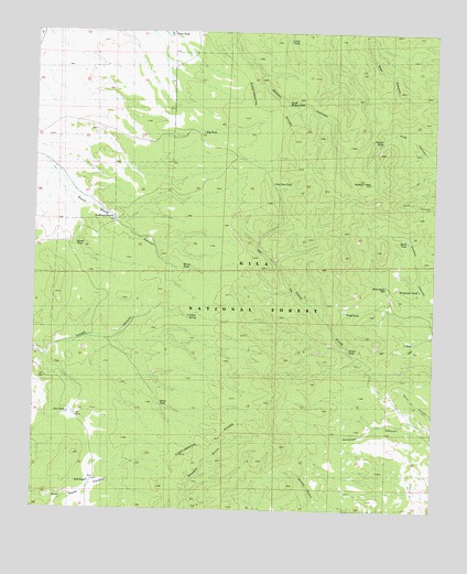
Wahoo Peak, NM USGS Topographic Map
Click on map above to begin viewing in our Map Viewer.

This topographic map contains these locations and features:
Feature Name Type Latitude Longitude GNIS ID View Map
Adobe SpringSpringN33.5509°W107.8278°2038344View Map
Adobe TankReservoirN33.5509°W107.8275°1847415View Map
Bambi ClaimsMineN33.5253°W107.7787°917245View Map
Black Box MineMineN33.5309°W107.7787°939923View Map
Brush TankReservoirN33.5521°W107.7778°1847401View Map
Day Time TankReservoirN33.5855°W107.8013°1847409View Map
Doe TankReservoirN33.5251°W107.8650°1847418View Map
Dolan TankReservoirN33.5272°W107.8352°1847416View Map
Exit TankReservoirN33.5075°W107.8579°1847417View Map
Hog TankReservoirN33.5991°W107.8234°1847408View Map
House TankReservoirN33.5697°W107.8628°1926573View Map
Little TankReservoirN33.6229°W107.7965°1847411View Map
Northeast TankReservoirN33.5763°W107.8515°1847413View Map
Poison TankReservoirN33.5419°W107.7772°1847402View Map
Polecat TankReservoirN33.5965°W107.7674°1847407View Map
Quail TankReservoirN33.5708°W107.7591°1847405View Map
South Wahoo TankReservoirN33.6062°W107.7966°1847410View Map
Tyson TankReservoirN33.6244°W107.8339°1847412View Map
Wahoo PeakSummitN33.5859°W107.7709°1847406View Map
Wahoo TankReservoirN33.5632°W107.8291°1847414View Map
White Saddle WellWellN33.5592°W107.7656°1847403View Map
Woodcutter TankReservoirN33.5580°W107.7551°1847404View Map
Y TankReservoirN33.5441°W107.7567°1847400View Map

Note: Coordinates in the location and feature list above are referenced to NAD83 datum.


Copyright (C) 2008-2025 Ryan Niemi / Sunset Dynamics ... All Rights Reserved