TopoQuest Logo
Do you find TopoQuest useful?
Help keep TopoQuest running and adding new maps/features by donating!
Bitcoin:  19c7KJd3qBynnjoSw5npx9KScwjBe4ifkT
Litecoin:  LXs6TkuXGGXo1vDsWCkWVdjQX94eUKd6ui
Home View Maps Find Maps Find Places Resources & Links


Bald Hills, Montana Topographic Map

USGS Map Title: Bald Hills, MT
USGS Map MRC: 46111H2
DRG (GeoTIFF) Download: o46111h2.tif


Neighboring USGS Topographic Map Quads:


  Millegan, MT  
47111A3
 

  Deep Creek Park, MT  
47111A2
 

  Blankenbaker Flats, MT  
47111A1
 

  Lingshire NE, MT  
46111H3
 

  Bald Hills, MT  
46111H2
 

  Monument Peak, MT  
46111H1
 

  Ellis Canyon, MT  
46111G3
 

  Devils Footstool, MT  
46111G2
 

  Sheep Mountain, MT  
46111G1


Map MRC Location:

N47°
W112°
N47°
W111°
H8 H7 H6 H5 H4 H3 H2 H1
G8 G7 G6 G5 G4 G3 G2 G1
F8 F7 F6 F5 F4 F3 F2 F1
E8 E7 E6 E5 E4 E3 E2 E1
D8 D7 D6 D5 D4 D3 D2 D1
C8 C7 C6 C5 C4 C3 C2 C1
B8 B7 B6 B5 B4 B3 B2 B1
A8 A7 A6 A5 A4 A3 A2 A1
N46°
W112°
N46°
W111°

Bald Hills, MT USGS 1:24K Topographic Map Preview:
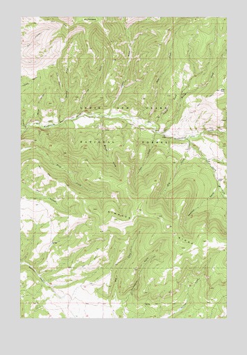
Bald Hills, MT USGS Topographic Map
Click on map above to begin viewing in our Map Viewer.

This topographic map contains these locations and features:
Feature Name Type Latitude Longitude GNIS ID View Map
Bald HillsSummitN46.9697°W111.1300°779282View Map
Barrel CouleeValleyN46.9563°W111.2391°779378View Map
Bear CreekStreamN46.9558°W111.1738°779485View Map
Coyote CreekStreamN46.9550°W111.1719°781813View Map
Daisy CreekStreamN46.9513°W111.1658°782047View Map
Daisy SpringSpringN46.9959°W111.1251°782058View Map
Deadman GulchValleyN46.9302°W111.1308°782155View Map
Double GulchValleyN46.9558°W111.2275°782499View Map
Ducolon-Potter MineMineN46.9491°W111.1486°804697View Map
Lion GulchValleyN46.9594°W111.2166°786195View Map
Lobley GulchValleyN46.9600°W111.1972°786407View Map
Miners CreekStreamN46.9586°W111.2013°787468View Map
Mongar CreekStreamN46.9480°W111.1483°785713View Map
NW NW Section 26 MineMineN46.9533°W111.1994°804682View Map
Old BaldySummitN46.9986°W111.2108°788402View Map
Post CreekStreamN46.9522°W111.1691°789127View Map
Rimrock RidgeRidgeN46.9052°W111.1425°789595View Map
South Fork Tenderfoot CreekStreamN46.9500°W111.1508°791068View Map
Strawberry GulchValleyN46.8780°W111.1941°791593View Map
Zehntner RanchLocaleN46.9325°W111.1308°793630View Map

Note: Coordinates in the location and feature list above are referenced to NAD83 datum.


Copyright (C) 2008-2025 Ryan Niemi / Sunset Dynamics ... All Rights Reserved