TopoQuest Logo
Do you find TopoQuest useful?
Help keep TopoQuest running and adding new maps/features by donating!
Bitcoin:  19c7KJd3qBynnjoSw5npx9KScwjBe4ifkT
Litecoin:  LXs6TkuXGGXo1vDsWCkWVdjQX94eUKd6ui
Home View Maps Find Maps Find Places Resources & Links


Jackson, Kentucky Topographic Map

USGS Map Title: Jackson, KY
USGS Map MRC: 37083E4
DRG (GeoTIFF) Download: o37083e4.tif


Neighboring USGS Topographic Map Quads:


  Campton, KY  
37083F5
 

  Landsaw, KY  
37083F4
 

  Lee City, KY  
37083F3
 

  Tallega, KY  
37083E5
 

  Jackson, KY  
37083E4
 

  Quicksand, KY  
37083E3
 

  Cowcreek, KY  
37083D5
 

  Canoe, KY  
37083D4
 

  Haddix, KY  
37083D3


Map MRC Location:

N38°
W84°
N38°
W83°
H8 H7 H6 H5 H4 H3 H2 H1
G8 G7 G6 G5 G4 G3 G2 G1
F8 F7 F6 F5 F4 F3 F2 F1
E8 E7 E6 E5 E4 E3 E2 E1
D8 D7 D6 D5 D4 D3 D2 D1
C8 C7 C6 C5 C4 C3 C2 C1
B8 B7 B6 B5 B4 B3 B2 B1
A8 A7 A6 A5 A4 A3 A2 A1
N37°
W84°
N37°
W83°

Jackson, KY USGS 1:24K Topographic Map Preview:
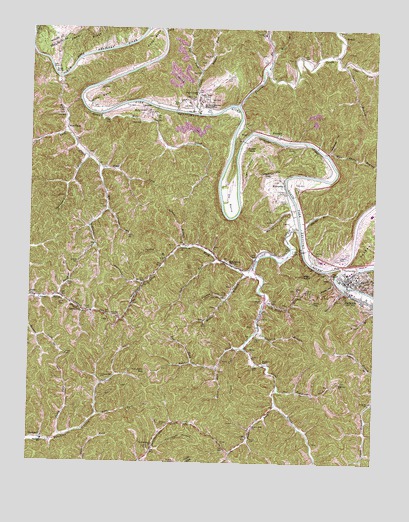
Jackson, KY USGS Topographic Map
Click on map above to begin viewing in our Map Viewer.

This topographic map contains these locations and features:
Feature Name Type Latitude Longitude GNIS ID View Map
Bailey HollowValleyN37.5527°W83.3897°486228View Map
Bear ForkStreamN37.5140°W83.4749°486562View Map
Belcher ForkStreamN37.5331°W83.4213°486779View Map
Big Bridge BranchStreamN37.5506°W83.3799°487144View Map
Big Rock SchoolSchoolN37.5287°W83.4146°487234View Map
Blanche Haddix ChurchChurchN37.6065°W83.4396°487449View Map
Boone ForkStreamN37.6129°W83.4143°487691View Map
Breathitt County Sheriff's OfficeBuildingN37.5536°W83.3840°2767521View Map
Cane CreekStreamN37.5676°W83.4024°511190View Map
Cane Creek ChurchChurchN37.5623°W83.4455°488775View Map
Caney ForkStreamN37.5331°W83.4238°488853View Map
Cedar BendBendN37.6215°W83.4557°489162View Map
Cedar CreekStreamN37.6243°W83.4516°489180View Map
Chaney CemeteryCemeteryN37.5781°W83.4080°489330View Map
ChenoweePopulated PlaceN37.5434°W83.4805°507692View Map
Chenowee TunnelTunnelN37.5420°W83.4693°489389View Map
Chestnut GapGapN37.5831°W83.4163°489431View Map
City of JacksonCivilN37.5590°W83.3783°2404776View Map
Colts ForkStreamN37.5590°W83.4321°489884View Map
Combs CemeteryCemeteryN37.5006°W83.4463°489904View Map
Combs CemeteryCemeteryN37.5048°W83.4555°489905View Map
Cope ForkStreamN37.6168°W83.3893°490072View Map
Cripple CreekStreamN37.5509°W83.3852°490346View Map
Cy BendBendN37.5756°W83.4277°490515View Map
Day CemeteryCemeteryN37.6109°W83.4271°490701View Map
Deaton CemeteryCemeteryN37.5579°W83.4824°490744View Map
ElkatawaPopulated PlaceN37.5570°W83.4268°491681View Map
Eye ForkStreamN37.5290°W83.4402°491866View Map
FivemilePopulated PlaceN37.5943°W83.4099°508002View Map
Fivemile ChurchChurchN37.5904°W83.4041°492156View Map
Flat HollowValleyN37.5780°W83.4240°492194View Map
Frozen CreekPopulated PlaceN37.5912°W83.4218°508046View Map
Frozen CreekStreamN37.6031°W83.4246°492582View Map
Gabbard Flat CemeteryCemeteryN37.5237°W83.4735°492637View Map
Granny BranchStreamN37.5473°W83.4280°493108View Map
Griffith BranchStreamN37.5376°W83.4168°493386View Map
Gross ForkStreamN37.5726°W83.4716°493421View Map
GuerrantPopulated PlaceN37.5068°W83.4971°508144View Map
Haddix ForkStreamN37.5170°W83.4099°512497View Map
Haddix Fork ChurchChurchN37.5109°W83.4174°493529View Map
Hagins CemeteryCemeteryN37.5595°W83.3874°493543View Map
Hayes CemeteryCemeteryN37.5754°W83.4068°493908View Map
Helton CemeteryCemeteryN37.5490°W83.3982°494013View Map
High KnobSummitN37.5543°W83.4007°494184View Map
High Top ChurchChurchN37.5234°W83.3871°494193View Map
Highland SchoolSchoolN37.5065°W83.4946°494220View Map
Holly CreekStreamN37.6226°W83.4996°494406View Map
Hollybush HollowValleyN37.5041°W83.4544°494425View Map
Hurricane BranchStreamN37.5512°W83.4588°494807View Map
JacksonPopulated PlaceN37.5531°W83.3835°495097View Map
Jackson CemeteryCemeteryN37.5592°W83.3966°495111View Map
Jackson DivisionCivilN37.5679°W83.3860°1937076View Map
Jackson Fire DepartmentBuildingN37.5587°W83.3870°2636714View Map
Jackson Police DepartmentBuildingN37.5532°W83.3862°2767491View Map
Jerry ForkStreamN37.5076°W83.4877°495236View Map
Kentucky Mountain Bible InstituteSchoolN37.6034°W83.4382°495675View Map
Kings Branch CemeteryCemeteryN37.5445°W83.3752°495756View Map
LawsonPopulated PlaceN37.6020°W83.4585°508430View Map
Left Fork White Oak CreekStreamN37.6126°W83.4382°496270View Map
Lindon BranchStreamN37.5623°W83.4435°496569View Map
Lindon ForkStreamN37.5543°W83.4218°496570View Map
Little CemeteryCemeteryN37.5462°W83.4880°496665View Map
Little CemeteryCemeteryN37.5467°W83.4124°496666View Map
Mill BranchStreamN37.6179°W83.4127°498209View Map
Mill CreekStreamN37.6001°W83.4744°498247View Map
Miller BendBendN37.6048°W83.4752°498307View Map
Miller BranchStreamN37.5559°W83.4180°498313View Map
Miller CemeteryCemeteryN37.5481°W83.4288°498328View Map
Miller CemeteryCemeteryN37.5515°W83.4863°498329View Map
Mount Carmel SchoolSchoolN37.6012°W83.4574°498715View Map
O and K TunnelTunnelN37.5618°W83.4024°499640View Map
Oakdale CemeteryCemeteryN37.5484°W83.4999°499729View Map
Oakdale DivisionCivilN37.5483°W83.4953°1937179View Map
Panbowl LakeReservoirN37.5744°W83.3764°500145View Map
PanhandlePopulated PlaceN37.5568°W83.3832°508773View Map
Pasture BranchStreamN37.5476°W83.4894°500230View Map
Puncheon GapGapN37.5259°W83.4566°501451View Map
Right Fork White Oak CreekStreamN37.6126°W83.4385°501940View Map
Road ForkStreamN37.5848°W83.4735°502017View Map
Robinson ForkStreamN37.5231°W83.4096°502093View Map
Rose BendBendN37.6118°W83.4905°502314View Map
Rose CemeteryCemeteryN37.6137°W83.4905°502321View Map
Salyor CemeteryCemeteryN37.5070°W83.4188°502869View Map
Shacks BranchStreamN37.5676°W83.4016°503204View Map
Shoulderblade ChurchChurchN37.5054°W83.4541°503461View Map
Spencer CemeteryCemeteryN37.5106°W83.4516°504055View Map
Spicer ChurchChurchN37.5498°W83.4035°504066View Map
Spicewood ForkStreamN37.5873°W83.4791°504073View Map
Spring BranchStreamN37.6009°W83.4410°504109View Map
Stillhouse HollowValleyN37.5899°W83.3911°504423View Map
Stray Branch SchoolSchoolN37.5173°W83.3763°504579View Map
Talent CemeteryCemeteryN37.5365°W83.4171°504922View Map
The CutoffAreaN37.5554°W83.3880°505116View Map
Town BranchStreamN37.5465°W83.4143°505378View Map
Trace ForkStreamN37.5948°W83.4877°505443View Map
Trent CemeteryCemeteryN37.6004°W83.4880°505485View Map
Turkey BranchStreamN37.5587°W83.4505°505581View Map
Turner CemeteryCemeteryN37.5312°W83.4868°505658View Map
Turner CemeteryCemeteryN37.5442°W83.4774°505659View Map
Tyra BranchStreamN37.6145°W83.3871°505743View Map
Vancleve SchoolSchoolN37.6234°W83.4155°505974View Map
Vancleve Volunteer Fire DepartmentBuildingN37.5974°W83.4229°2637225View Map
Vires ForkStreamN37.5276°W83.4316°506065View Map
War CreekStreamN37.6106°W83.4891°506209View Map
War CreekPopulated PlaceN37.5965°W83.4866°509316View Map
War Shoal BranchStreamN37.5890°W83.3927°506211View Map
WEKG-AM (Jackson)TowerN37.5781°W83.4052°517614View Map
White Oak CemeteryCemeteryN37.6045°W83.4410°506600View Map
White Oak CreekStreamN37.6006°W83.4396°506614View Map
WJSN-FM (Jackson)TowerN37.5462°W83.3949°517706View Map
WMTC-AM (Vancleve)TowerN37.6034°W83.4441°517668View Map
WMTC-FM (Vancleve)TowerN37.6065°W83.4466°517744View Map
WolverinePopulated PlaceN37.5809°W83.4082°509398View Map
Wolverine HollowValleyN37.5729°W83.4053°507075View Map

Note: Coordinates in the location and feature list above are referenced to NAD83 datum.


Copyright (C) 2008-2024 Ryan Niemi / Sunset Dynamics ... All Rights Reserved