TopoQuest Logo
Do you find TopoQuest useful?
Help keep TopoQuest running and adding new maps/features by donating!
Bitcoin:  19c7KJd3qBynnjoSw5npx9KScwjBe4ifkT
Litecoin:  LXs6TkuXGGXo1vDsWCkWVdjQX94eUKd6ui
Home View Maps Find Maps Find Places Resources & Links


Jacksonport, Arkansas Topographic Map

USGS Map Title: Jacksonport, AR
USGS Map MRC: 35091F3
DRG (GeoTIFF) Download: o35091f3.tif


Neighboring USGS Topographic Map Quads:


  Charlotte, AR  
35091G4
 

  Cord, AR  
35091G3
 

  Swifton West, AR  
35091G2
 

  Newark, AR  
35091F4
 

  Jacksonport, AR  
35091F3
 

  Tuckerman, AR  
35091F2
 

  Olyphant, AR  
35091E4
 

  Newport, AR  
35091E3
 

  Auvergne, AR  
35091E2


Map MRC Location:

N36°
W92°
N36°
W91°
H8 H7 H6 H5 H4 H3 H2 H1
G8 G7 G6 G5 G4 G3 G2 G1
F8 F7 F6 F5 F4 F3 F2 F1
E8 E7 E6 E5 E4 E3 E2 E1
D8 D7 D6 D5 D4 D3 D2 D1
C8 C7 C6 C5 C4 C3 C2 C1
B8 B7 B6 B5 B4 B3 B2 B1
A8 A7 A6 A5 A4 A3 A2 A1
N35°
W92°
N35°
W91°

Jacksonport, AR USGS 1:24K Topographic Map Preview:
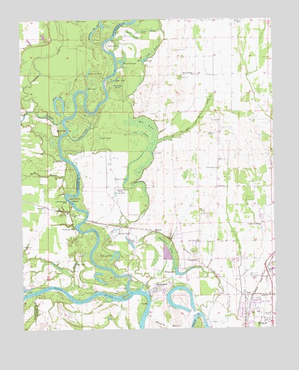
Jacksonport, AR USGS Topographic Map
Click on map above to begin viewing in our Map Viewer.

This topographic map contains these locations and features:
Feature Name Type Latitude Longitude GNIS ID View Map
Air BrakeSwampN35.7042°W91.3154°45798View Map
Arkansas State Police Troop BBuildingN35.6390°W91.2514°2118577View Map
Bell LakeLakeN35.7339°W91.3133°74651View Map
Bell Lake BrakeSwampN35.7306°W91.3132°46355View Map
Bergen LakeLakeN35.6471°W91.2975°74655View Map
Berkley BluffCliffN35.6934°W91.3568°46400View Map
Bethel ChurchChurchN35.6379°W91.2571°46457View Map
Black IslandIslandN35.6379°W91.3240°46670View Map
Black RiverStreamN35.6401°W91.3218°66965View Map
Brush LakeLakeN35.7396°W91.3263°74703View Map
Brushy BrakeSwampN35.6624°W91.3305°47052View Map
Burgess CemeteryCemeteryN35.7034°W91.2818°47192View Map
Bush BrakeSwampN35.7439°W91.3191°47228View Map
Carter CreekStreamN35.7134°W91.3685°47496View Map
Cheshire CemeteryCemeteryN35.7378°W91.2987°47730View Map
City of Campbell StationCivilN35.6678°W91.2538°2403981View Map
City of DiazCivilN35.6476°W91.2619°2404225View Map
Cole CemeteryCemeteryN35.7340°W91.2515°47914View Map
Dead Mule BendBendN35.6776°W91.3490°48422View Map
Devils ElbowBendN35.6842°W91.3162°48488View Map
DiazPopulated PlaceN35.6384°W91.2651°76792View Map
Diaz Baptist ChurchChurchN35.6398°W91.2657°63146View Map
Diaz City HallBuildingN35.6376°W91.2654°61811View Map
Diaz Police DepartmentBuildingN35.6374°W91.2656°2118574View Map
Diaz Post OfficePost OfficeN35.6371°W91.2649°84033View Map
Diaz Volunteer Fire DepartmentBuildingN35.6372°W91.2656°2116363View Map
Dota CreekStreamN35.7092°W91.3546°76812View Map
Dota Old RiverLakeN35.7122°W91.3560°74799View Map
Dunahay BrakeSwampN35.7196°W91.3261°48698View Map
Eagle LakeLakeN35.7256°W91.3283°74810View Map
Elgin Landmark ChurchChurchN35.7279°W91.2896°48845View Map
Fish LakeLakeN35.7224°W91.3419°74832View Map
FitzgeraldPopulated PlaceN35.6526°W91.2887°57754View Map
Gamble LakeLakeN35.6599°W91.3217°74843View Map
Goose PondLakeN35.6799°W91.3288°74856View Map
Heinmann BrakeSwampN35.6579°W91.3027°49991View Map
Hickory Grove CemeteryCemeteryN35.6892°W91.2787°1900756View Map
Hickory Grove ChurchChurchN35.6895°W91.2779°50068View Map
Hickory Grove School (historical)SchoolN35.6895°W91.2779°63148View Map
Holloway CemeteryCemeteryN35.7092°W91.2762°50207View Map
Hope ChurchChurchN35.7495°W91.2668°50295View Map
Horseshoe LakeLakeN35.6556°W91.3294°74914View Map
Horseshoe LakeLakeN35.7330°W91.3244°74915View Map
Hout DitchCanalN35.7301°W91.2576°50358View Map
Howard LakeLakeN35.6854°W91.3232°74918View Map
Howard MoundSummitN35.6812°W91.3243°57951View Map
Jack CreekStreamN35.6504°W91.3337°50538View Map
JacksonportPopulated PlaceN35.6417°W91.3096°77360View Map
Jacksonport Post OfficePost OfficeN35.6420°W91.3093°2781867View Map
Jacksonport State ParkParkN35.6390°W91.3112°61821View Map
Jacksonport Volunteer Fire StationBuildingN35.6391°W91.3092°2116624View Map
Jonah LakeLakeN35.6961°W91.3105°74933View Map
Little Cow PondLakeN35.7287°W91.3412°74954View Map
Little Paroquet BluffCliffN35.6770°W91.3521°51306View Map
Long LakeLakeN35.6517°W91.3489°74992View Map
M R BranchStreamN35.6801°W91.3518°51532View Map
Mason BendBendN35.6281°W91.3037°51728View Map
Mercy Seat CemeteryCemeteryN35.6606°W91.2879°51916View Map
Moss BrakeSwampN35.6771°W91.3129°52236View Map
Moss CemeteryCemeteryN35.7120°W91.3082°52239View Map
Otter LakeLakeN35.7023°W91.3459°75063View Map
ParoquetPopulated PlaceN35.6745°W91.3637°57152View Map
Paroquet BluffCliffN35.6656°W91.3485°53200View Map
Point FerryLocaleN35.6415°W91.3240°53643View Map
Pullum BendBendN35.6890°W91.3476°59274View Map
Ray BrakeSwampN35.7456°W91.3110°53918View Map
ReameyPopulated PlaceN35.6645°W91.3093°58467View Map
Roberts-Penix CemeteryCemeteryN35.6823°W91.2779°53269View Map
Robinson CemeteryCemeteryN35.6615°W91.3021°54076View Map
Salem CemeteryCemeteryN35.7262°W91.2960°54491View Map
Scott CemeteryCemeteryN35.6642°W91.3107°54640View Map
Shiloh CemeteryCemeteryN35.6379°W91.2593°61832View Map
Surrounded HillSummitN35.7048°W91.3576°58717View Map
Town of JacksonportCivilN35.6418°W91.3080°2405901View Map
Township of JeffersonCivilN35.6822°W91.2813°66727View Map
Township of Logan (historical)CivilN35.7376°W91.3696°68771View Map
Tupelo BrakeSwampN35.7012°W91.3376°55702View Map
Whisnant Old RiverStreamN35.7404°W91.3379°56238View Map
White ChurchChurchN35.6590°W91.3737°56250View Map

Note: Coordinates in the location and feature list above are referenced to NAD83 datum.


Copyright (C) 2008-2025 Ryan Niemi / Sunset Dynamics ... All Rights Reserved