TopoQuest Logo
Do you find TopoQuest useful?
Help keep TopoQuest running and adding new maps/features by donating!
Bitcoin:  19c7KJd3qBynnjoSw5npx9KScwjBe4ifkT
Litecoin:  LXs6TkuXGGXo1vDsWCkWVdjQX94eUKd6ui
Home View Maps Find Maps Find Places Resources & Links


Tuckerman, Arkansas Topographic Map

USGS Map Title: Tuckerman, AR
USGS Map MRC: 35091F2
DRG (GeoTIFF) Download: o35091f2.tif


Neighboring USGS Topographic Map Quads:


  Cord, AR  
35091G3
 

  Swifton West, AR  
35091G2
 

  Swifton East, AR  
35091G1
 

  Jacksonport, AR  
35091F3
 

  Tuckerman, AR  
35091F2
 

  Grubbs, AR  
35091F1
 

  Newport, AR  
35091E3
 

  Auvergne, AR  
35091E2
 

  Amagon, AR  
35091E1


Map MRC Location:

N36°
W92°
N36°
W91°
H8 H7 H6 H5 H4 H3 H2 H1
G8 G7 G6 G5 G4 G3 G2 G1
F8 F7 F6 F5 F4 F3 F2 F1
E8 E7 E6 E5 E4 E3 E2 E1
D8 D7 D6 D5 D4 D3 D2 D1
C8 C7 C6 C5 C4 C3 C2 C1
B8 B7 B6 B5 B4 B3 B2 B1
A8 A7 A6 A5 A4 A3 A2 A1
N35°
W92°
N35°
W91°

Tuckerman, AR USGS 1:24K Topographic Map Preview:
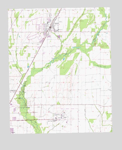
Tuckerman, AR USGS Topographic Map
Click on map above to begin viewing in our Map Viewer.

This topographic map contains these locations and features:
Feature Name Type Latitude Longitude GNIS ID View Map
Airport Industrial ParkLocaleN35.6412°W91.1901°61806View Map
Airport VillagePopulated PlaceN35.6379°W91.1951°57251View Map
Amith AdditionPopulated PlaceN35.7112°W91.2126°66353View Map
Arkansas Department of Corrections McPherson UnitBuildingN35.6260°W91.1914°2733390View Map
Arkansas State University - NewportSchoolN35.6399°W91.1889°2547517View Map
Arkansas State University Police Department NewportBuildingN35.6385°W91.1887°2118579View Map
Cage DitchCanalN35.6792°W91.1937°47271View Map
Campbell DitchCanalN35.6973°W91.2399°47348View Map
Campbell LakeLakeN35.6609°W91.2371°76512View Map
Campbell StationPopulated PlaceN35.6684°W91.2448°57497View Map
Campbell Station Baptist ChurchChurchN35.6667°W91.2451°63145View Map
Church of ChristChurchN35.7120°W91.2135°66351View Map
Church of ChristChurchN35.7270°W91.2023°66352View Map
City of TuckermanCivilN35.7238°W91.2024°2405609View Map
Eastside SchoolSchoolN35.7287°W91.1868°48790View Map
Gracelawn CemeteryCemeteryN35.7151°W91.2135°49533View Map
Greenhaw CemeteryCemeteryN35.6715°W91.2073°49655View Map
Greenhaw CemeteryCemeteryN35.6762°W91.2040°49656View Map
Greenhaw ChurchChurchN35.6687°W91.2104°49657View Map
Guthrie LakeLakeN35.7231°W91.1407°77097View Map
Harper-Barnes CemeteryCemeteryN35.6317°W91.1857°46102View Map
Harrison CemeteryCemeteryN35.7106°W91.2357°49908View Map
Hatchet DitchCanalN35.7312°W91.2451°49935View Map
Hurricane ChurchChurchN35.6673°W91.1262°50436View Map
Lawrence CemeteryCemeteryN35.7123°W91.2315°51005View Map
Layton LakeLakeN35.7106°W91.1643°77278View Map
Little Mott LakeLakeN35.6670°W91.2340°77282View Map
Mott LakeLakeN35.6731°W91.2323°77292View Map
New Hope ChurchChurchN35.7017°W91.2182°52692View Map
Newport Army Airfield (historical)MilitaryN35.6397°W91.1847°1988508View Map
Newport Municipal AirportAirportN35.6405°W91.1777°83795View Map
Parrott CemeteryCemeteryN35.7126°W91.1957°53201View Map
Parrott LakeLakeN35.6992°W91.1937°77302View Map
Pompeys DitchCanalN35.7337°W91.2318°53672View Map
Post Oak CemeteryCemeteryN35.6529°W91.1962°53717View Map
Prysock CemeteryCemeteryN35.7373°W91.1610°53836View Map
Stennick CemeteryCemeteryN35.6326°W91.2379°55201View Map
Swan Pond DitchCanalN35.7373°W91.1643°45765View Map
Toms CreekStreamN35.6292°W91.1257°55603View Map
Township of VillageCivilN35.6484°W91.1809°66730View Map
TuckermanPopulated PlaceN35.7306°W91.1985°55689View Map
Tuckerman Elementary SchoolSchoolN35.7348°W91.2017°61837View Map
Tuckerman High SchoolSchoolN35.7362°W91.2003°61838View Map
Tuckerman Industrial ParkLocaleN35.7134°W91.2173°66354View Map
Tuckerman Landing Strip (historical)AirportN35.7370°W91.1885°66355View Map
Tuckerman Police DepartmentBuildingN35.7270°W91.2032°2118578View Map
Tuckerman Post OfficePost OfficeN35.7320°W91.1977°84379View Map
Tuckerman United Methodist ChurchChurchN35.7317°W91.1985°66356View Map
Tuckerman Volunteer Fire DepartmentBuildingN35.7313°W91.2006°2117225View Map
Tuckerman Volunteer Fire Department AmbulanceBuildingN35.7314°W91.2006°2119153View Map
Tupelo BrakeSwampN35.6900°W91.1311°55703View Map
White Rover Vocational Technical SchoolSchoolN35.6384°W91.1890°61842View Map
Williamson CemeteryCemeteryN35.6801°W91.2440°56405View Map

Note: Coordinates in the location and feature list above are referenced to NAD83 datum.


Copyright (C) 2008-2025 Ryan Niemi / Sunset Dynamics ... All Rights Reserved