TopoQuest Logo
Do you find TopoQuest useful?
Help keep TopoQuest running and adding new maps/features by donating!
Bitcoin:  19c7KJd3qBynnjoSw5npx9KScwjBe4ifkT
Litecoin:  LXs6TkuXGGXo1vDsWCkWVdjQX94eUKd6ui
Home View Maps Find Maps Find Places Resources & Links


Baldwin, Iowa Topographic Map

USGS Map Title: Baldwin, IA
USGS Map MRC: 42090A7
DRG (GeoTIFF) Download: o42090a7.tif


Neighboring USGS Topographic Map Quads:


  Canton, IA  
42090B8
 

  Leisure Lake, IA  
42090B7
 

  Fulton, IA  
42090B6
 

  Wyoming East, IA  
42090A8
 

  Baldwin, IA  
42090A7
 

  Maquoketa, IA  
42090A6
 

  Oxford Junction, IA  
41090H8
 

  Lost Nation, IA  
41090H7
 

  Elwood, IA  
41090H6


Map MRC Location:

N43°
W91°
N43°
W90°
H8 H7 H6 H5 H4 H3 H2 H1
G8 G7 G6 G5 G4 G3 G2 G1
F8 F7 F6 F5 F4 F3 F2 F1
E8 E7 E6 E5 E4 E3 E2 E1
D8 D7 D6 D5 D4 D3 D2 D1
C8 C7 C6 C5 C4 C3 C2 C1
B8 B7 B6 B5 B4 B3 B2 B1
A8 A7 A6 A5 A4 A3 A2 A1
N42°
W91°
N42°
W90°

Baldwin, IA USGS 1:24K Topographic Map Preview:
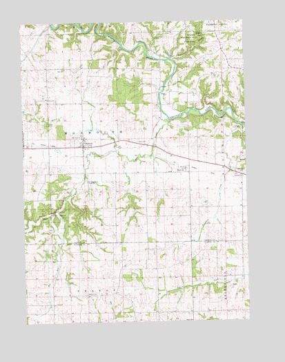
Baldwin, IA USGS Topographic Map
Click on map above to begin viewing in our Map Viewer.

This topographic map contains these locations and features:
Feature Name Type Latitude Longitude GNIS ID View Map
BaldwinPopulated PlaceN42.0742°W90.8415°454330View Map
Baldwin (historical)LocaleN42.0728°W90.8407°2001006View Map
Baldwin Catholic CemeteryCemeteryN42.0775°W90.8418°2001074View Map
Baldwin Monmouth Methodist ChurchChurchN42.0742°W90.8407°2001002View Map
Baldwin Post OfficePost OfficeN42.0742°W90.8407°2001004View Map
Baldwin Volunteer Fire DepartmentBuildingN42.0729°W90.8402°2001003View Map
Bear CreekStreamN42.0850°W90.7935°454418View Map
Beers CreekStreamN42.0714°W90.8218°454486View Map
BuckhornPopulated PlaceN42.0600°W90.7532°464477View Map
BurgessLocaleN42.0036°W90.8618°465528View Map
Burgess Post Office (historical)Post OfficeN42.0036°W90.8618°2000654View Map
City of BaldwinCivilN42.0732°W90.8385°2394054View Map
Dickman CemeteryCemeteryN42.0120°W90.8402°455915View Map
Eden Valley County RefugeParkN42.0456°W90.8568°456234View Map
Eden Valley Nature CentureBuildingN42.0459°W90.8599°2001005View Map
Foley Farm CemeteryCemeteryN42.0556°W90.8501°2001072View Map
Hershberger CemeteryCemeteryN42.0833°W90.8501°2001073View Map
Hershberger CemeteryCemeteryN42.0772°W90.8418°1958062View Map
Holy Trinity ChurchChurchN42.0772°W90.8421°1825079View Map
Joinerville County ParkParkN42.0806°W90.7524°1825080View Map
Lost Nation Public Hunting AreaParkN42.0070°W90.8418°2000622View Map
Maquoketa Caves Natural BridgeArchN42.1172°W90.7810°1679007View Map
Maquoketa Caves State ParkParkN42.1175°W90.7807°458790View Map
Mill Rock School County ParkParkN42.0586°W90.8393°1825078View Map
MillrockPopulated PlaceN42.0550°W90.8393°464197View Map
NashvillePopulated PlaceN42.0625°W90.7838°459438View Map
Nashville (historical)LocaleN42.0625°W90.7838°2000905View Map
Nashville Post Office (historical)Post OfficeN42.0625°W90.7838°2000904View Map
Pence CemeteryCemeteryN42.0751°W90.8103°460067View Map
Raccoon CreekStreamN42.1092°W90.7912°460493View Map
Rat RunStreamN42.0378°W90.8543°460530View Map
Reel CemeteryCemeteryN42.1050°W90.8508°460576View Map
Township of MonmouthCivilN42.0769°W90.8401°468389View Map
Waterford CemeteryCemeteryN42.0611°W90.7521°462726View Map
Waterford Post Office (historical)Post OfficeN42.0639°W90.7585°2000903View Map

Note: Coordinates in the location and feature list above are referenced to NAD83 datum.


Copyright (C) 2008-2025 Ryan Niemi / Sunset Dynamics ... All Rights Reserved