TopoQuest Logo
Do you find TopoQuest useful?
Help keep TopoQuest running and adding new maps/features by donating!
Bitcoin:  19c7KJd3qBynnjoSw5npx9KScwjBe4ifkT
Litecoin:  LXs6TkuXGGXo1vDsWCkWVdjQX94eUKd6ui
Home View Maps Find Maps Find Places Resources & Links


Fulton, Iowa Topographic Map

USGS Map Title: Fulton, IA
USGS Map MRC: 42090B6
DRG (GeoTIFF) Download: o42090b6.tif


Neighboring USGS Topographic Map Quads:


  Bernard, IA  
42090C7
 

  Zwingle, IA  
42090C6
 

  La Motte, IA  
42090C5
 

  Leisure Lake, IA  
42090B7
 

  Fulton, IA  
42090B6
 

  Andrew, IA  
42090B5
 

  Baldwin, IA  
42090A7
 

  Maquoketa, IA  
42090A6
 

  Delmar North, IA  
42090A5


Map MRC Location:

N43°
W91°
N43°
W90°
H8 H7 H6 H5 H4 H3 H2 H1
G8 G7 G6 G5 G4 G3 G2 G1
F8 F7 F6 F5 F4 F3 F2 F1
E8 E7 E6 E5 E4 E3 E2 E1
D8 D7 D6 D5 D4 D3 D2 D1
C8 C7 C6 C5 C4 C3 C2 C1
B8 B7 B6 B5 B4 B3 B2 B1
A8 A7 A6 A5 A4 A3 A2 A1
N42°
W91°
N42°
W90°

Fulton, IA USGS 1:24K Topographic Map Preview:
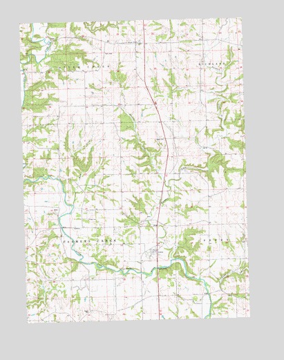
Fulton, IA USGS Topographic Map
Click on map above to begin viewing in our Map Viewer.

This topographic map contains these locations and features:
Feature Name Type Latitude Longitude GNIS ID View Map
Beedle Farm CemeteryCemeteryN42.1833°W90.7168°2001057View Map
Beedle Farm CemeteryCemeteryN42.1739°W90.6812°1957777View Map
Buck CreekStreamN42.1736°W90.7224°454917View Map
Cedar CreekStreamN42.1392°W90.6496°455231View Map
East Iron HillsPopulated PlaceN42.1431°W90.7376°465358View Map
Esgate CemeteryCemeteryN42.1294°W90.7150°456390View Map
Farmers CreekStreamN42.1500°W90.6668°456548View Map
Farmers CreekLocaleN42.1961°W90.6954°466155View Map
FultonPopulated PlaceN42.1536°W90.6782°456803View Map
Fulton Post Office (historical)Post OfficeN42.1536°W90.6782°2000896View Map
Iron Hill QuarryMineN42.1708°W90.7344°2571513View Map
New Castle Post Office (historical)Post OfficeN42.1570°W90.6960°2000894View Map
Otter CreekPopulated PlaceN42.2406°W90.6826°464688View Map
Ottercreek Post Office (historical)Post OfficeN42.2406°W90.6826°2000895View Map
Saint Lawrence CemeteryCemeteryN42.2414°W90.6959°461141View Map
Saint Lawrence ChurchChurchN42.2408°W90.6957°461142View Map
Sutton CemeteryCemeteryN42.1677°W90.7145°462127View Map
Sweezy CemeteryCemeteryN42.2003°W90.6705°462152View Map
Tarecoat CreekStreamN42.1808°W90.6682°462180View Map
Township of Farmers CreekCivilN42.1641°W90.7233°467823View Map

Note: Coordinates in the location and feature list above are referenced to NAD83 datum.


Copyright (C) 2008-2025 Ryan Niemi / Sunset Dynamics ... All Rights Reserved