TopoQuest Logo
Do you find TopoQuest useful?
Help keep TopoQuest running and adding new maps/features by donating!
Bitcoin:  19c7KJd3qBynnjoSw5npx9KScwjBe4ifkT
Litecoin:  LXs6TkuXGGXo1vDsWCkWVdjQX94eUKd6ui
Home View Maps Find Maps Find Places Resources & Links


Leisure Lake, Iowa Topographic Map

USGS Map Title: Leisure Lake, IA
USGS Map MRC: 42090B7
DRG (GeoTIFF) Download: o42090b7.tif


Neighboring USGS Topographic Map Quads:


  Fillmore, IA  
42090C8
 

  Bernard, IA  
42090C7
 

  Zwingle, IA  
42090C6
 

  Canton, IA  
42090B8
 

  Leisure Lake, IA  
42090B7
 

  Fulton, IA  
42090B6
 

  Wyoming East, IA  
42090A8
 

  Baldwin, IA  
42090A7
 

  Maquoketa, IA  
42090A6


Map MRC Location:

N43°
W91°
N43°
W90°
H8 H7 H6 H5 H4 H3 H2 H1
G8 G7 G6 G5 G4 G3 G2 G1
F8 F7 F6 F5 F4 F3 F2 F1
E8 E7 E6 E5 E4 E3 E2 E1
D8 D7 D6 D5 D4 D3 D2 D1
C8 C7 C6 C5 C4 C3 C2 C1
B8 B7 B6 B5 B4 B3 B2 B1
A8 A7 A6 A5 A4 A3 A2 A1
N42°
W91°
N42°
W90°

Leisure Lake, IA USGS 1:24K Topographic Map Preview:
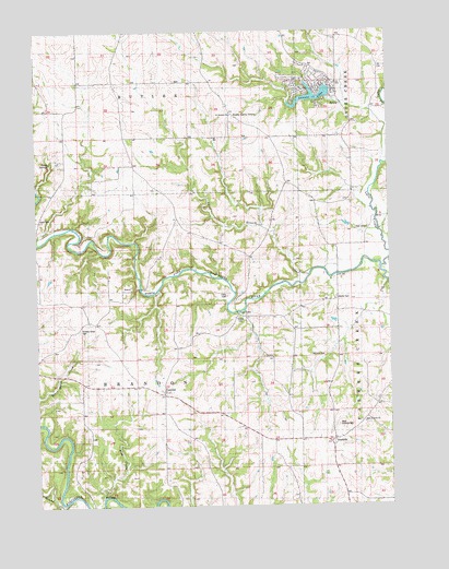
Leisure Lake, IA USGS Topographic Map
Click on map above to begin viewing in our Map Viewer.

This topographic map contains these locations and features:
Feature Name Type Latitude Longitude GNIS ID View Map
Alma Post Office (historical)Post OfficeN42.2333°W90.8474°2000882View Map
Buzzard Ridge Wildlife AreaParkN42.1458°W90.8724°2000869View Map
Cline BranchStreamN42.1856°W90.7779°455478View Map
Crab TownPopulated PlaceN42.1733°W90.8060°464510View Map
Crabb CemeteryCemeteryN42.1750°W90.8024°455691View Map
Crabb Post Office (historical)Post OfficeN42.1756°W90.8032°2000885View Map
Crabb's Mills Post Office (historical)Post OfficeN42.1756°W90.8029°2000884View Map
Duggan Post Office (historical)Post OfficeN42.2278°W90.8057°2000886View Map
East Iron Hill CemeteryCemeteryN42.1466°W90.7590°1957878View Map
East Ironhills ChurchChurchN42.1464°W90.7590°456162View Map
EmelinePopulated PlaceN42.1553°W90.8307°456359View Map
Emeline Post Office (historical)Post OfficeN42.1553°W90.8307°2000887View Map
English CemeteryCemeteryN42.1472°W90.8668°2001718View Map
Griffin Estate CemeteryCemeteryN42.1333°W90.8724°2001717View Map
Hickory Grove CemeteryCemeteryN42.1715°W90.8600°457436View Map
Iron Hills Post Office (historical)Post OfficeN42.1417°W90.7699°2000883View Map
IronhillsPopulated PlaceN42.1417°W90.7699°457852View Map
Leisure LakeReservoirN42.2328°W90.7766°458283View Map
Lytle CreekStreamN42.1875°W90.7521°458703View Map
Mineral CreekStreamN42.1270°W90.8682°459126View Map
North Spring BranchStreamN42.2317°W90.7643°459633View Map
Ozark (historical)Populated PlaceN42.1575°W90.8743°465430View Map
Ozark CemeteryCemeteryN42.1997°W90.8732°459981View Map
Ozark Post Office (historical)Post OfficeN42.1575°W90.8743°2000888View Map
Ozark SpringsSpringN42.2150°W90.8690°459982View Map
Ozark Wildlife AreaParkN42.1917°W90.8599°2000870View Map
Pine CreekStreamN42.1275°W90.8521°460160View Map
Said CemeteryCemeteryN42.1980°W90.7578°460915View Map
Saint Aloysius CemeteryCemeteryN42.2258°W90.8054°460919View Map
Saint Aloysius ChurchChurchN42.2281°W90.8051°460920View Map
Schwenker Lake DamDamN42.2495°W90.7710°463449View Map
South Garry OwenPopulated PlaceN42.2306°W90.8071°461786View Map
South Spring BranchStreamN42.2317°W90.7646°461812View Map
Spring BranchStreamN42.2142°W90.7510°461862View Map
Streets CemeteryCemeteryN42.1797°W90.7689°462034View Map
Township of BrandonCivilN42.1637°W90.8396°467483View Map
Tracy Farm CemeteryCemeteryN42.1806°W90.8068°462293View Map
West Iron HillsPopulated PlaceN42.1422°W90.7918°465359View Map
West Ironhills CemeteryCemeteryN42.1459°W90.7686°462870View Map
William Potter Historical MarkerParkN42.1720°W90.8601°2001076View Map
Willison CemeteryCemeteryN42.1645°W90.7783°463067View Map

Note: Coordinates in the location and feature list above are referenced to NAD83 datum.


Copyright (C) 2008-2024 Ryan Niemi / Sunset Dynamics ... All Rights Reserved