TopoQuest Logo
Do you find TopoQuest useful?
Help keep TopoQuest running and adding new maps/features by donating!
Bitcoin:  19c7KJd3qBynnjoSw5npx9KScwjBe4ifkT
Litecoin:  LXs6TkuXGGXo1vDsWCkWVdjQX94eUKd6ui
Home View Maps Find Maps Find Places Resources & Links


James, Georgia Topographic Map

USGS Map Title: James, GA
USGS Map MRC: 32083H4
DRG (GeoTIFF) Download: o32083h4.tif


Neighboring USGS Topographic Map Quads:


  Gray, GA  
33083A5
 

  Haddock, GA  
33083A4
 

  Browns Crossing, GA  
33083A3
 

  Macon NE, GA  
32083H5
 

  James, GA  
32083H4
 

  Gordon, GA  
32083H3
 

  Macon East, GA  
32083G5
 

  Dry Branch, GA  
32083G4
 

  Massey Hill, GA  
32083G3


Map MRC Location:

N33°
W84°
N33°
W83°
H8 H7 H6 H5 H4 H3 H2 H1
G8 G7 G6 G5 G4 G3 G2 G1
F8 F7 F6 F5 F4 F3 F2 F1
E8 E7 E6 E5 E4 E3 E2 E1
D8 D7 D6 D5 D4 D3 D2 D1
C8 C7 C6 C5 C4 C3 C2 C1
B8 B7 B6 B5 B4 B3 B2 B1
A8 A7 A6 A5 A4 A3 A2 A1
N32°
W84°
N32°
W83°

James, GA USGS 1:24K Topographic Map Preview:
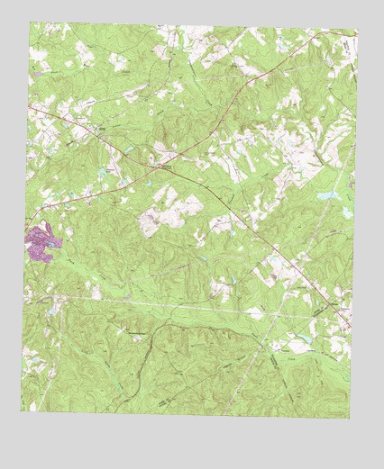
James, GA USGS Topographic Map
Click on map above to begin viewing in our Map Viewer.

This topographic map contains these locations and features:
Feature Name Type Latitude Longitude GNIS ID View Map
Big CreekStreamN32.9857°W83.4785°311367View Map
BrooksPopulated PlaceN32.9099°W83.3816°331246View Map
Burden School (historical)SchoolN32.8979°W83.4513°345338View Map
Corinth Church (historical)ChurchN32.9176°W83.4229°334688View Map
Crooked CreekStreamN32.9485°W83.3777°313135View Map
Ethridge - Minter CemeteryCemeteryN32.9296°W83.4360°345348View Map
Friendship ChurchChurchN32.9685°W83.4818°314415View Map
Greenberry CrossroadsPopulated PlaceN32.9540°W83.4496°326306View Map
Griffin LakeReservoirN32.8851°W83.4349°341950View Map
Griffin Lake DamDamN32.8851°W83.4349°341949View Map
Happoldt - Stevens CemeteryCemeteryN32.8885°W83.4402°345357View Map
Hardys ChapelChurchN32.9165°W83.3913°356174View Map
Hawthorne CemeteryCemeteryN32.9099°W83.3799°315252View Map
JamesPopulated PlaceN32.9665°W83.4738°316035View Map
James CemeteryCemeteryN32.9021°W83.4610°345362View Map
James School (historical)SchoolN32.9629°W83.4721°334689View Map
Jones County Fire Department Station 4BuildingN32.9658°W83.4756°2604546View Map
Jones LakeReservoirN32.9600°W83.4607°340655View Map
Jones Lake DamDamN32.9601°W83.4599°340654View Map
LewistonPopulated PlaceN32.8965°W83.4021°326368View Map
Little CreekStreamN32.9740°W83.4282°317009View Map
Marys Chapel (historical)ChurchN32.9590°W83.4327°334690View Map
Marys Chapel CemeteryCemeteryN32.9590°W83.4318°317767View Map
Mountain SpringsPopulated PlaceN32.8993°W83.4557°332442View Map
New Hope ChurchChurchN32.9368°W83.4974°319403View Map
New Salem CemeteryCemeteryN32.9876°W83.4199°345381View Map
New Salem ChurchChurchN32.9874°W83.4196°319535View Map
Oetter LakeReservoirN32.9006°W83.3921°340807View Map
Oetter Lake DamDamN32.9001°W83.3899°340806View Map
Pickart CemeteryCemeteryN32.9768°W83.4618°345383View Map
Ray LakeReservoirN32.9051°W83.4882°340657View Map
Ray Lake DamDamN32.9051°W83.4882°340656View Map
Slocumbs LakeReservoirN32.9525°W83.4706°323086View Map
Slocumbs Lake DamDamN32.9535°W83.4713°340764View Map
Watson and Couch CemeteryCemeteryN32.9098°W83.4978°345401View Map
Whitehurst CemeteryCemeteryN32.9021°W83.3971°346823View Map
William Woods CemeteryCemeteryN32.9426°W83.4666°345404View Map
Wolf CreekStreamN32.9876°W83.4388°330333View Map

Note: Coordinates in the location and feature list above are referenced to NAD83 datum.


Copyright (C) 2008-2024 Ryan Niemi / Sunset Dynamics ... All Rights Reserved