TopoQuest Logo
Do you find TopoQuest useful?
Help keep TopoQuest running and adding new maps/features by donating!
Bitcoin:  19c7KJd3qBynnjoSw5npx9KScwjBe4ifkT
Litecoin:  LXs6TkuXGGXo1vDsWCkWVdjQX94eUKd6ui
Home View Maps Find Maps Find Places Resources & Links


Massey Hill, Georgia Topographic Map

USGS Map Title: Massey Hill, GA
USGS Map MRC: 32083G3
DRG (GeoTIFF) Download: o32083g3.tif


Neighboring USGS Topographic Map Quads:


  James, GA  
32083H4
 

  Gordon, GA  
32083H3
 

  Napier Pond, GA  
32083H2
 

  Dry Branch, GA  
32083G4
 

  Massey Hill, GA  
32083G3
 

  Irwinton, GA  
32083G2
 

  Marion, GA  
32083F4
 

  Jeffersonville, GA  
32083F3
 

  Stuckey Boone Lake, GA  
32083F2


Map MRC Location:

N33°
W84°
N33°
W83°
H8 H7 H6 H5 H4 H3 H2 H1
G8 G7 G6 G5 G4 G3 G2 G1
F8 F7 F6 F5 F4 F3 F2 F1
E8 E7 E6 E5 E4 E3 E2 E1
D8 D7 D6 D5 D4 D3 D2 D1
C8 C7 C6 C5 C4 C3 C2 C1
B8 B7 B6 B5 B4 B3 B2 B1
A8 A7 A6 A5 A4 A3 A2 A1
N32°
W84°
N32°
W83°

Massey Hill, GA USGS 1:24K Topographic Map Preview:
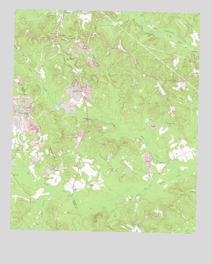
Massey Hill, GA USGS Topographic Map
Click on map above to begin viewing in our Map Viewer.

This topographic map contains these locations and features:
Feature Name Type Latitude Longitude GNIS ID View Map
Alligator CreekStreamN32.7715°W83.3432°310484View Map
Asbury CemeteryCemeteryN32.7743°W83.3327°346775View Map
Asbury ChurchChurchN32.7738°W83.3321°354400View Map
Augusta Fountain CemeteryCemeteryN32.8487°W83.2938°346776View Map
Branan-Vinson CemeteryCemeteryN32.8360°W83.2624°311719View Map
ClayfieldsPopulated PlaceN32.8538°W83.2513°331412View Map
Clear CreekStreamN32.7840°W83.2574°312716View Map
Clear Creek CemeteryCemeteryN32.8129°W83.3235°346782View Map
Clear Creek ChurchChurchN32.8138°W83.3235°355184View Map
Dry ForkStreamN32.8099°W83.3029°313680View Map
Faith ChurchChurchN32.8440°W83.2929°346789View Map
Freeport Kaolin Tailings PondReservoirN32.8735°W83.3266°340809View Map
Freeport Kaolin Tailings Pond DamDamN32.8735°W83.3266°340808View Map
Gordon DivisionCivilN32.8735°W83.3085°1936292View Map
H A Fountain BridgeBridgeN32.7701°W83.3343°345429View Map
Holloways-Hatfield CemeteryCemeteryN32.7546°W83.2910°346795View Map
Lee CemeteryCemeteryN32.8396°W83.3299°316733View Map
Liberty Hill CemeteryCemeteryN32.7951°W83.3729°345436View Map
Liberty Hill ChurchChurchN32.7951°W83.3727°316835View Map
Macon Rescue Mission Rehabilitation FarmLocaleN32.8468°W83.3663°346801View Map
Massey CemeteryCemeteryN32.8621°W83.3454°317780View Map
Massey HillPopulated PlaceN32.8601°W83.3466°326390View Map
McArthur-Robinson CemeteryCemeteryN32.8374°W83.2682°346802View Map
Mercer CemeteryCemeteryN32.7585°W83.3704°345443View Map
New Hope ChurchChurchN32.8554°W83.3463°319400View Map
New Hopewell CemeteryCemeteryN32.7804°W83.3743°319449View Map
New Hopewell ChurchChurchN32.7813°W83.3749°319451View Map
Ramah CemeteryCemeteryN32.8593°W83.3415°346812View Map
Ramah ChurchChurchN32.8590°W83.3399°321300View Map
Spring Hill ChurchChurchN32.7857°W83.3054°323431View Map
Ugly CreekStreamN32.7640°W83.3527°324479View Map
White Springs CemeteryCemeteryN32.8121°W83.2696°346822View Map
White Springs ChurchChurchN32.8121°W83.2693°325197View Map
WMRW-FM (Gordon)TowerN32.8621°W83.3654°352701View Map

Note: Coordinates in the location and feature list above are referenced to NAD83 datum.


Copyright (C) 2008-2024 Ryan Niemi / Sunset Dynamics ... All Rights Reserved