TopoQuest Logo
Do you find TopoQuest useful?
Help keep TopoQuest running and adding new maps/features by donating!
Bitcoin:  19c7KJd3qBynnjoSw5npx9KScwjBe4ifkT
Litecoin:  LXs6TkuXGGXo1vDsWCkWVdjQX94eUKd6ui
Home View Maps Find Maps Find Places Resources & Links


Jamestown, Texas Topographic Map

USGS Map Title: Jamestown, TX
USGS Map MRC: 30093H7
DRG (GeoTIFF) Download: o30093h7.tif


Neighboring USGS Topographic Map Quads:


  Harrisburg, TX  
31093A8
 

  Weeks Settlement, TX  
31093A7
 

  Wiergate, TX  
31093A6
 

  Jasper East, TX  
30093H8
 

  Jamestown, TX  
30093H7
 

  Shankleville, TX  
30093H6
 

  Roganville, TX  
30093G8
 

  Newton West, TX  
30093G7
 

  Newton East, TX  
30093G6


Map MRC Location:

N31°
W94°
N31°
W93°
H8 H7 H6 H5 H4 H3 H2 H1
G8 G7 G6 G5 G4 G3 G2 G1
F8 F7 F6 F5 F4 F3 F2 F1
E8 E7 E6 E5 E4 E3 E2 E1
D8 D7 D6 D5 D4 D3 D2 D1
C8 C7 C6 C5 C4 C3 C2 C1
B8 B7 B6 B5 B4 B3 B2 B1
A8 A7 A6 A5 A4 A3 A2 A1
N30°
W94°
N30°
W93°

Jamestown, TX USGS 1:24K Topographic Map Preview:
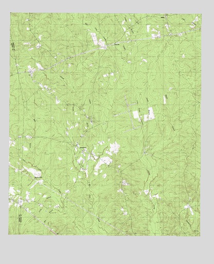
Jamestown, TX USGS Topographic Map
Click on map above to begin viewing in our Map Viewer.

This topographic map contains these locations and features:
Feature Name Type Latitude Longitude GNIS ID View Map
Bay BranchStreamN30.8894°W93.8399°1351610View Map
Blue BranchStreamN30.9155°W93.8607°1352442View Map
Caney BranchStreamN30.9019°W93.7824°1353724View Map
Dry CreekStreamN30.9558°W93.8057°1356322View Map
Fannie BranchStreamN30.9071°W93.8568°1357221View Map
Farrs ChapelChurchN30.9383°W93.8121°1357259View Map
FarrsvillePopulated PlaceN30.9835°W93.8074°1379754View Map
Huff CreekStreamN30.9080°W93.8535°1359788View Map
Huff Creek ChurchChurchN30.9299°W93.8680°1359789View Map
Irving BranchStreamN30.8916°W93.8396°1360036View Map
JamestownPopulated PlaceN30.9230°W93.8263°1360148View Map
Jordan BranchStreamN30.9885°W93.7918°1360425View Map
Lewis GullyValleyN30.9174°W93.8180°1361128View Map
Little Caney BranchStreamN30.9346°W93.7860°1361299View Map
Martin BranchStreamN30.9019°W93.7824°1362211View Map
MattoxPopulated PlaceN30.9999°W93.7735°1380154View Map
Pinehill ChurchChurchN30.9113°W93.8041°1365317View Map
Pleasant Hill ChurchChurchN30.9913°W93.8243°1365429View Map

Note: Coordinates in the location and feature list above are referenced to NAD83 datum.


Copyright (C) 2008-2024 Ryan Niemi / Sunset Dynamics ... All Rights Reserved